
The guidebook for the Wales Coast Path claims the total length is 896 miles. Quite a distance in anyone’s book, and probably one we won’t manage in it’s entirety, but Aunty and I are plugging away with determination. Early September is always a good time for a walk, especially if it’s not raining. This stretch of our undertaking was a fairly long walk from Penarth to Barry, a total of 12.6 miles (20.3km), and for once we were organised and took the train from home to Penarth. After passing through Cardiff it was all new train territory for us, passing through the litany of stations I’d heard over the station announcer’s tannoy for years: Grange Town, Coban, Dingle Road and finally Penarth. From the station is was down hill all the way to see the pier. And who can’t resist a walk to the end of a pier in the sunshine.
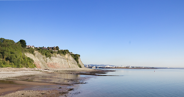
This gentle seaside town was created the rich who had made their money from coal, where they built large houses overlooking the Bristol Channel, clinging to the steep hill side plunging down to the shore. It feels different to Cardiff, and is far enough by road and train to be different, but when you stand on the promenade you can almost touch Cardiff Bay and the Barrage just around the corner. A short walk under the cliffs at low tide and within 5 minutes you can be standing on the Barrage.
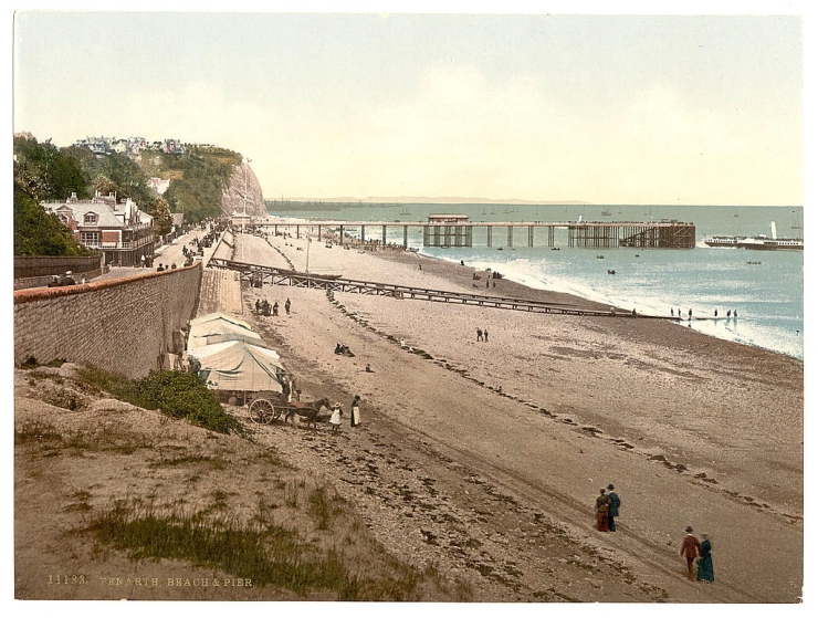
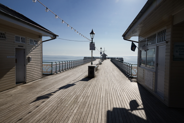
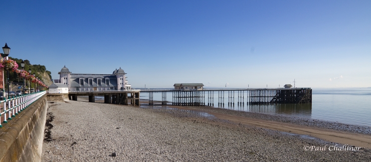
Like many aspiring Victorian seaside towns Penarth has a pier. But unlike many other towns today, this pier is in good nick. Standing proud from the shore out into the Bristol Channel, it makes a fine spectacle in the sun. So much so that in 2014 it was voted Pier of the Year by the National Piers Society (it never ceases to amaze me that these sort of organisations exist). The pier was opened in 1898 after an earlier failed attempt when the contractors were bankrupted. It was intended as a landing stage for regular ferry boats to accommodate increasing number of visitors from Cardiff. Up until then the ferry boats were hauled up onto the beach. Originally it was primarily a wooden pier for the pleasure cruise ships, but in 1907 a small wooden concert hall was built on the end. During World War One, it was used as a base for mine sweepers, which over the years damaged the landing stage. The insurance payment form the MoD didn’t cover the cost of repair and eventually after a period of decline the pier was sold to Penarth Borough Council in 1929. Just after this the Art Deco pavilion was completed – in concrete so it wouldn’t burn down!
Even though the Pier looks in good condition today, there has been excitement in it’s history. In 1931 the wooden theatre caught fire, eventually burning itself out after three days. £3157 later the pier was rebuilt. Then in 1947 the SS Port Royal Park hit the pier during a gale cause a fair amount of damage, which took 3 years to repair. It was hit again in 1966 by the pleasure steamer PS Bristol Queen causing £25000 of damage. The last pleasure cruise from the pier was in 1982. A serious restoration project started in 1994, and the pier was opened again to the public in 1998. Through grants by the National Lottery we can again walk out over the sea – a job well done I think.
The sea was mill pond smooth, a sight not often encountered on the Severn Estuary. From the pier it was a pleasant walk along the seafront up the hill and along the cliff tops towards Lavernock point. As soon as we left Penarth proper there were few people abroad and we had the path to ourselves. The sun was shining, it was warm and a fantastic walk. The hedgerows this year are full of fruit, and present a real picture against the blue skies.

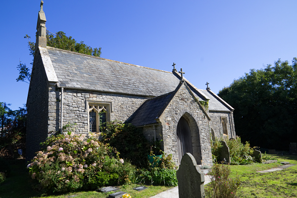
A surprise along the way included stumbling across St Lawrence Church at Lavernock. The early history of the church is a little uncertain, but it’s thought to be a 12th century parish church. Like many small churches St Lawrence didn’t escape ‘improvement’ during by the Victorians. Little used today, except for a small number of services throughout the year, it appears to be isolated today with only a couple of houses nearby.
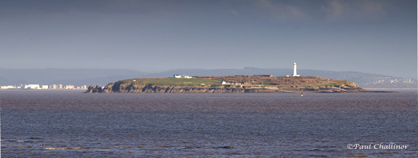
But Lavernock has other surprises in store. Least of which is it’s part in the history of wireless communication. Marconi and his assistants from the Post Office used Lavernock to transmit the first wireless communication transmission across water. On 13 May 1897 the first “Hello. Hello.” Was sent over the airways from Lavernock Point to Flatholm Island. Kemp, a Cardiff man and a Post Office engineer who assisted Marconi, recorded the following in his diary.
“Mr Marconi’s apparatus was set up on the cliff at Lavernock Point, which is about twenty yards above sea-level. Here we erected a pole, 30 yards (27 m) high, on the top of which was a cylindrical cap of zinc, 2 yards (1.8 m) long and 1-yard (0.91 m) diameter.
Connected with this cap was an insulated copper wire leading to one side of the detector, the other side of which was connected to a wire led down the cliff and dipping into the sea. At Flat Holm Mr Preece’s apparatus was arranged, the Ruhmkorff coil also giving 20-inch (510 mm) sparks from an eight-cell battery.
On the 10th May experiments on Mr Preece’s electro-magnetic transmission method were repeated, and with perfect success.
The next few days were eventful ones in the history of Mr Marconi. On the 11th and 12th his experiments were unsatisfactory — worse still, they were failures — and the fate of his new system trembled in the balance.
An inspiration saved it. On the 13th May the apparatus was carried down to the beach at the foot of the cliff, and connected by another 20 yards (18 m) of wire to the pole above, thus making an aerial height of 50 yards (46 m) in all. Result, The instruments which for two days failed to record anything intelligible, now rang out the signals clear and unmistakable, and all by the addition of a few yards of wire!”
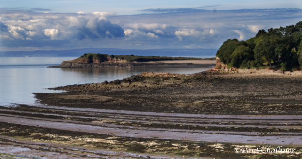
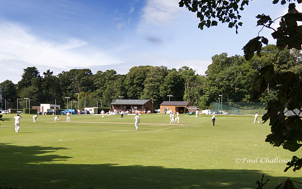
But this small piece of land butting out into the Severn Estuary has another secrets up it’s sleeve. In 1870 a gun battery was positioned here to protect the approach to the docks at Bristol and Cardiff. There is little to see today, but the remains of the coastal defences from the Second World War are still clearly visible along the edge of the Nature Reserve that now occupies the site. It would be too easy spend the day here, but we still had a long way to go. But not before I’d spent a few minutes watching a local game of cricket played next to the path.
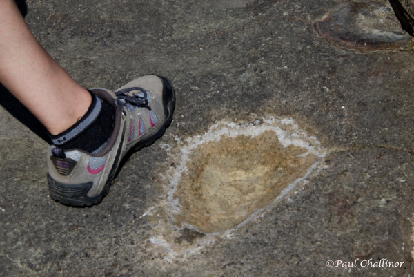
Aunty wanted to make a small detour to revisit one of our other Welsh 100 sites – the dinosaur footprints at The Bendricks (https://paulchallinor.com/2015/03/15/palaeontologists-for-the-day-but-dont-give-up-the-day-job/). The last time we came here the weather was cold and overcast. Then we had a challenge to find them, and it wasn’t much easier this time either. But they’re still there, despite someone having dug up a few and sold them in the USA. These are the footprints of some of the earliest dinosaurs in the world. At this time, 220 million years ago, dinosaurs had not long evolved from other crocodile-like reptiles and these ancestral animals were still present. They were soon to become extinct and leave the dinosaurs to dominate the land during the following Jurassic and Cretaceous Periods. Some of the footprints exposed here probably belong to some of these dinosaur ancestors.
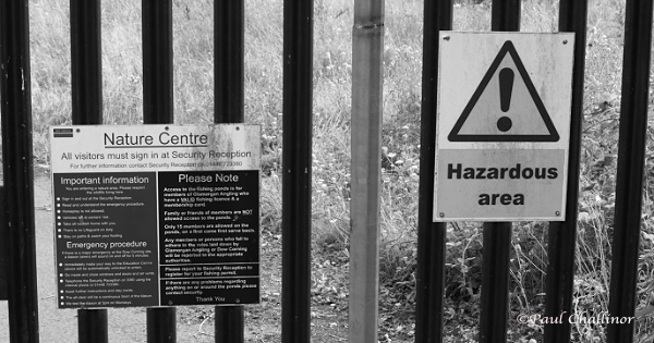
The next stage of the walk was a little unpleasant, and involved a 3 mile walk along a bury main road around the large chemical plant on the edge of Barry. One puzzling area caught my eye. There is a nature reserve on part of the old chemical works, but apparently there are dangerous things in there. So much so it warrants a keep out sign.
Eventually we arrived at Barry Docks. In 1871 Barry was just an ordinary village on the coast with a population of just 100 people. But how things change. By 1909 about 8,000 women and 10,000 men were employed in the docks alone. By 1913, Barry had out grown Cardiff as the premier coal exporting docks, and are even claimed to have been the busiest coal port in the world, exporting 11.05 million long tons (11,230,000 t; 12,380,000 short tons) at it’s peak.
The docks were conceived by a group of local mine owners determined to break the hedgemony of Cardiff on coal exports and boy did they succeed. Today all that industry has vanished, leaving only empty pier and mooring points. The warehouses have been replaced by flats and housing developments. I’ll have to leave Barry a little short on words are there is so much to say. But perhaps we’ll return and have a wonder around here in the future.
2nd September 2017

Cracking photos and blog, Paul!
LikeLike
Thanks Pete – photography slowing improving
LikeLiked by 1 person
Really like this both for the text and the photographs, caught and bowled matey!
LikeLike