
My goodness, it’s been almost 4 years since Auntie and I last strolled along this beautiful stretch of the coastal path. So much has changed since then – both in our lives and in the lives of others. Retirement came for me last August after 44 years of nursing, and I finally have the opportunity to take time for both Auntie and myself. In theory, I should have more time for writing now, but somehow I still find myself as busy as ever. It’s hard to believe how I managed to juggle work all those years. But enough about us – let’s focus on this section of the Coastal Path as we continue our journey towards Kidwelly. This follows on from the section from Llanelli to Burry Port.
Before we move on, let’s pause and reflect on our journey. We parked our car at Kidwelly Station and boarded the train headed to Burry Port, also known as Porth Tywyn in Welsh. This section of the coastal path is an easy 10.6 miles along flat sands and old roads. Burry Port has a rich history intertwined with the industrial revolution and the exploitation of the South Wales Coalfield. Its early roots can be traced back to the medieval village of Pembrey, where the Church of St Illtyd stands as a reminder of that period. Prior to industrialisation, Burry Port’s economy relied on farming and fishing.
The industrial past of Burry Port is closely linked to its harbour, which was constructed to export coal from the Gwendraeth Valley. The harbour opened in 1832 but faced initial setbacks, including collapsed harbour walls, leading to a delayed full operation. It was later named Burry Port Harbour to avoid confusion with the older Pembrey Harbour. The main advantage of the new harbour’s location was it did not require ships to navigate the narrow channel to Llanelli Harbour.
The town of Burry Port emerged around the new docks in the mid-19th century, with the earliest records of the town dating from around 1850. The arrival of the railways further increased the town’s importance, with the Burry Port and Gwendraeth Valley Railway replacing part of the canal network to handle the coal loads. Despite the initial optimism, the harbour did not achieve the anticipated levels of trade and gradually declined in the 20th century. Consequently the harbour has been converted into a marina. However, there is little if any sign of the port at Pembrey, silting of the once tidal port has now resulted in the area becoming salt marsh.
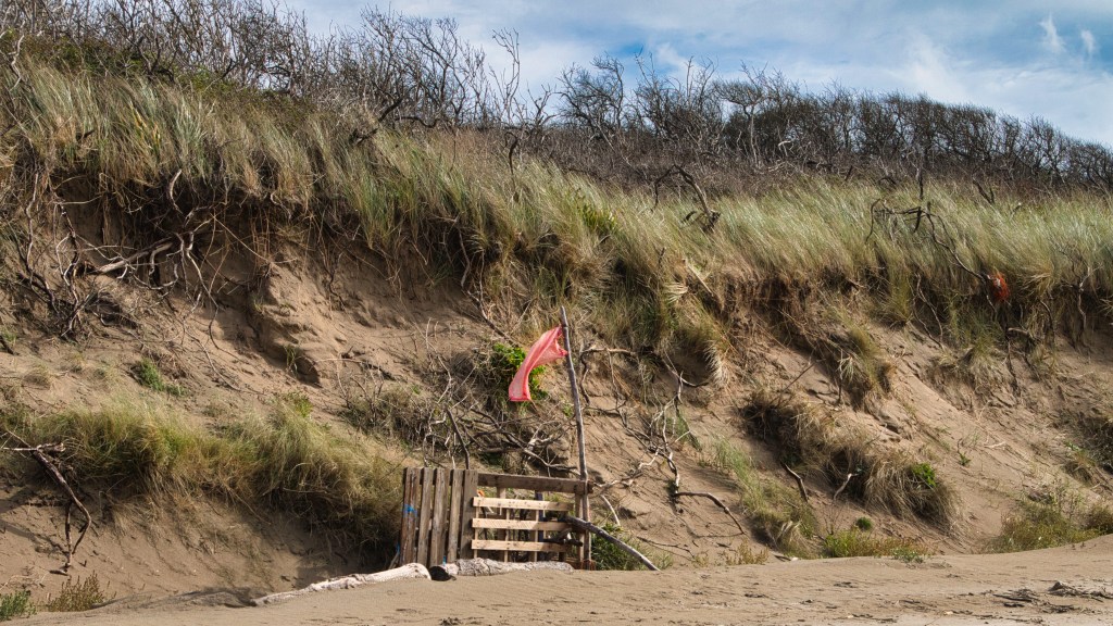
The path starts at Burry Port harbour and continues west entering into the eastern side of Pembrey Burrows before dropping down onto the expanse of Cefn Sidan Sands. Pembrey Burrows is part of a series of dune systems along the eastern part of Carmarthen Bay. It is a dynamic landscape, with dunes that are actively still being built up, which is a rare feature. The area showcases various types of sand dunes, including embryo dunes, large semi-stable yellow dunes, and more stable grey dunes that form dune grassland. Today it’s a nature reserve, but hidden among the dunes are hints of a very very different use.
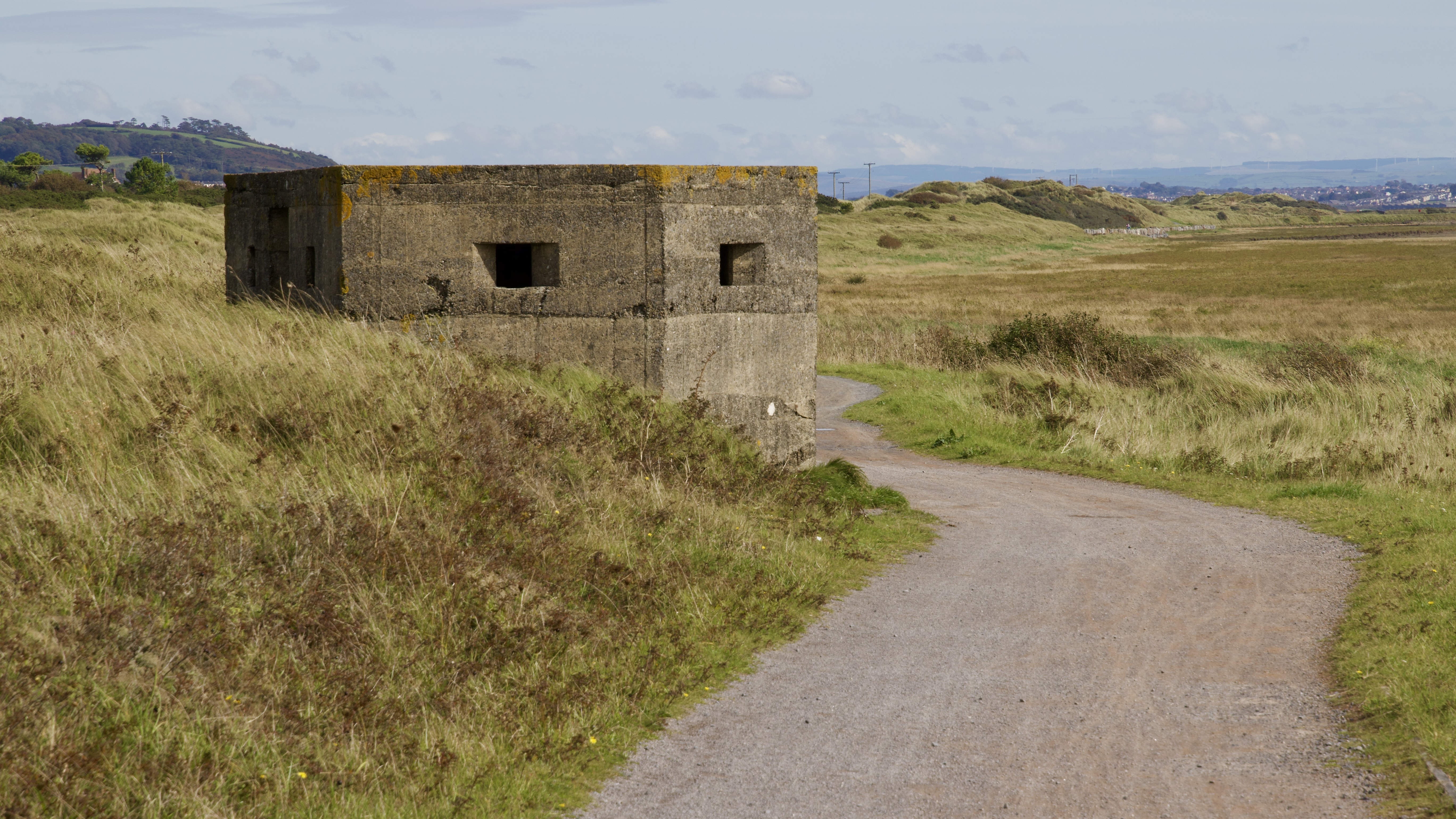
The area has a long history, with evidence of industrial activity dating back to at least 1881 when it attracted producers of gunpowder and dynamite due to its isolated sand dunes, which provided an effective screen and minimised damage in the event of an explosion. During World War I, the Nobel Explosive Company Ltd of Glasgow established a large-scale Royal Ordnance Factory at Pembrey, which became the country’s largest producer of TNT. The factory was run down after the war but was rebuilt and expanded as the Second World War approached. The dune area is criss crossed by narrow gauge tram lines, and large bunkers where there explosives were stored. It would be very easy to spend the whole day here exploring the dunes and finding the remains of the factory buildings and infrastructure, but it would equally easy to be side tracked and immerse yourself into the wildlife. We’ve done this a few times in the past.
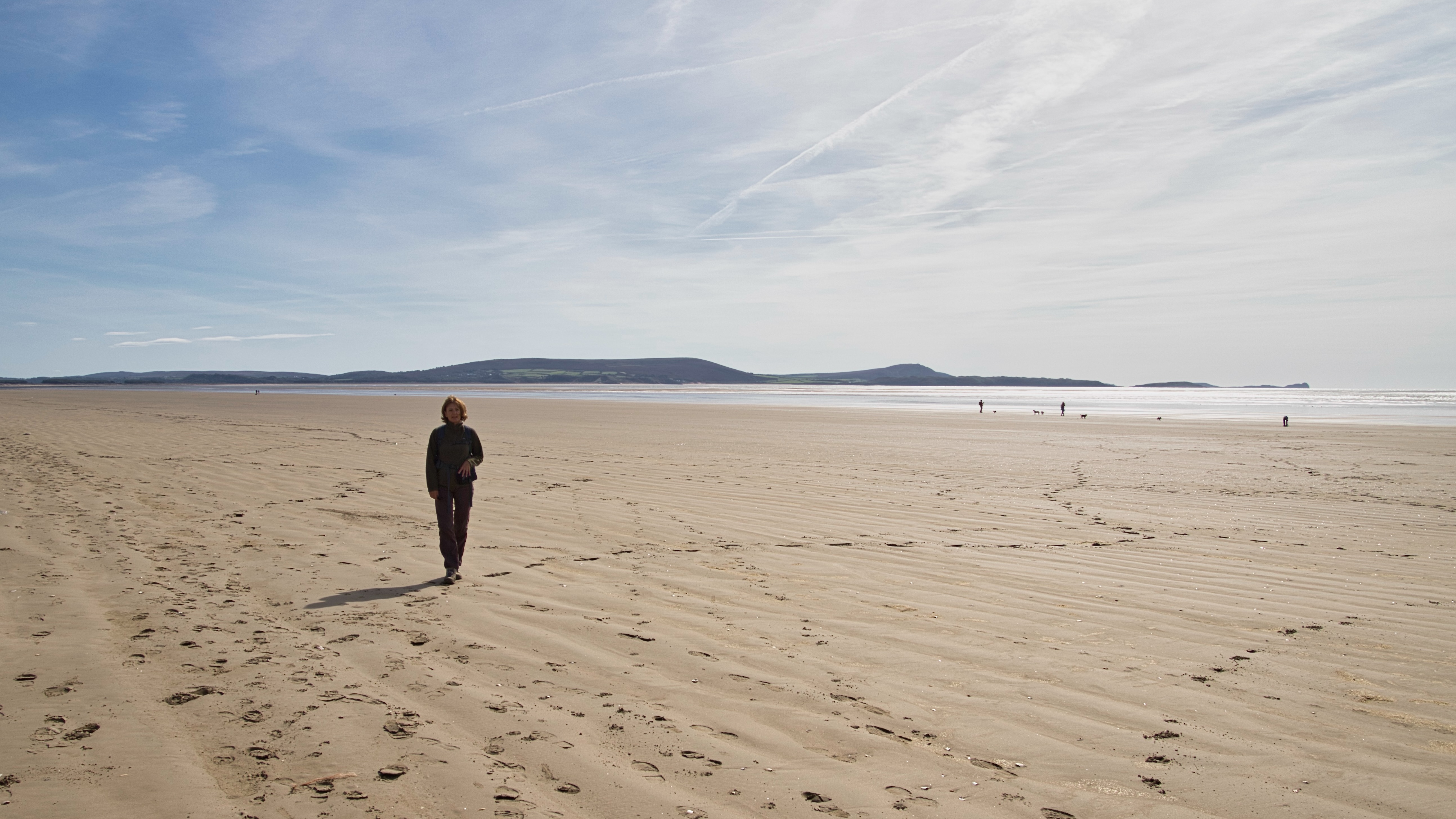
Although I love sand dunes, I would very much prefer not to have to walk any distance among them. Memories of school cross country runs back home when I was growing up maybe. I always feel I’m taking 3 steps forward and 2 steps backwards when struggling up and down the unstable sand hills. Getting old maybe. Although there is a path through the dunes near Porth Tywyn we thankfully dropped down on the beautifully flat Cefn Sidan Sands.
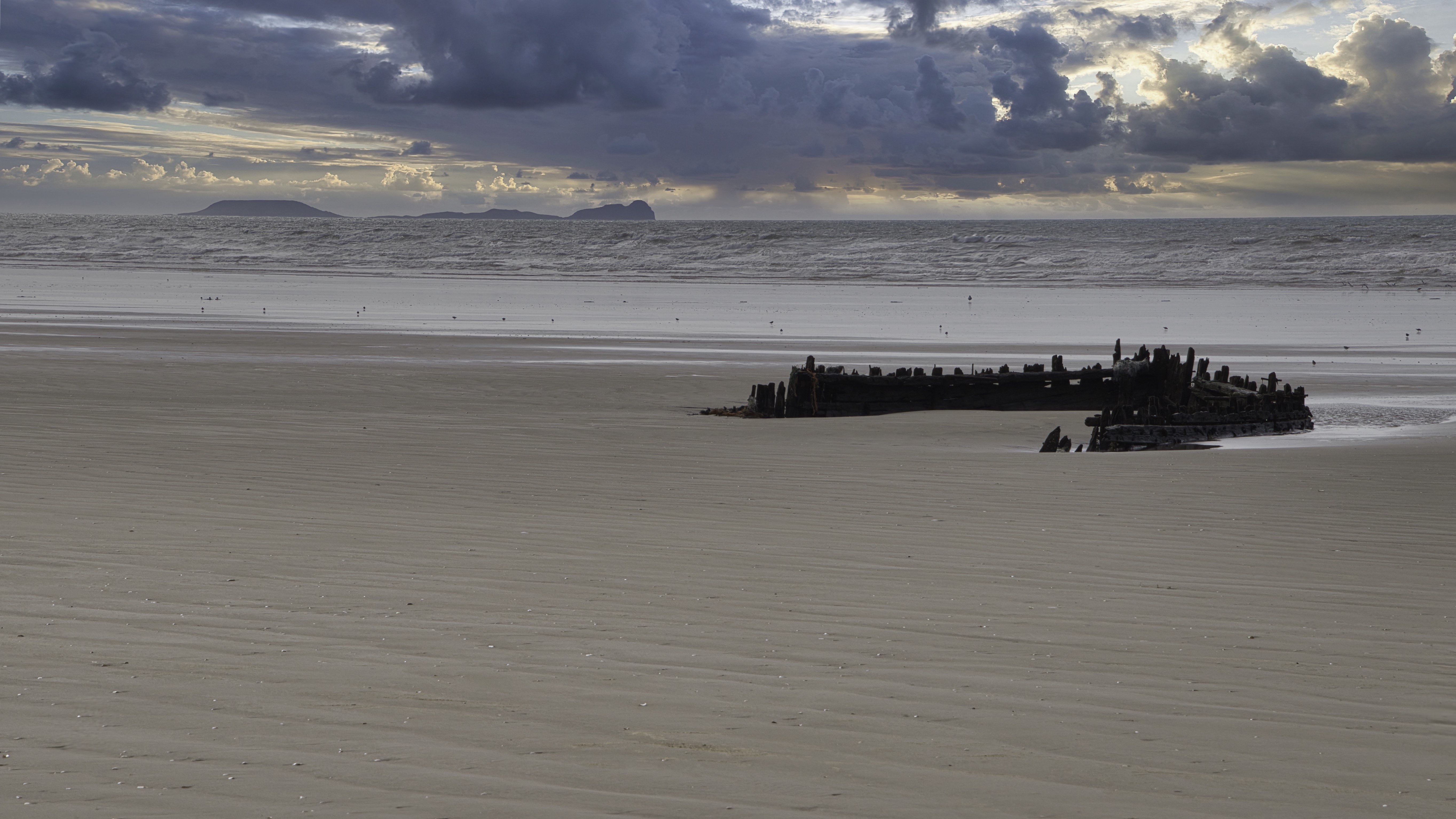
The long sandy beach now stretched ahead of us making walking so much easier than among the dunes. Cefn Sidan, translated at Silky Ridge, lives up to its name as it creates an eight mile border between the sea and the land all the way from Bury Port to Tywyn Point near Kidwelly. On a sunny day the beach has a serene look, but this changes when the winds blow. The beach has witnessed 182 recorded wrecks along its eight-mile stretch of flat sand, with the earliest record dating back to 1668.
Local legends have it that Cefn Sidan has a long history tied to a group of individuals known as Gwyr y Bwelli Bach, or the “People of the Little Hatchets.” These people were residents of the surrounding hamlets who carried uniquely designed tomahawk-type hatchets, perfect for plundering shipwrecks. Their most notorious period was between 1770 and 1870. During stormy weather, they would set up beacon bonfires on Pembrey Mountain under the cover of darkness. The purpose of these fires was to deceive passing ships, making them believe they were seeing a safe harbour or port. The hope was that the ships would be lured closer to shore where the crew could be robbed and the cargo plundered.
In reality, it would be a dire situation for a ship’s captain to even have the opportunity to observe a bonfire ashore while navigating through stormy conditions in the darkness of night. By that point, the ship would likely already be in a perilous position, surrounded by shallows, sandbanks, and tumultuous storm waves. A seasoned ship’s captain would never intentionally steer towards an unfamiliar light on the shore, as it typically serves as a warning sign of imminent danger.
Closer examination of historical records and careful analysis of the various ports of destination, it becomes evident that navigational errors, sail damage, or being blown off course are the most likely causes of these tragic shipwrecks. However, regardless of how the ships ended up stranded on the shores, the ruthless act of looting and plundering always followed. Survivors of the wrecks were left to fend for themselves as their belongings and possessions were mercilessly stolen. The looters showed no mercy, taking everything from valuable cargo to the personal belongings of the crew and passengers. Even items that proved difficult to remove, such as rings, were forcibly taken, often resulting in the brutal removal of fingers with a stroke of a hatchet. The disregard for human life and the callousness of these acts of theft and violence are truly despicable.
The wreck of La Jeune Emma on Cefn Sidan Beach is one of the most notable shipwrecks in the area’s history. This French brig was on a voyage from Martinique in the West Indies to Le Havre, France, carrying a valuable cargo of rum, sugar, and coffee. On the night of November 21, 1828, La Jeune Emma encountered treacherous conditions as it approached the Welsh coast. The ship ran aground on the eastern tip of Cefn Sidan Sands. As daybreak arrived, the situation became dire, with seas washing over the deck of the stranded vessel.The crew of La Jeune Emma faced a desperate struggle for survival. By morning, 13 people had managed to climb into the ship’s rigging, clinging to it for dear life as the waves battered the vessel. Despite their precarious position, these survivors held on, hoping for rescue.
The wreck of La Jeune Emma gained particular notoriety due to its connection to Napoleon Bonaparte. Among the passengers was the nephew of the former French emperor. This royal connection added to the drama and historical significance of the shipwreck. Unfortunately, the outcome of the wreck was tragic. Local wreckers, known for their unscrupulous practices, spotted the stranded ship. Instead of immediately alerting authorities or attempting a rescue, they focused on salvaging the valuable cargo. Their actions likely contributed to the loss of life among the ship’s passengers and crew.
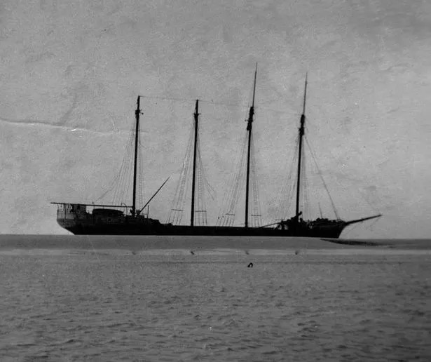
More recently the SV Paul was another shipwreck victim that occurred on Cefn Sidan Sands in 1925. Originally launched as the Mount Whitney in Seattle in 1919, this four-masted, fore-and-aft rigged windjammer was later renamed Margaret Sayer before finally being acquired by Flensburg owners and renamed Paul. The ship was on a voyage from Halifax to Dublin, carrying 2,000 tons of timber, when it encountered severe gales on October 30, 1925. These gales caused the vessel to lose many of its sails and anchors, ultimately leading to its grounding on Cefn Sidan Sands due to the lack of auxiliary motive power.At the time of the wreck, the SV Paul had a crew of twelve, including a cook, the master, and a teenage stewardess. Despite efforts to refloat the ship by several tugs from Cardiff, these attempts were unsuccessful. A salvage company employed 26 local men to recover the timber cargo, which was then made into rafts and floated to the nearby railway line at Bertwn.
The last recorded wreck occurred in 1996 when an unregistered and unnamed yacht was blown ashore on it’s way from Morocco. when boarded it was found to to be carrying a large number of sealed packs containing over £800,000 worth of cannabis resin. There was a find and a half! No opportunity for plundering in this case.
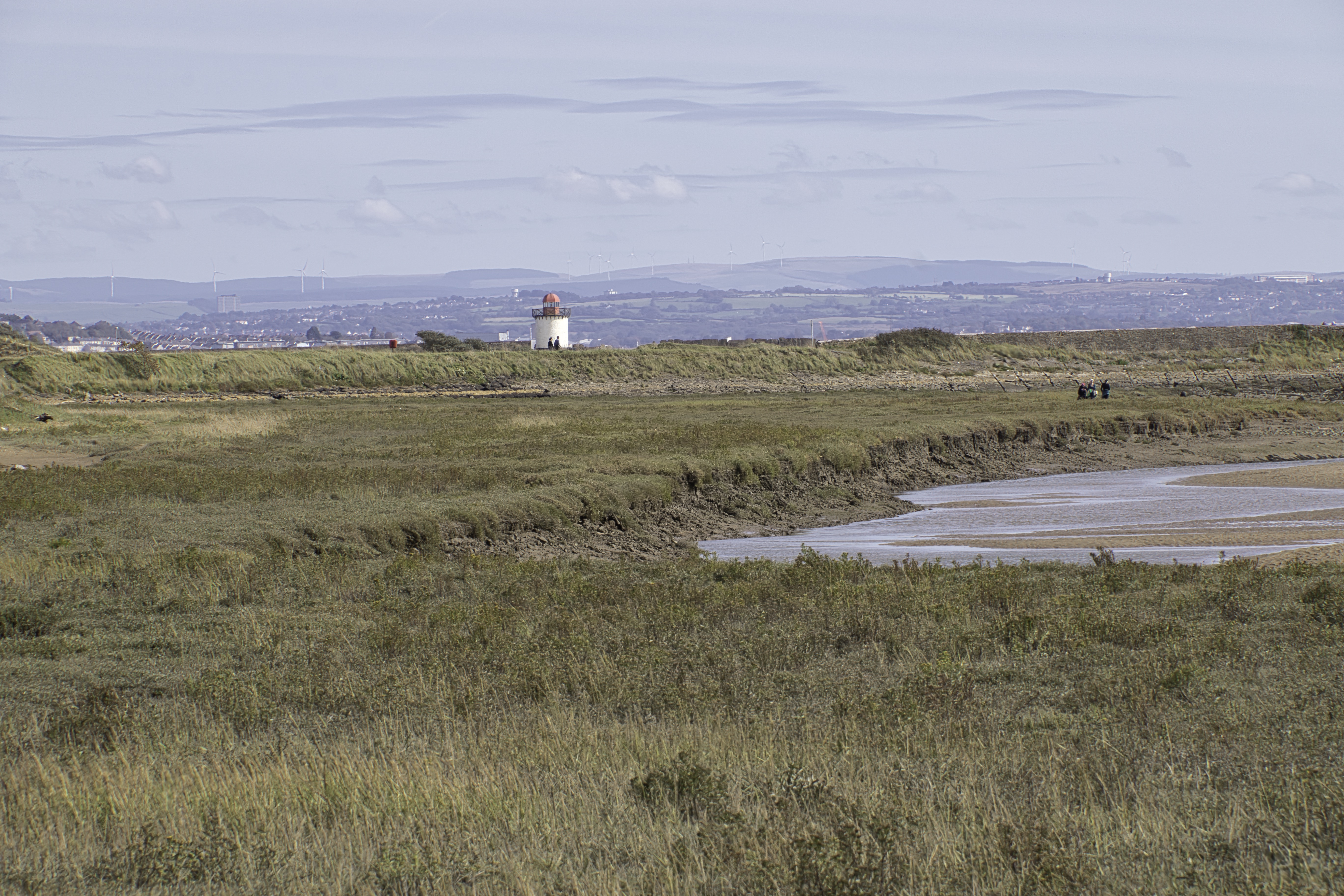
After a while the coastal path turns inland and follows the periphery of Pembrey Airfield on our right, with the extensive salt marsh on the right. Pembrey Airport originated as a Royal Air Force station called RAF Pembrey. The site was acquired by the RAF in 1937 and developed into an airfield. During World War II, RAF Pembrey served several important functions. It was used as a training base, hosting No. 1 Air Gunners School from 1941-1945. Fighter Command squadrons were stationed there in 1940-1941 for convoy patrols, and Polish Air Force squadrons like No. 316 Squadron were formed at Pembrey in 1941. After WWII, RAF Pembrey continued to be used hosting anti-aircraft cooperation units in the late 1940s. Then from 1952-1957, No. 233 Operational Conversion Unit was based there, training jet fighter pilots on aircraft like the de Havilland Vampire and Hawker Hunter. RAF Pembrey closed as an active military airfield in 1957.
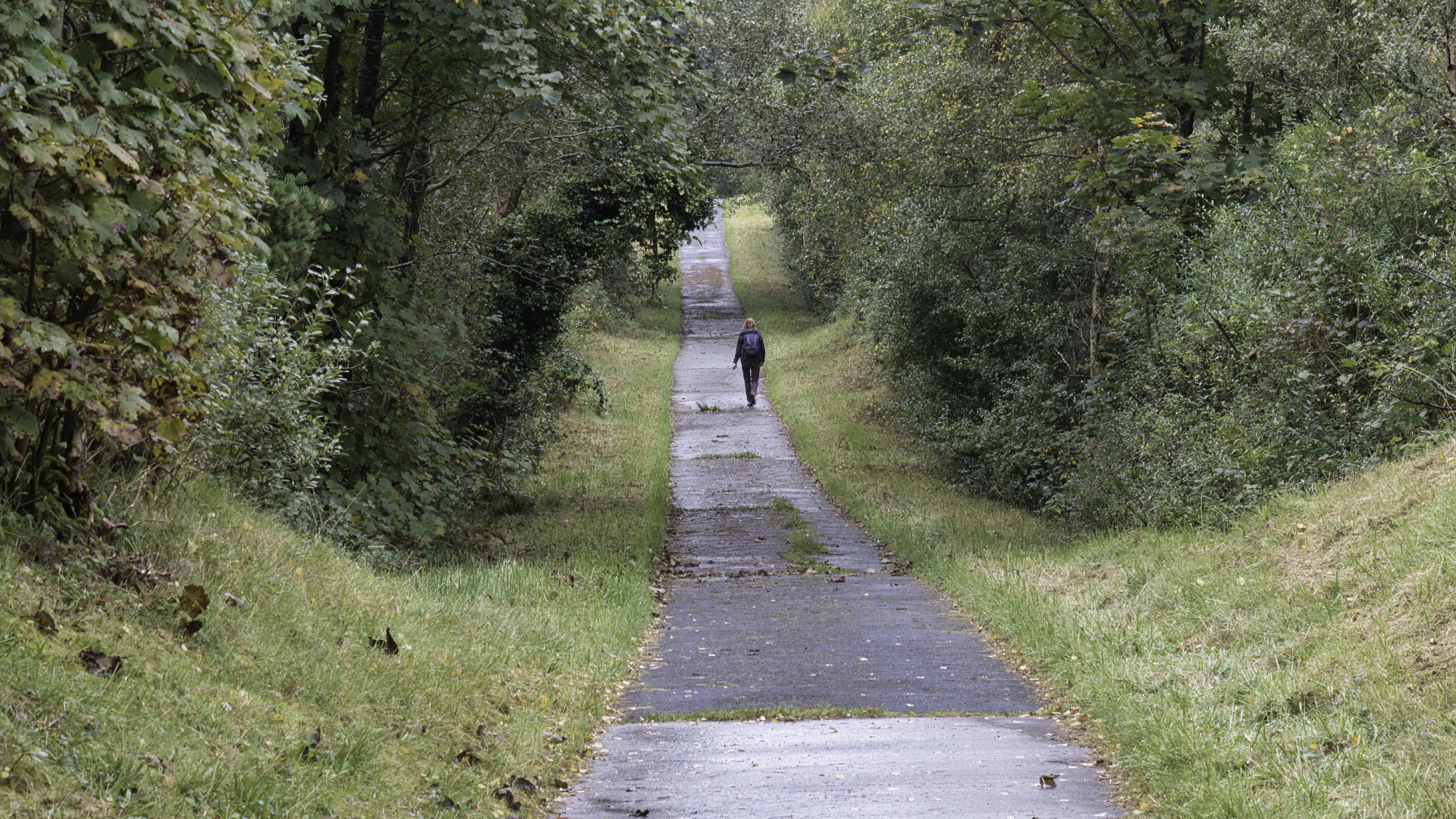
For several decades after closure as an RAF base, the Pembrey site saw limited use. However, plans were eventually made to convert it to civilian use an on August 22, 1997, Pembrey was officially reopened as a civil airfield and renamed Pembrey Airport. It was developed to serve as the primary airport for the growing West Wales region, and the owner still has ambitious plans to expand into a major international airport. Not sure that there is the population to support this.
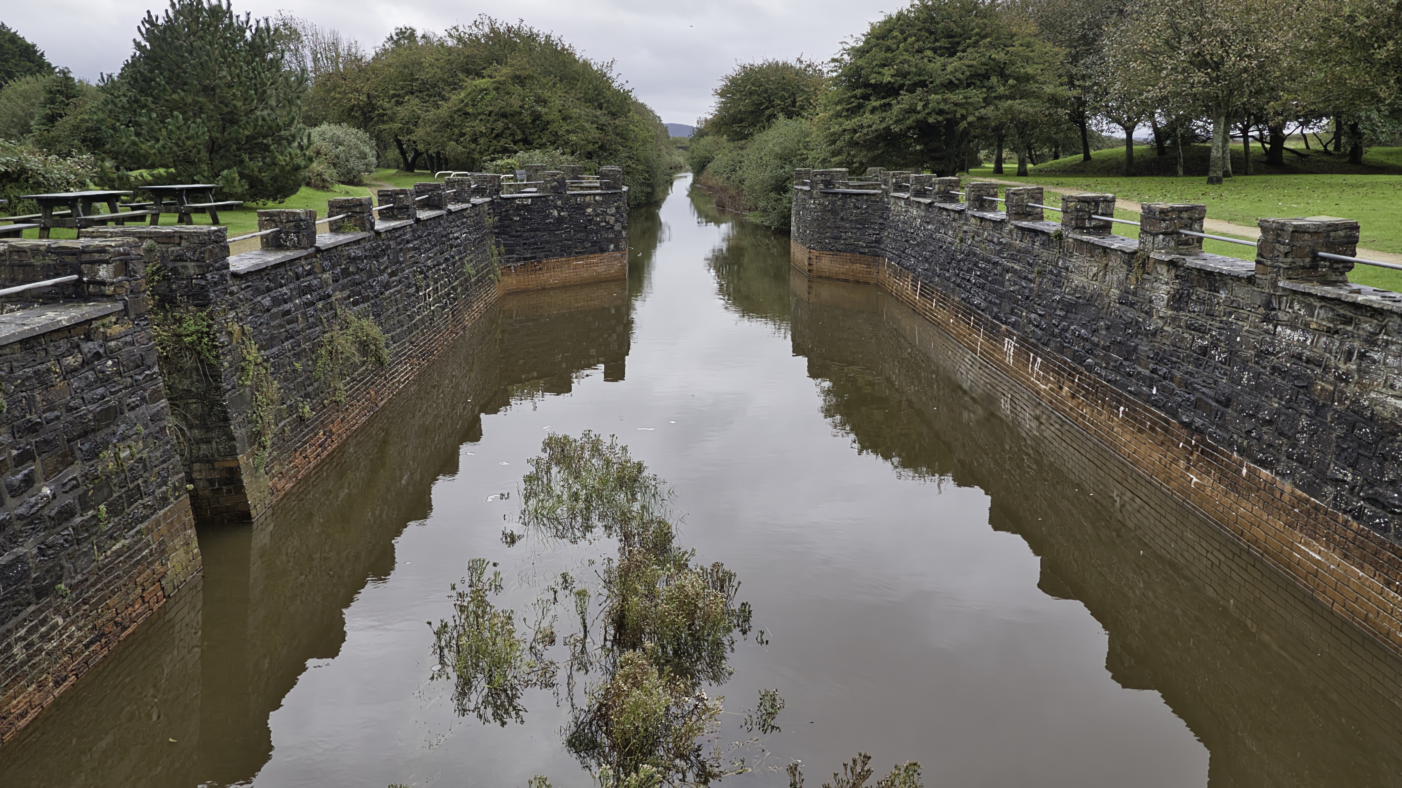
Just outside Kidwelly the path returns towards the Gwendraeth estuary and brought us to Kymer’s Dock, also known as Kidwelly Quay. Like Pembrey and Bury Port the dock was developed primarily to export Black Gold from the coal mines operating in the Gwendraeth Valley. To bring the coal to the port the Kymer Canal was built and operational by May 1768, and it was about 4.9km (3 miles) long. It linked pits at Pwll y Llygod to the dock, providing a means to transport coal to the coast for onward shipment by coastal ships. The canal was initially successful, but the dock and river were affected by silting. In 1797, a new channel across the sands was created. In 1812, the canal was extended and became part of The Kidwelly and Llanelli Canal and Tramroad. The canal was eventually replaced by the railway, and the company running it changed its name to the Kidwelly and Burry Port Railway in 1865.
Kymer’s dock continued to be used for the export of coal for another 50 years. before eventually closing. It was used as a rubbish dump during the 1950s. Why did we do this to our coutryside in the past. It was nothing short of organised and officially sanctioned vandalism. However, we now live in better time and the dock together with a short section of the canal was restored in the 1980s. A few of the structures of the canal can still be traced in the landscape, and the route of the now closed railway can be followed for most of its length.
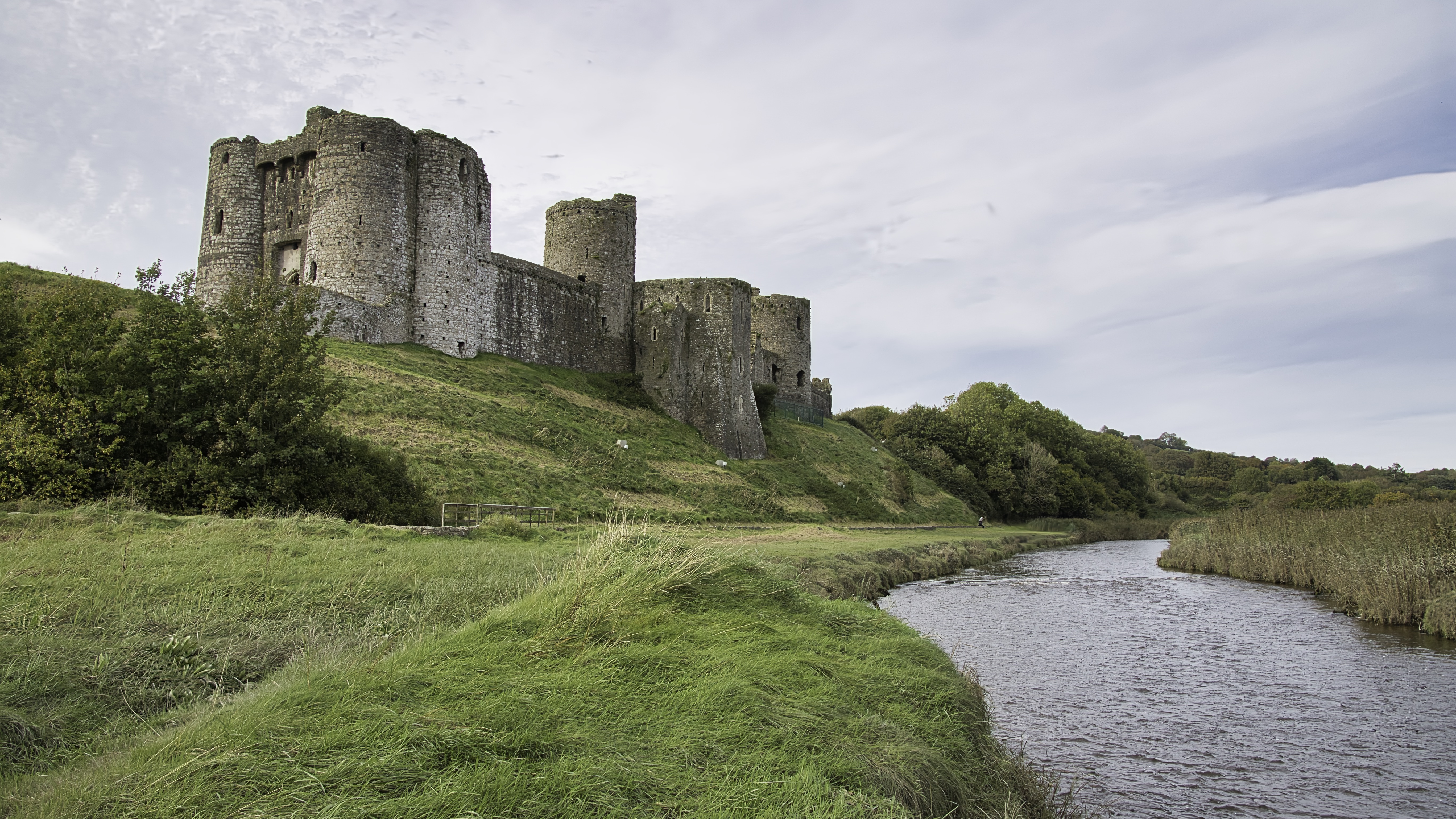
It was then a short walk into Kidwelly itself. The name “Kidwelly” is believed to be of ancient origin, with its earliest recorded form, “Cetgueli,” dating back to the 9th century. However, the town’s true foundation as we know it today began in the early 12th century, around 1115 AD, when it was established as a borough by the invading Normans. It has a stonking great big castle and is very much worth a visit. I won’t go into much detail here about the castle. One of the most famous events in Kidwelly’s history occurred in 1136 when Princess Gwenllian, wife of Gruffudd ap Rhys, Prince of Deheubarth, led a Welsh army against the Norman-held castle. The battle, which took place in a nearby field known as Maes Gwenllian, ended in tragedy for the Welsh. Gwenllian was defeated and killed, either during the battle or shortly after. Her bravery and sacrifice have made her a legendary figure in Welsh history, and her name remains closely associated with Kidwelly to this day – well in Wales at least.
As with many towns in South Wales, Kidwelly experienced significant growth during the Industrial Revolution. The town became home to large brickworks and tinworks, transforming its economy and landscape. However, with the decline of heavy industry in the 20th century, Kidwelly has had to adapt once again. Today, Kidwelly is a town of approximately 3,000 residents, welcoming around 30,000 tourists annually. From its Norman foundations to its industrial heyday and its current role as a charming tourist destination, Kidwelly’s history is a testament to the resilience and adaptability of Welsh communities. Not many post industrial towns in Wales have been so lucky. Walking the streets of this ancient borough and exploring the imposing walls of its castle, it’s easy to get the feeling that you are not just witnessing history, but becoming a part of Kidwelly’s ongoing story.

Leave a comment