
Hooray the sun is shining. There isn’t a cloud in the sky, and I need to walk off the effects of the return flight from South Africa Friday night. Auntie is up for a walk, so where can we go. After all the rain, the most interesting paths will be nothing short of a muddy nightmare. The boss doesn’t like walking through mud, and to be honest I don’t look forward to cleaning the boots afterwards.
Inspiration came from a great little book Circular Walks in the Vale of Glamorgan, written by Dorothy Hamilton. This is only one in an extensive series of circular walks around Wales published by Llygad Gwalch, a Welsh company.
So we decided upon a walk around Sully, along the coast a little way and then up to Cosmeston Lakes. The original plan was to park near the church and then walk north towards Dinas Powis. However, one look at the fields under water just outside Sully along Sully Brook led to a new plan. This was driven by comments such “you’ve got to be kidding” and “I’m not walking through that” from Auntie! So we reversed the walk and headed off to the beach instead. This was allowed because it’s still part of the Coastal Path.

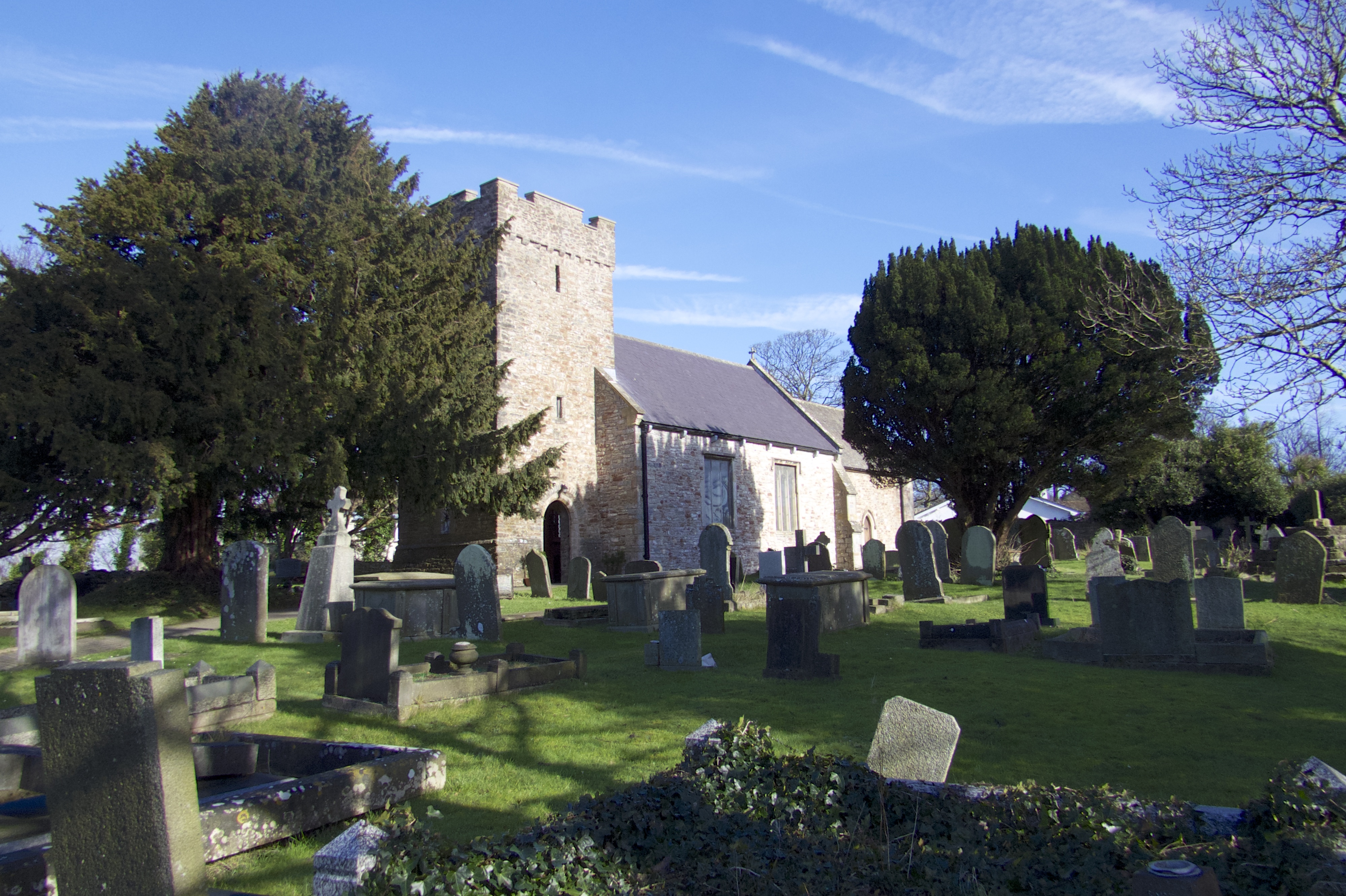
The village could be named as an abbreviation of “south lea” meaning “southern pasture” but it is more commonly understood to be named after the Norman family of Baron Reginald de Sully, one of the ‘Twelve Knights if Glamorgan’ who was awarded the Manor around 1093 by the conqueror of Glamorgan Sir Robert Fitzwilliam probably under charter by William II. Sully Church looked good in the sunshine and is a great setting for the start of the walk. Just behind the church is the site of Sully Castle. Apparently the smallest castle in Glamorgan. We didn’t have time to look for it, but I doubt there is much left.
The beach at Sully is long and wide when the tide is out. There is no sand, but is covered in stone and limestone. There is clear evidence of the how high the tides have been recently with the storms driving the sea water over the estuary banks and into the gardens lining the beach.
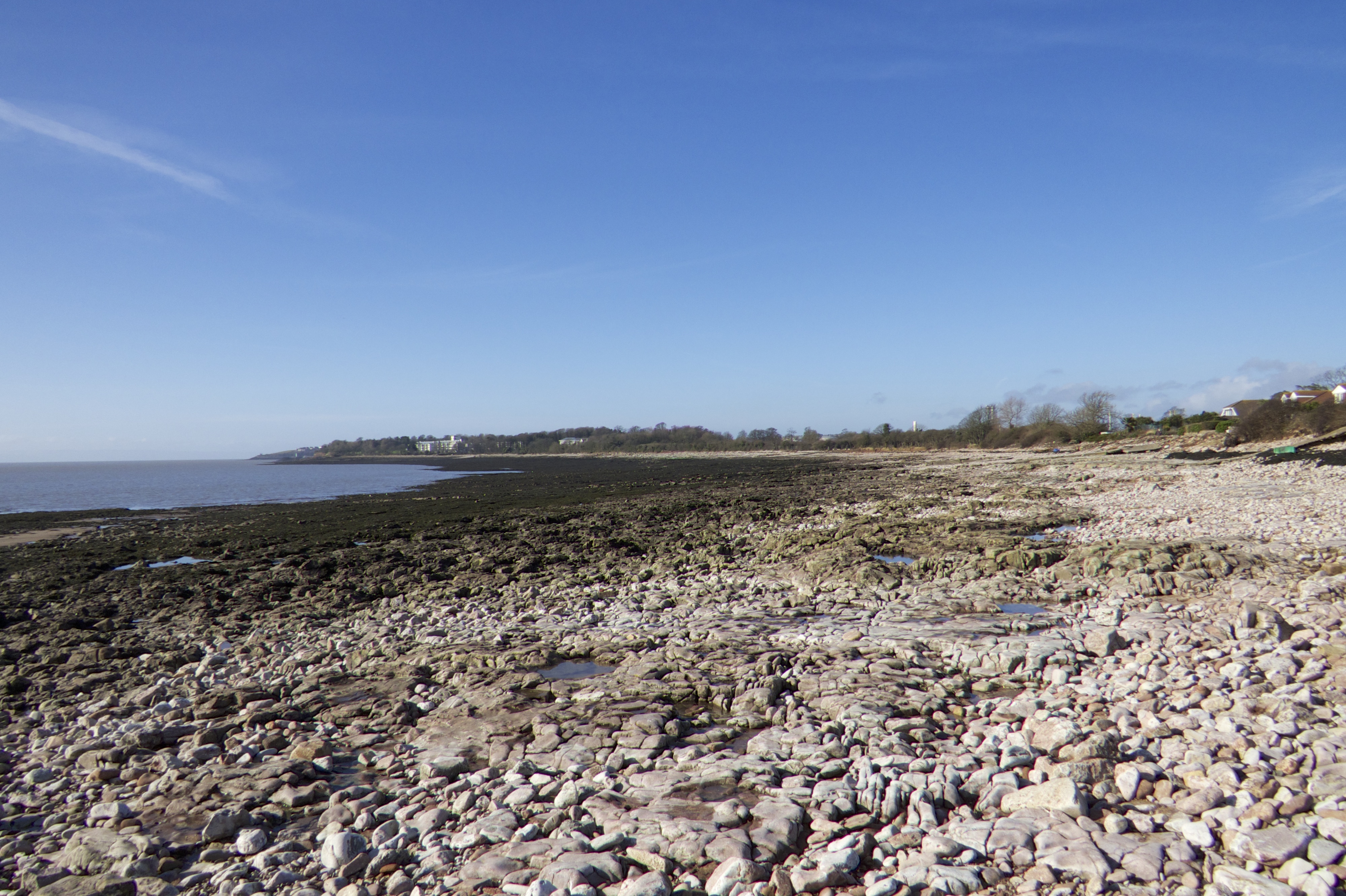
The clear skies and bright sunshine gave good views along the coast to Barry, and the Islands of Flat Holm and Steep Holm. My ambition this year to to finally visit these two nature reserves, so I hope to tell you about the islands then.

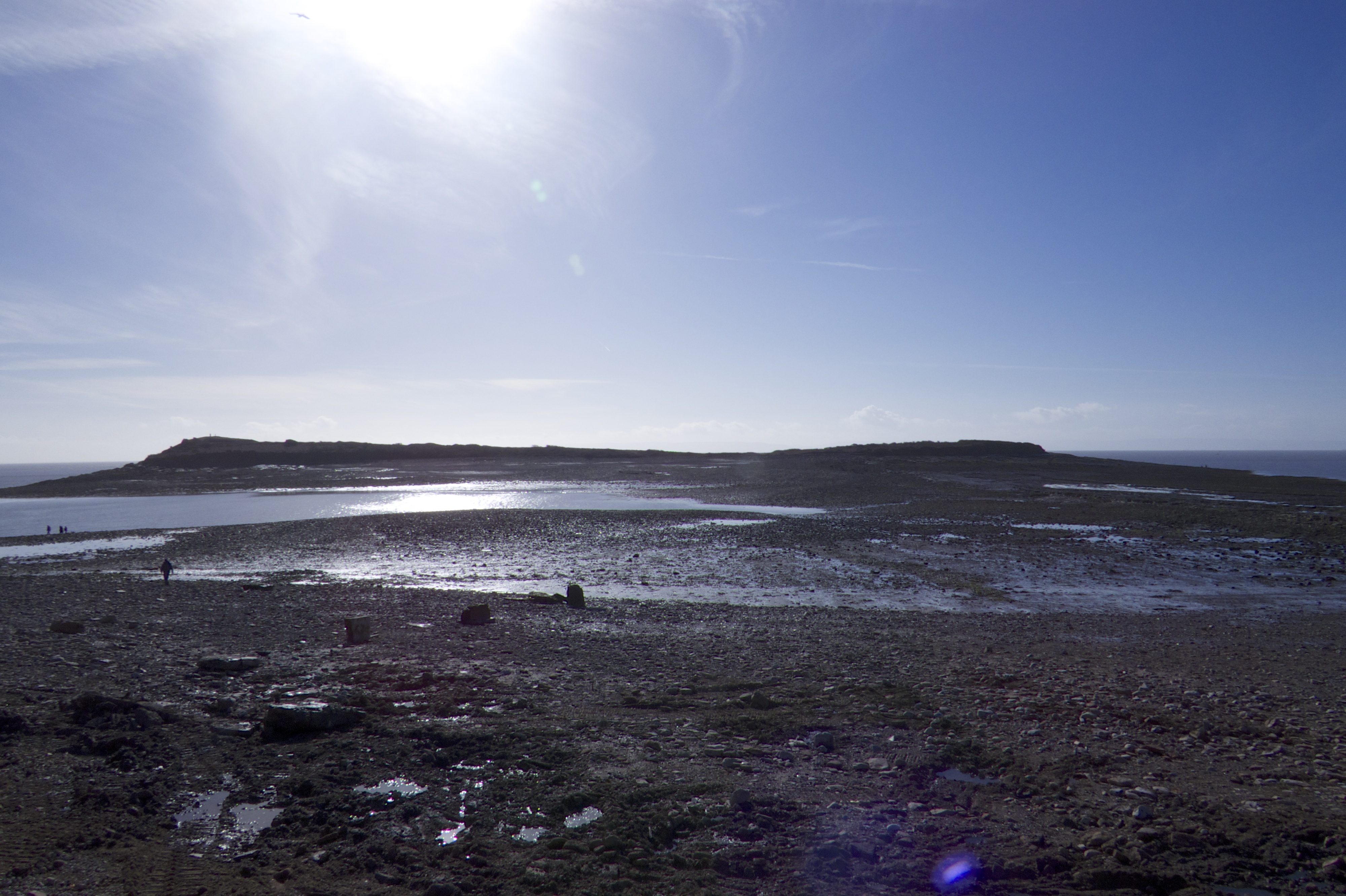
Sully Island is a small island just off the coast and is accessible during low tide. However, the walk There is evidence that the island was frequently visited by both Romans and Vikings, and there is archeological evidence for remains of a multivallate promontory fort occupying the eastern end of the Island, on the summit of which is a Bronze Age barrow. It has been suggested by some that this was an armed stronghold, but it was more likely to have been a defended residence and farm homestead.

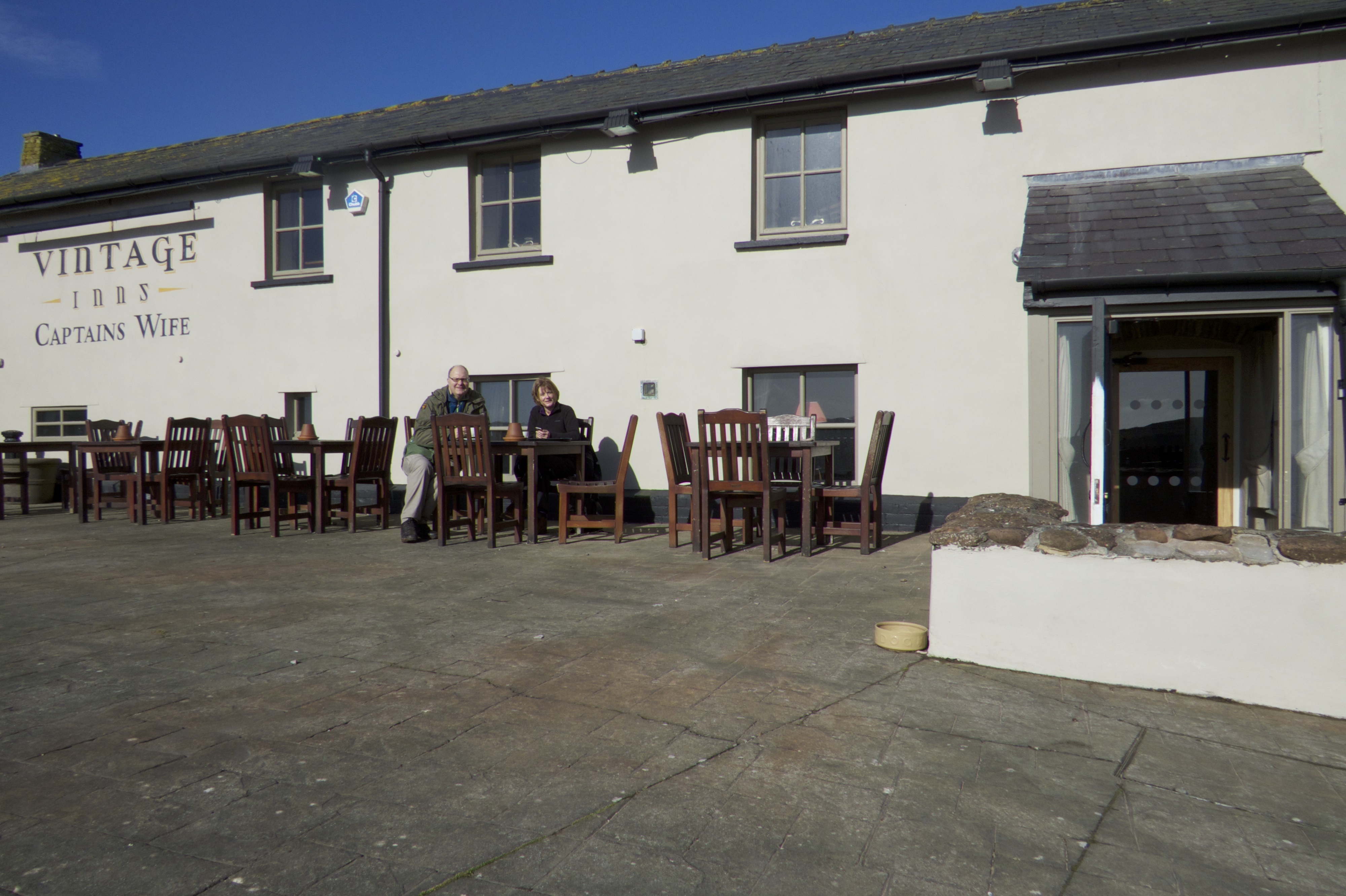
Before we left the sea side it was time for a coffee at the Captain’s Wife Pub. This great little pub was only came into being in the 1970s when it was converted from a row of cottages. This area of the beach is called Swanbridge, and was once a thriving port, though there is no evidence of this to be seen today. The pub is named after a sea captain who lived in the near-by Sully House. The Captains wife would often accompany him on his voyages, but died during one of them. Because it was deem unlucky for a body to stay on board a ship, the Captain concealed the body from the crew by keeping it in a box. When he got back ashore, he buried his wife in the back garden while making arrangements for her funeral. However, when he went to dig her up ready for the funeral he found that some one had already got there before him and exhumed the box, possibly in the believe it was buried treasure. The Captains wife was often seen around the village haunting the area.
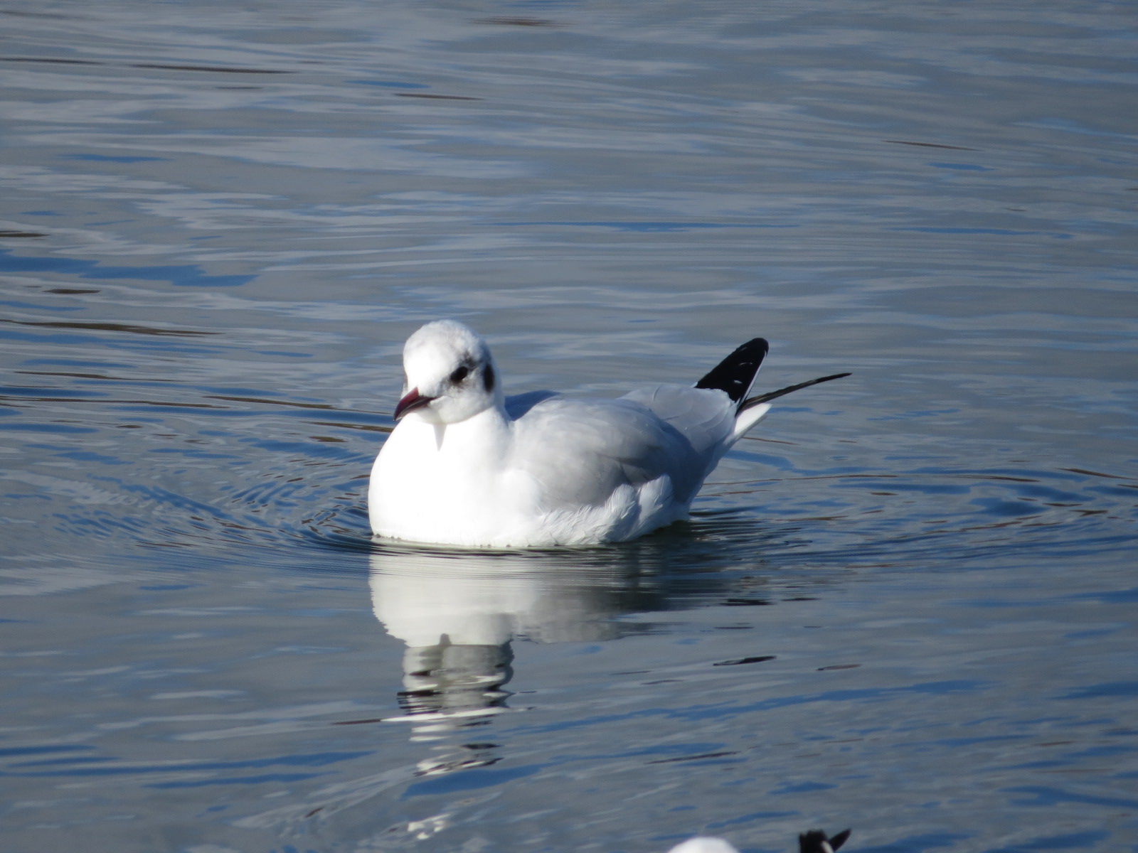
From there we struck inland and along to Cosmeston Lakes. The area was originally a lime stone quarry, which was closed in 1962. the old working filled with water from the many springs in the area. It is now a designated local nature reserve, and is very popular with families and bird watchers.

As we were walking around I watched a blue tit inspecting a hole in a tree. Even though the weather is dreadful, it is not affecting the plans for nesting.

The lakes are great for a walk, bird watching, but also has a small boating area.

From here we then walked over the fields back towards the car. Even though they don’t look too wet here, we found quite a bit of water, and there were a few moans form Auntie as the water started to find its way into her boots!

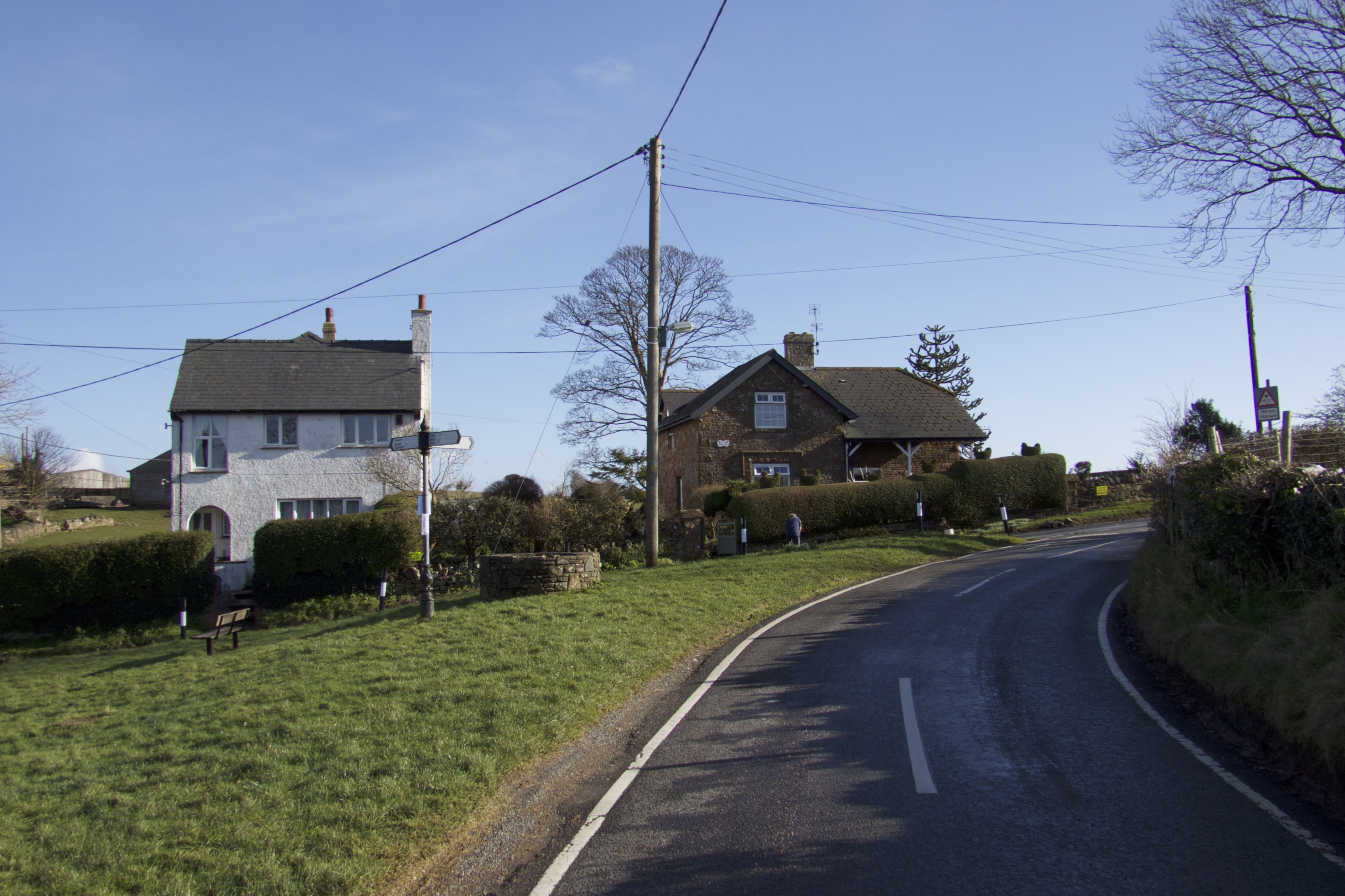
So after slogging away through wet fields and a couple of areas of thick mud we made it back to the road at Cog. This small village, just outside Sully has a long recorded agricultural history as evidenced by the following listed buildings: Nicells, a 17th Century farmhouse (believed to be the original farmhouse at Cog); a 19thCentury stone barn at Home Farm; Cog Farm and outbuildings and 8 rickstands: and The Homestead. There is a system of wells at Cog, one of which can be seen on the grass triangle in the hamlet.

Leave a comment