
We woke to rain on the caravan roof this morning, and hoped that it would clear up. Luckily it did, and the rain held off for the rest of the day. But the cloud cover was low, and the light didn’t lend itself to sparkling photos, so thee aren’t too many in this post.
If yesterday was all about Moels (treeless or bald hills) then today seemed to be about Iron Age hill forts. The day started at the base of one, Moel Arthur and we passed at least 4 others during the 13 miles to Rhuallt.
Hill forts are hilltop settlements built during the Iron Age, about 2500 years ago. Their large banks (ramparts) suggest they were built for protection. However Iron Age people were farmers, crafts- people and traders as well as warriors. In addition to being secure places to live, hillforts may have been used for markets and special celebrations.
Moel Arthur May be one of the smallest hill forts in the area, but it is certainly one of the most eye catching being situated on top of an almost perfectly shaped conical hill. This is where we finished last night and where we started today.

As we climbed to the top the views over to Snowdonia were clearer than yesterday, making it easier to see the outline of Snowdon and the Carneddau mountains in the distance.
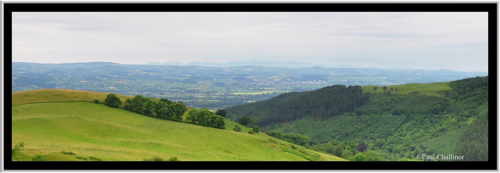
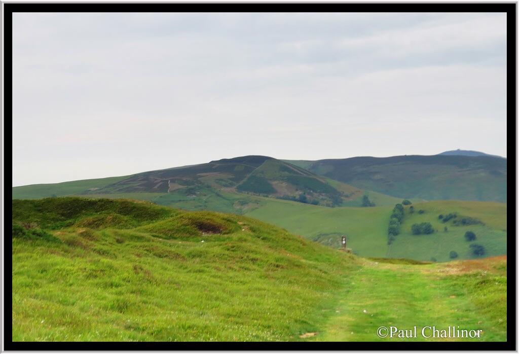
Further along the ridgeway we came to another steep climb up to another hill fort at Penycloddiau. This fort is on a totally different scale to Moel Arthur, and is the largest in the area. From here it is easy to see Moel Arthur and the whole of the Clwydian Range to the South from where we had come.
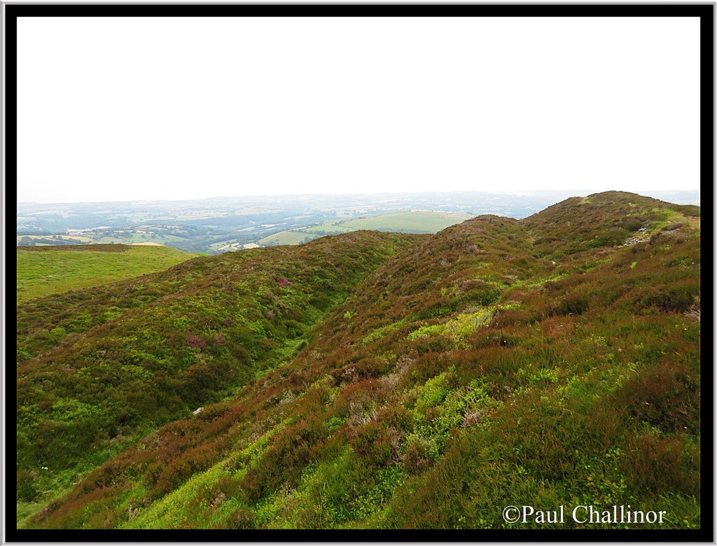
Penycloddiau is the largest hillfort on the Clwydian Range and one of the largest in Wales, enclosing an area of 21 hectares. It is multivallate (with multiple concentric ditches) with extensive ramparts to the north and north-west. These ramparts can be seen in the photo below.
Evidence suggests that houses were built around the edge of the fort to make use of the shelter from the large banks and the large wooden fence that would have topped it. Ponds in the centre of the fort may have provided the inhabitants with water. But even so it doesn’t seem to be the best place for a permanent settlement right on the top of a hill, with no permanent or easy access to water. In reality, all I’ve read hasn’t fully explained the main reasons for this hill forts, especially with so many in such a small area.
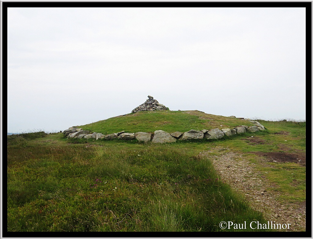
But what is more interesting to me is the antiquity of the site as a whole. On the northern edge of the fort is a Bronze Age burial cairn, taking the age of the site back another 2000 years.
After this the walk slowly wound down to the valley bottom, taking a few more brief hauls over some more hills and eventually down into Rhuallt. Today was a good day for butterflies and moths.
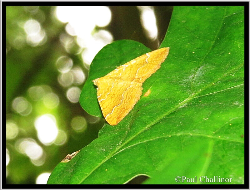
I think this is a Yellow Shell (Camptogramma bilineata). If I discover it’s not I’ll update the blog. It’s a great colour, and the more I learn about moths the moth fascinated I become. But as Aunty would say “don’t bore people” I’ll leave it at that for now.
Another moth we found has superb cryptic markings, but I’ve not been able to identify him yet without all my books in the caravan – “remember the weight restriction” Aunty says.

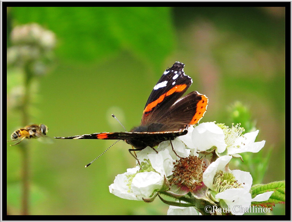
But the photograph I’m pleased with came by accident. As I was lining up the Red Admiral a Hoverfly came into frame.
After 4 days of walking in areas without cars it came as a bit of a shock to cross the busy A55 with cars and lorries screaming underneath us as we descended into Rhuallt at the end of the day. One more day and we will finish the Offa’s Dyke path in Prestatyn tomorrow. There I have promised myself an ice cream. I’ve been on holiday for 4 days now and not had an ice cream yet!

Leave a comment