
If yesterday was about Llans then today it’s all about Moels. There are lots of Moels in north East Wales, and is a common part of the name for many hills in this area. A Moel is a treeless or bald hill. We started off just underneath Moel y Waun (Waun is a moor) and then continued up and down for 14 miles, climbing up or around Moel y Plas (open space), Moel Llanfair (Chruch of St Mary – no church up here though), Moel Eithinen (gorse, not much gorse to day though), Moel Fammau (more on this hill later) and we finished rather gratefully at Moel Arthur (I’m sure you can work that one out yourself).
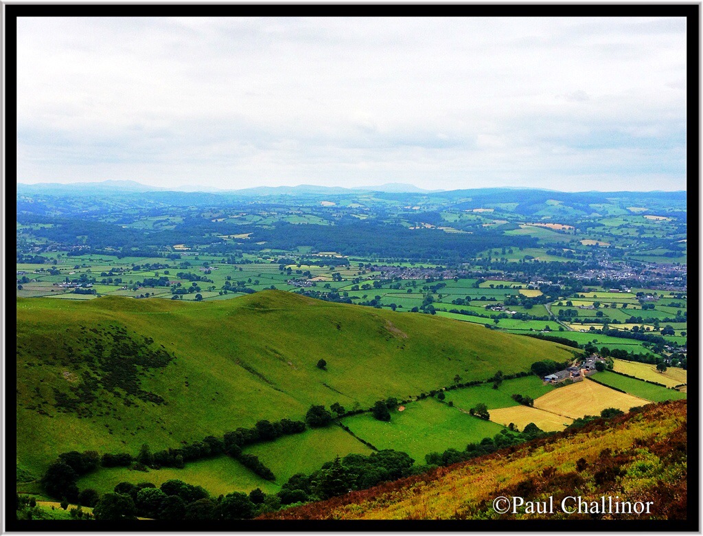
But first a look back across the hills that we walked yesterday – Llandeglar Forest.

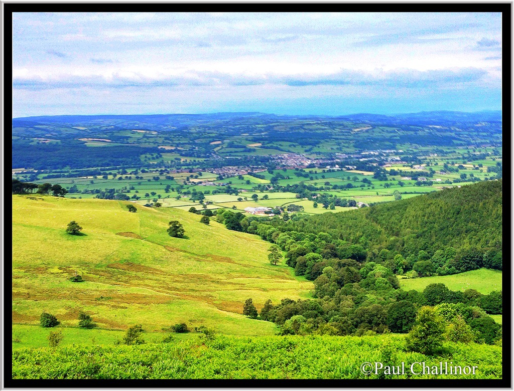
The Offa’s Dyke Path followed the western ridges most of the time and so we were given fantastic views over the Clwyd Valley, and out towards Cadair Idris and Snowdon. Although the sun wasn’t shining the views across this lush green valley are still beautiful.
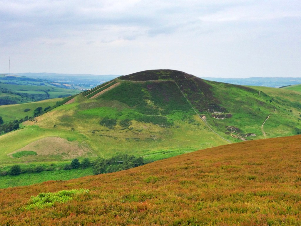
We had lunch just underneath Foel Fenlli (which may be a persons name). This is one of many hill forts along the range of hills and in parts the old ditches and dykes were still visible. But you couldn’t beat the views as we sat munching our way through the ham rolls for lunch.
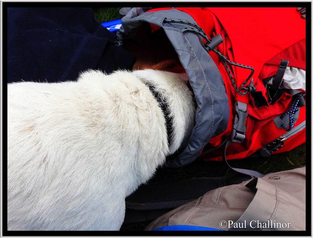
Mind you there was at least one member of the party that wasn’t satisfied with his lunch, and tried a quick raid on my rucksack.
As we climbed out of one valley into another I noticed a bright orange label stuck to the fence. The words are clearly a plaintive cry from a group of young Duke of Edinburg Award candidates! Read and decide for yourselves.

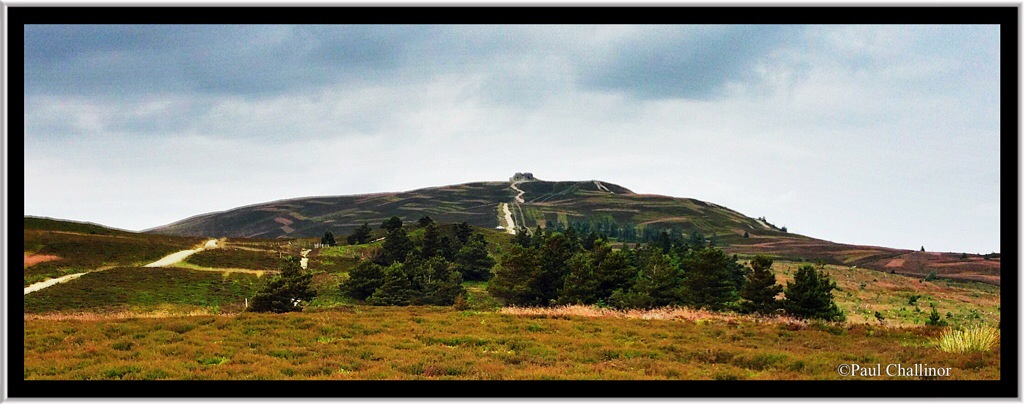
From here the next main landmark was Moel Famau. At 1821 feet, or in new money, 555m, it’s the highest hill around. The meaning of Famau is uncertain, but may be a reference to a persons name. The dominant image of Moel Famau is the Jubille Tower, which can be seen from all around the surrounding area. The tower was built to commemorate the golden jubilee of George III in 1810. It was designed like an Egyptian obelisk with three tiers. Although the foundation stone was laid in 1810 the tower was never completed due to a lack of funds. In 1862, a major storm brought down the incomplete tower. Sycophancy is obviously not a modern trait.
However, on our approach it looked more like the Temple of Doom!
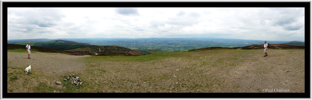
From here the views are great, and I couldn’t resist a panorama photograph which included two brothers-in-law! Is it possible to have too many brothers-in-law? As I have a few more days to spend with him, I’ll not answer that question here.
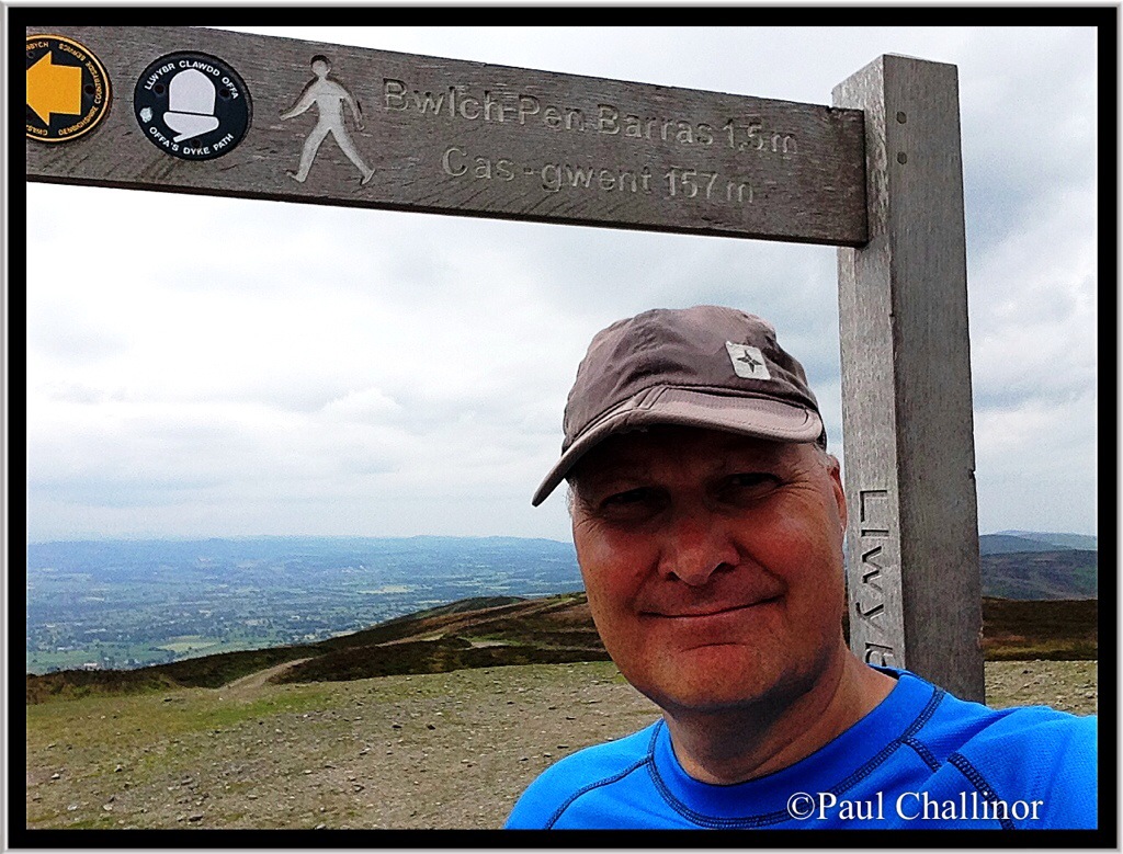
Up to this point we’ve completed 157 miles of the Offa’s Dyke. Well at least according to the sign at the top of Moel Famau.
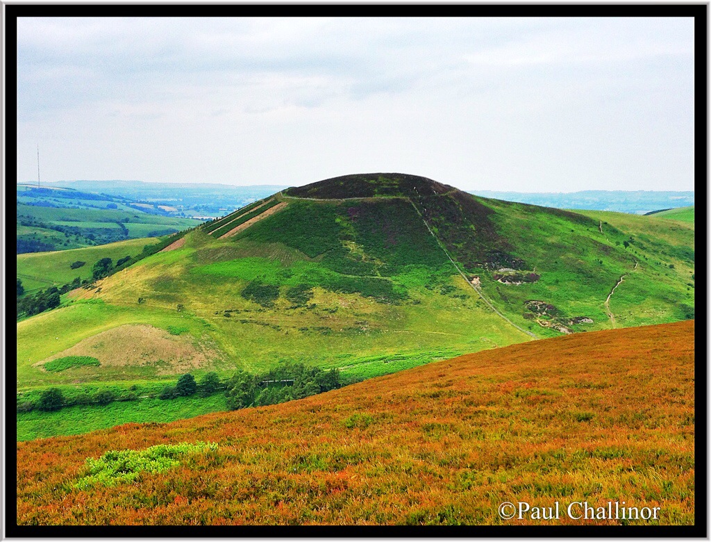
Then finally after almost 14 miles we come to the end of today’s walk, and where we parked one of the cars. Tomorrow we start here at Moel Arthur, another Iron Age fort.

Leave a comment