
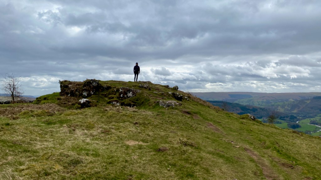
March 27th 2021 – a date that I may well remember. After a long, long winter the Welsh Government lifted travel restrictions, but only within Wales. The pandemic is slowing, the vaccination program is going exceptionally well and we are now rewarded with greater freedom, no longer restricted to “Staying Local”. Therefore, Aunty and I took full advantage and escaped for a quick walk in the Brecon Beacons. Just north of Abergavenny is a tiny hamlet to Llansantfraedd, sitting in the shadow of Allt yr Esgair. Allt means ridge and Esgair is a wooded slope. It’s not high and is classified as a Marilyn, that is “a hill of any height with a drop of 150 metres (nearly 500 ft) or more on all sides”. So it is a hill which is relatively high compared to its surroundings. This is a circular walk of about 6km and a great excuse for an easy a leg stretch. The summit has been measured at 393m (1289 feet), admittedly not very high, but still a great walk.

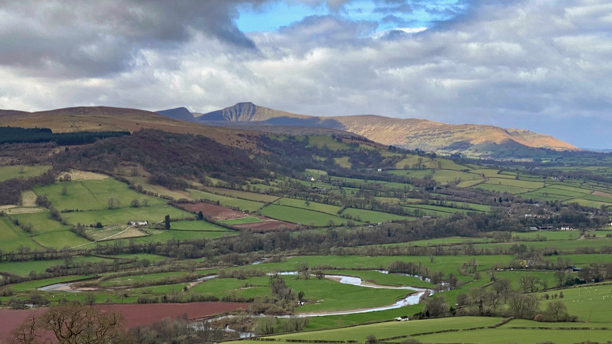
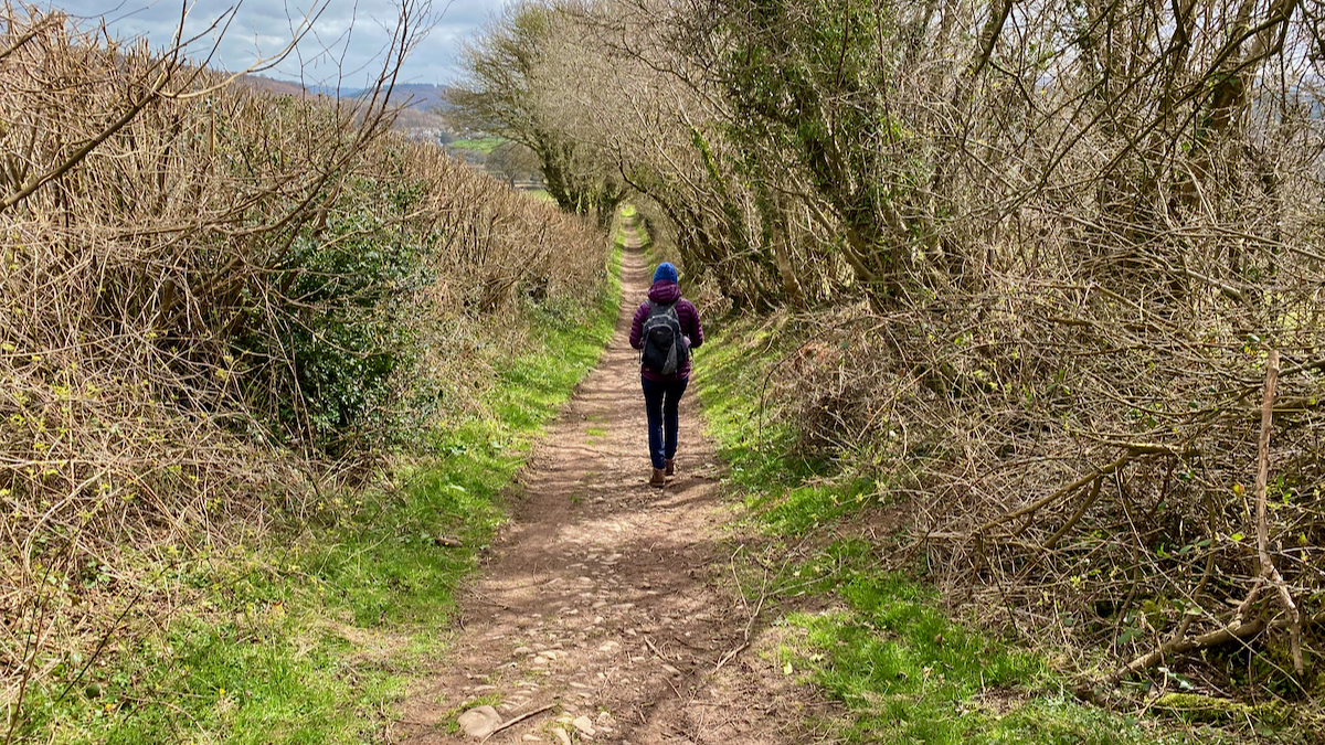
Allt yr Esgair is formed from sandstones and mudstones from the Senni period and were originally laid down during the Devonian period. The lower slopes are formed from mudstones and sandstones of the slightly older St Maughans Formation. There is evidence of small quarries along the slopes and near the summit. The route we took was along a bridal way the climbed slowly through woods until we reached the northern tip of the escarpment. At places it’s possible to see through the trees which offered great views over the Usk Valley through to the summit of Pen y Fan and Fan y Big to the west.
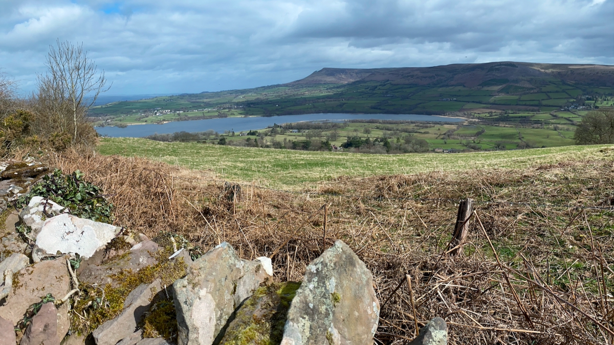
To the north is Llangorse Lake, Llyn Syfaddon in Welsh, and interesting destination in it’s own right. Llangorse is the largest freshwater lake in South Wales and offers a variety if water sports, but is also has the remains ion the only Crannog in Wales. The crannog was the central focus of one of TimeTeams programs.
The top of the ridge is occupied by a large Iron Iron Age hill fort. However the quarries that are scattered along the slopes and the summit complicated any of my attempts to find out where the Iron Age Forts stops and starts. If you look on any of the satellite maps like Google or Apple maps the shape and size of the fort is clear.
The ridge also plays host to the Roman road that linked the forts of Roman fort of Cicucuim at Brecon and Gobannium at Abergavenny. The most distinct of which can seen at the Southern end of the ridge, now a green lane.
If you are in the area it’s worth the effort to park up in the lay-by on the A40 and take a couple of hours to yourself and take in the beauty of the Use Valley and the Brecon Beacons to the west.

Leave a comment