
Easter weekend 2021 – lockdown in Wales has finished and Auntie’s gamble with booking the holiday paid off. We are now allowed to travel further than ‘local’ distances, within Wales at least, though no-one can yet travel across borders in the UK, except for essential travel. After a week of warm weather the forecast for the Bank Holiday weekend was stereotypical. Cold, but at least dry. Gone were the warm air currents from Africa, to be replaced overnight with arctic air from the north. After an eight. Month hiatus we are back tramping along the Wales Coast Path. This time in North Wales, having completed everything from Chepstow through to Criccieth. We started the walk in 5ºC, 15ºC lower than the day before. The days walk was from Criccieth to Pwllheli, but first we needed to catch the train to Criccieth. Pwllheli is the terminus of the Cambrian Coast line, and we boarded the train alone, no-one else got on besides the driver and the guard. Normally the place would be full of tourists on a Bank Holiday Weekend, but the pandemic has changed this fundamentally. The shops in town are shut, the pubs are shut and Pwllheli was very quiet. Hopefully this will change over the summer as restrictions are lifted, for everyones benefit.

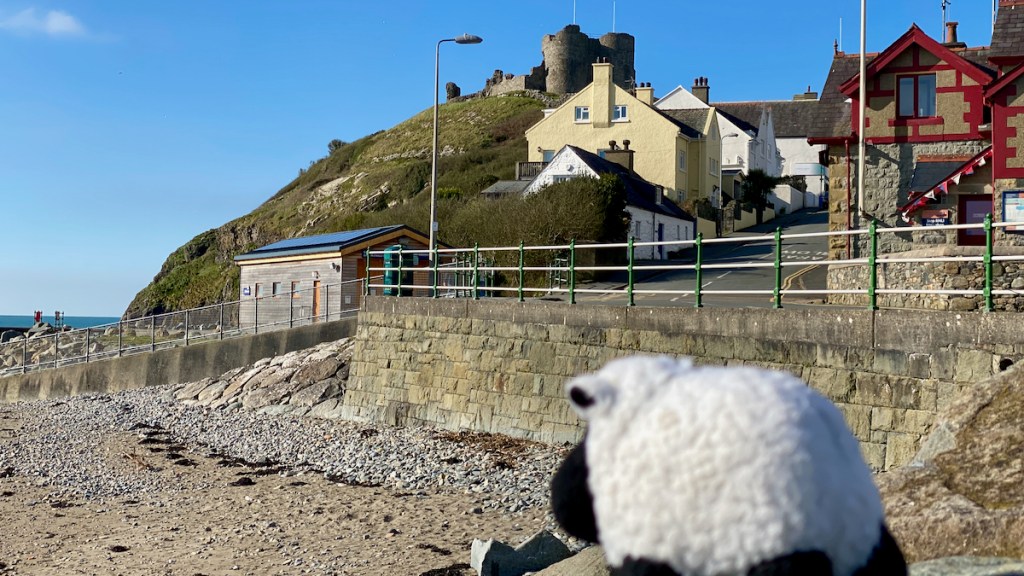
The walk started in the shadow of Criccieth Castle, standing on a rocky prominence surrounded by the sea and with the town laying down at it’s feet. The castle was originally founded by Llewelyn Fawr. The castle can be seen from so many perspectives as you approach the town, and would certainly have made the statement that “I have been built by a powerful Prince!”. Originally the administrative centre for the commote of Eifionydd, it was also used by Llewelyn as a prison. Llewelyn’s son Dafydd incarcerated his half brother, Gruffudd, here for years while their father was terminally ill. Family politics can be complicated and cruel. In March 1283 Criccieth was captured by Edward I on his campaign to finally subdue the Welsh. Edward rebuilt the castle and over the years it was attacked during a couple of rebellions, notably by Owain Glyndwr in 1404, when it was destroyed, never rebuilt and fell out history.
After leaving Criccieth the path follows along easy walking routes, first passing through low land marshy areas, before being forced inland to follow the main road for 2 miles. Not the best part of the walk by any means. Finally at Afonwen we were able to rejoin the coast, skirting around the old Butlins Holiday Camp.
I can remember coming up here on the train a few times on Sunday school trips, being allowed to run free in the swimming pool and other delights that were a fascination to a 9 year old boy. The camp was originally built by Billy Butlin in 1940 following a request by the Admiralty, to be used as a training camp, on the promise that after the war the camp would revert back to Butlins as a holiday camp. Just 4 weeks after construction was started it opened as HMS Glendower, and 8000 servicemen had to first sleep in tents until all the buildings were completed. True to it’s promise the Admiralty handed the camp over to Butlins after the war, and after some refurbishment the holiday camp opened to the public in March 1947. Over the years the camp expanded and by the 1960’s was able to host 12,000 holiday makers. A huge number when you consider the rural nature and relative sparse population of North Wales. Almost everyone arrived by train, disembarking at the camps own railway station, Penychain Station. Holiday patterns changed during the 1980s and 90s and the attraction of Butlins Holiday Camps in the UK declined. Overseas travel became increasing affordable hastening the decline. The camp is now owned by Haven Holidays, a sister company of Butlins. Gone are all the mini flats and accommodation, to be replaced by what seems to be hundreds of static caravans, all eerily silent because of the pandemic.

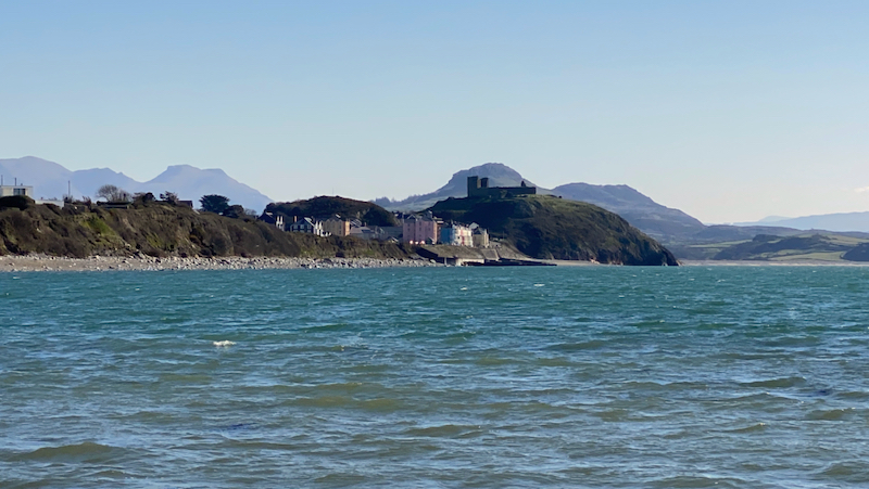
But the beach here provides a fantastic panorama looking back towards Criccieth Castle and Moel y Gest standing guard over the coast. From here we can also see all that we’ve walked so far along the Merionydd coast last year. The path then climbs up to Penychain Point. Well maybe a bit of an exaggeration, it’s not a high climb, more a stroll really. On the point gun placements are still visible, originally built to provide defence for the camp in case of bombing raids during the war. The trig point provides a great view of the long sweeping 4 mile beach that stretches all the way to Pwllheli.

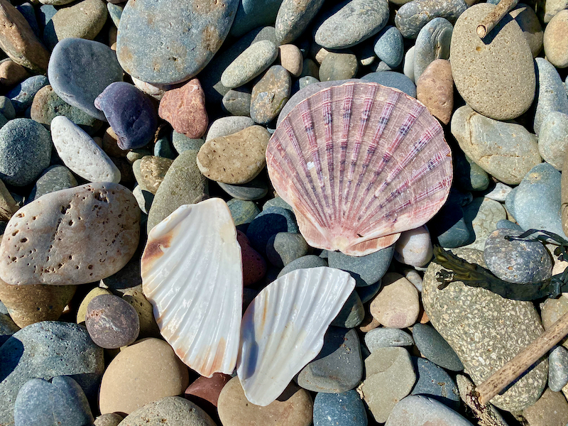
The huge expanse of Morfa Abererch stretches the rest of the way to Pwllheli. This beach was a treasure trove to me, with many finds including Great Scallop, Turban Topshells and much more besides. By this time it is warmed up considerably, but the wind still kept a bite to it at times. The walk along the beach continues as it enters Pwllheli taking walkers along the harbour.
The size of the harbour belies the small population of the town, barely more than 4000 people in the 2011 census, and I doubt it is very different today. The town has a long history and was The town was given its charter as a borough by Edward, the Black Prince, in 1355. The. Market is still held every Wednesday in the town centre on Y Maes. The town grew up around the harbour which supported ship building and fishing industries, and was also used to export granite from the local quarries. The end of the days walk. We’ll take off from Pwllheli later on the next stage around the Lleyn.


Leave a comment