
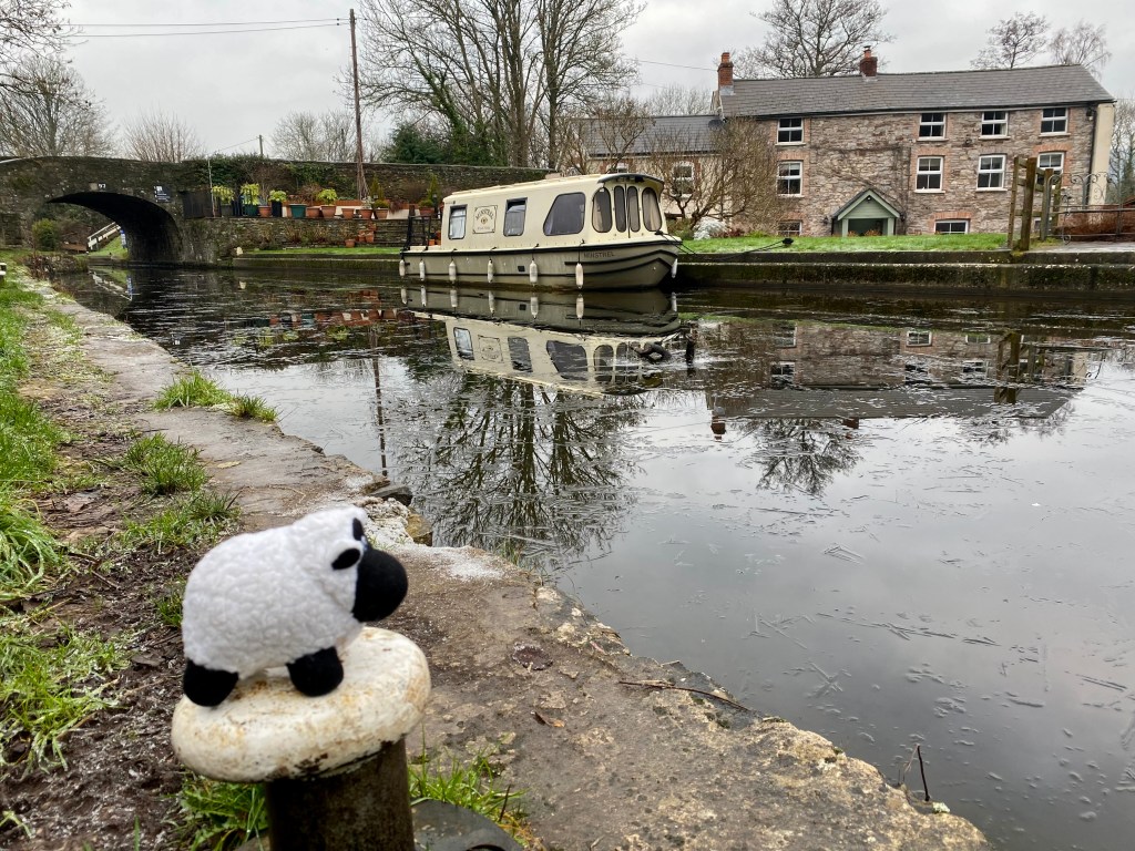
Isn’t it typical, after spending the week gazing out of the office window at wall to wall January sunshine the weekend brought the clouds hiding the sun. But that was not going to stop us. We panned a circular walk from Abergavenny along a canal and back. I like walking along canals, though Aunty less so thinking them ‘a little boring’. No I cry thinking about the wildlife (not really Aunty’s thing so much), the history and shear determination to survey, plan and dig the miles and miles of canals that crisscross the UK (also not so much Aunty’s thing). But there you go I suppose. But today we did go along the canal, and it was a pleasure to get out at last after Christmas, even thought the weather was a little disappointing. After a week of sunshine the weekend brought in dank, damp and cold overcast skies – drat. This was a short walk from Abergavenny up to the Canal at Llanfoist and along to Govilon. Even though this is such a short walk there is so much history along this section, and being a canal its industrial history.
Today it’s hard to imagine the noise, smells and industry that went on along the canal side. All we see now are tranquil scenes and water reflections. The old warehouses have been converted into holiday homes, and lime kilns have all been restored but are now only silent witnesses to the toil and lives of the past.
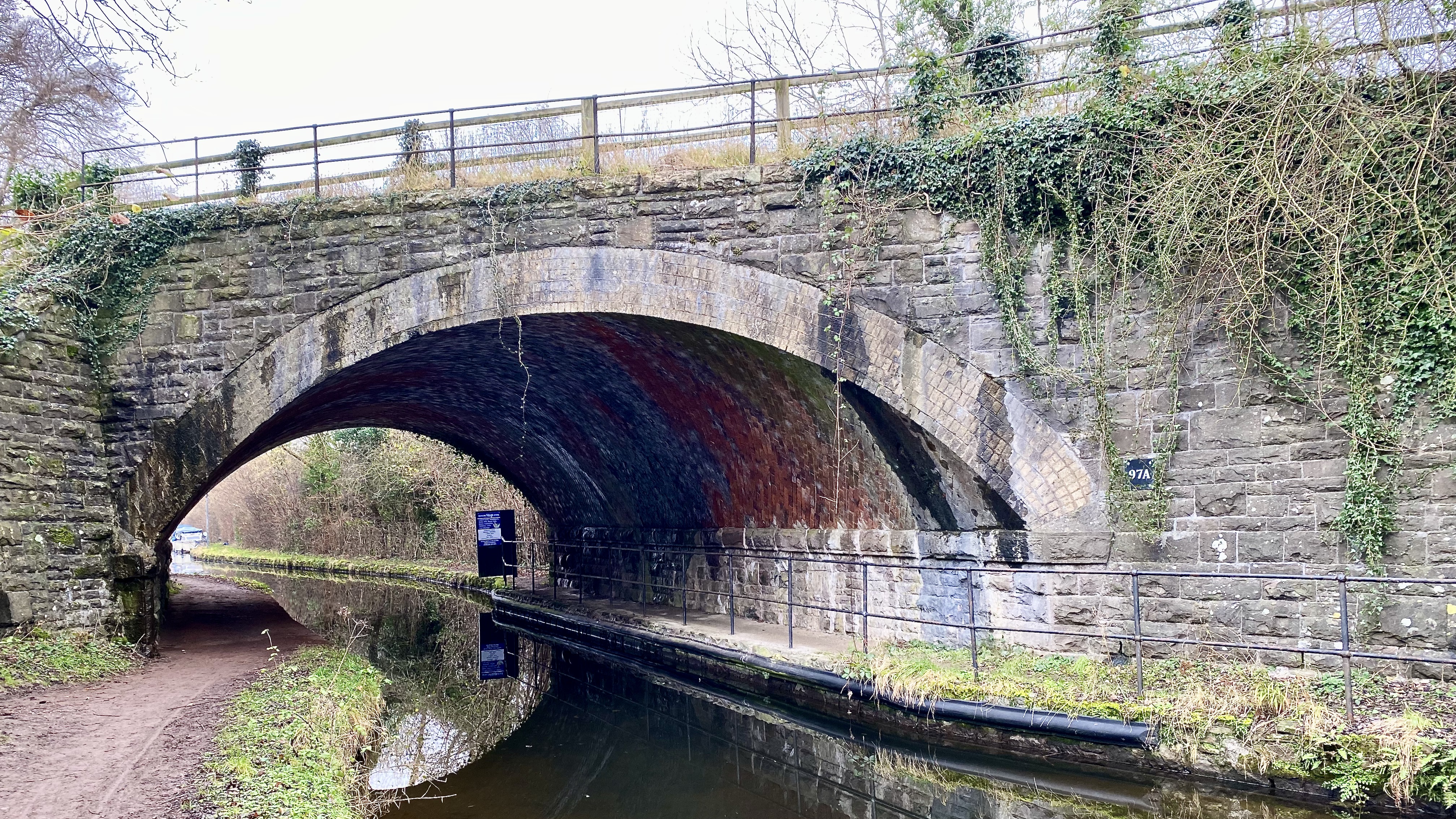
Known today as the Monmouth & Brecon canal it started life as two separate canals: the Brecknock & Abergavenny Canal, and the Monmouthshire Canal. Today the 35-mile navigable section seen today is mostly the former. After receiving an Act of Parliament in the 1790’s the Monmouthshire Canal Company started work, at the same time as the Brecknock & Abergavenny Canal was being planned. The decisions to join the two at Pontymoile. In 1799 The Monmouthshire Canal, including a branch from Malpas to Crumlin, was opened, with the Brecknock & Abergavenny extending from Brecon to Gilwern by 1800, finally reaching Pontymoile by 1812.
After a steep walk up a narrow single track road we joined the canal at Llanfoist, a small and now quiet village above Abergavenny and in the shadow of The Blorenge to the South. The etymology of Llanfoist is uncertain, but may originate from the church of St Faith, or from the Latin ‘Faustus’ meaning prosperous, or even from St Ffwyst, a Welsh saint of the 6th Century, about whom next to I’ve found very little. He was also known as Foist, hence the name of the village, but the Latin name was probably Fausta. Thodays picturesque wharf was once a busy interchange between a tram road bring down iron and the canal. The iron was brought down from Blaenavon, on the opposite side of the Blorenge. The tramroad was opened in 1821, and also served a forge on the west side of Blorenge at Garnddyrys. Before the ramrod was built iron was transported sound to Pontnewynydd, and then by boat to Newport on the Monmouthshire Canal. So why not continue with this arrangement? The tolls per ton were cheaper on the Brecon and Abergavenny Canal, and those toll prices applied to cargo with then continued on along the Monmouthshire Canal. Therefore loading the iron at LLanfoist meant the Thomas Hill, the Blaenavon Ironmaster, provided a real cost saving even though the iron was transported over a longer distance.
The trams descended down the hill side metres in three stages of an incline plane down to Llanfoist wharf and its warehouse. As the full wagons descended from the iron works they pulled up the empty ones to restart the process again. By 1880 the ramrod was rendered defunct when the railway from Blaenavon to Newport was opened. And eventually the railways will also mean the canals will have. No future as a major transport system. Today the warehouses on the wharf have been converted in holiday accommodation and are available for rent.
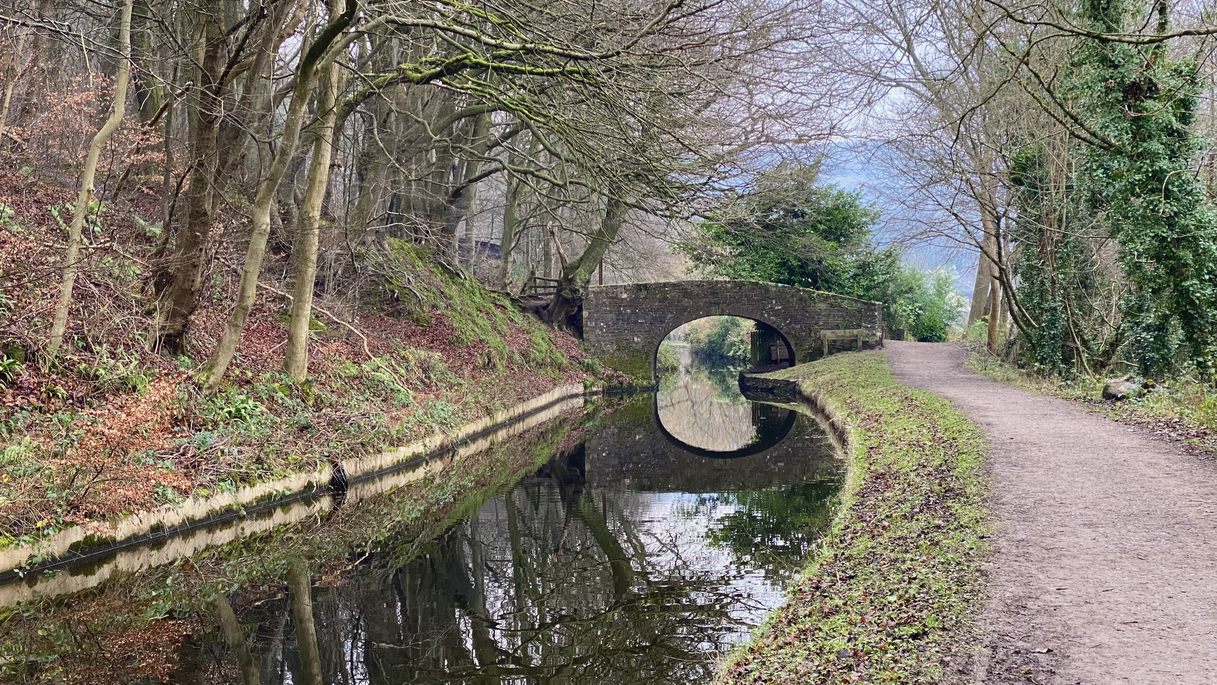
If you have ever walked along a canal you may be used to long stretches of water with few bends. Not so with the canal here in South Wales. By their very nature canals need to follow a level, otherwise it becomes a river. The valleys around here tend to be steep, and so to allow the canal to function the channel must follow the contours of the hillside, and so this means the canal meanders while it hugs the side of the valley. This makes a far more interesting walk. Walking westwards from Llanfoist we arrived at Govilon after a couple of miles.
Govilon is not the usual Welsh name that are so common, and its origin remains obscure. It may have come from the Welsh gefailion which can be roughly translated as force or power, relating to the old nail factory or flour mills that were active once in the village.
Govilon Wharf was built initially to allow transfer of goods, mostly coal, from the canal boats onto wagons of the Llanfihangel Railway, a horse drawn tramroad.
The wharf on the north side of the canal at Govilon was initially built for transfer of goods, primarily coal, between boats and wagons on the Llanfihangel Railway, a horse-worked tramroad. Govilon was the canal terminus after it was extended from Gilwern in 1805., and remained so for 7 years until the canal was extended to eventually meet the Monmouthshire Canal at Pontymoile. The canal towpath was originally on the north bank, but it was switched to accommodate the Llanfihangel Railway Company’s new wharf. The tramroad opened in 1814 and ran to Llanfihangel Crucorney (north of Abergavenny). Later on, coal was transferred there to the Grosmont and Hereford tramroads.

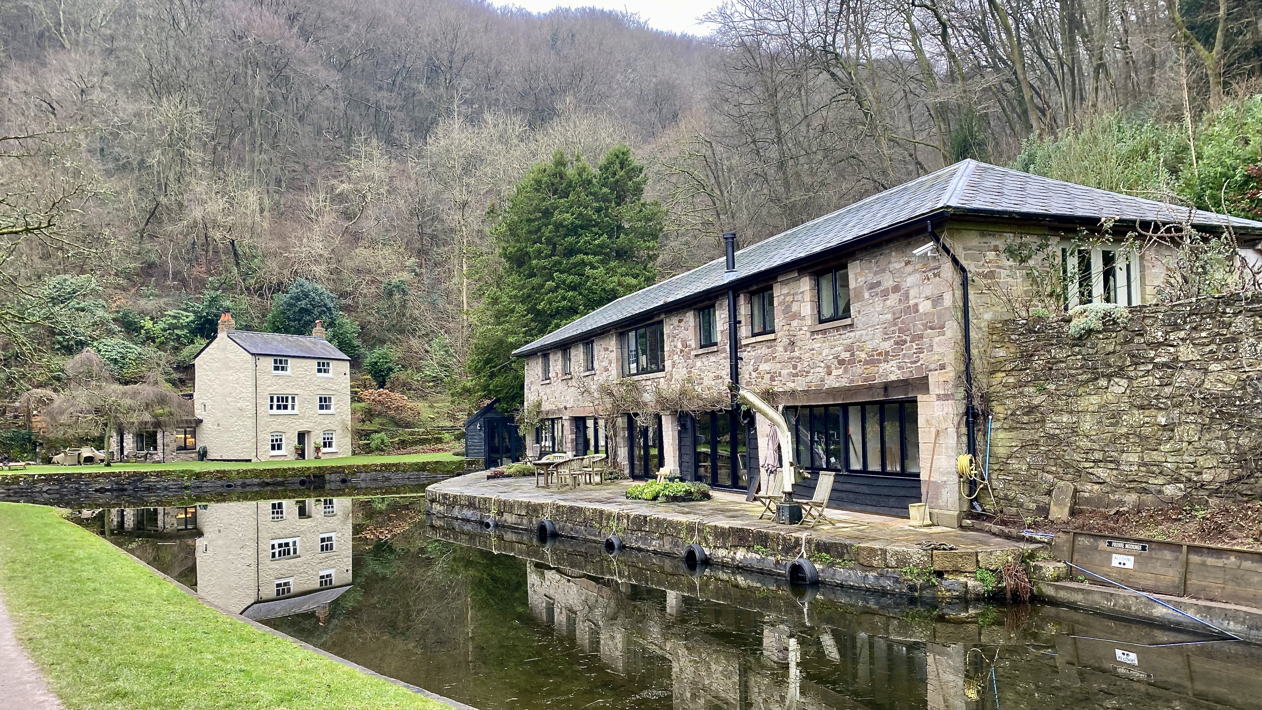
In 1821 another tramroad was built connecting the Crawshay Bailey Ironworks to the canal bring more business. The three-storey warehouse which Crawshay Bailey built at around the same time for storage of iron awaiting onward transport by boat is still standing, and is now hosts offices of the Canal & River Trust, which looks after the navigable part of the canal.
In 1848 it was suggested that the canal needed better security, after two men were attacked at Bailey’s Wharf in Govilon by a group of men who were “on the strike”. The boat belonged to a Mrs Prosser of Brecon and was in the care of Henry Parry, who went ashore here to unhitch the tow rope so the boat could pass moored vessels. He was knocked into the canal three times. The assailants then walked across the moored vessels to attack his colleague, John Williams. They abandoned the attack when they discovered a jug of rum in the boat’s cabin and made off with it.
We left the canal at Govilon and followed the track bed of the now disused railway back towards LLanfoist. The tramroads were superseded by railways with steam locomotives, and goods were increasingly carried southwards from the Heads of the Valleys. The railway through Govilon was built by an independent company as far as Brynmawr. The London & North Western Railway, then Britain’s biggest railway company, operated the line from the start, initially through a lease. It took over the line in 1866 and added numerous extensions, including Brynmawr to Merthyr. This line gave the LNWR a backdoor route to the huge industrial output of the South Wales Valleys.
The railway was one of the steepest in Britain, and the section past Govilon wharf was the steepest on the route. The gradient here was one in 34 (rising one metre in every 34 horizontal metres). This was taxing for steam engines. Freight trains had to be relatively short, to ease the load and to ensure the guard’s van at the rear could halt the wagons if they became detached. The gradient eased at Govilon station, west of here, but then continued at one in 37!
In 1877 a train ran out of control from Govilon and crashed into a stationary coal train at Llanfoist. The driver of the runaway train was unharmed. The fireman (stoker) leapt from the cab before the impact and was badly injured, as was the coal train’s guard.
After the Second World War the railway was owned by British Railways, which withdrew freight trains in 1954 to avoid the expense of operating them over such a steep route. The last passenger train ran in 1958.

Leave a comment