
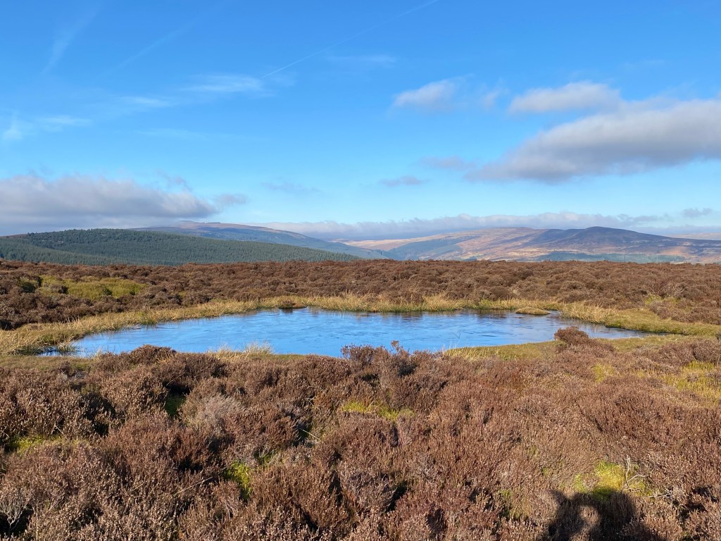
Today Cwm Grwyne Fawr seems to be a journeys end. The single track road becomes narrower and narrower snaking further into the hills. The farm houses we passed appeared less frequently giving a real sense of sense of remoteness even though this is only a few miles from Abergavenny. However, it was not always thus as the valley ridges provided trackways along the East West axis allowing travellers to move relatively freely though and across the country. The name probably originates from gweryn or gwerynau and mawr/fawr meaning ‘large river at the wet place’. This being Wales and among the Black Mountains in the west for the Brecon Beacons there is plenty of water.

After parking in the forestry car park at Pont Cadwgan it was necessary to wear a number of layers to protect us from the cold clear morning air. Overall this was a short walk of just under 8 miles, but it was full of contrasts and interest. But first we had to walk up the southern side of the valley and wheeze our way up the steep path through the dark Mynydd Ddu forestry plantation.
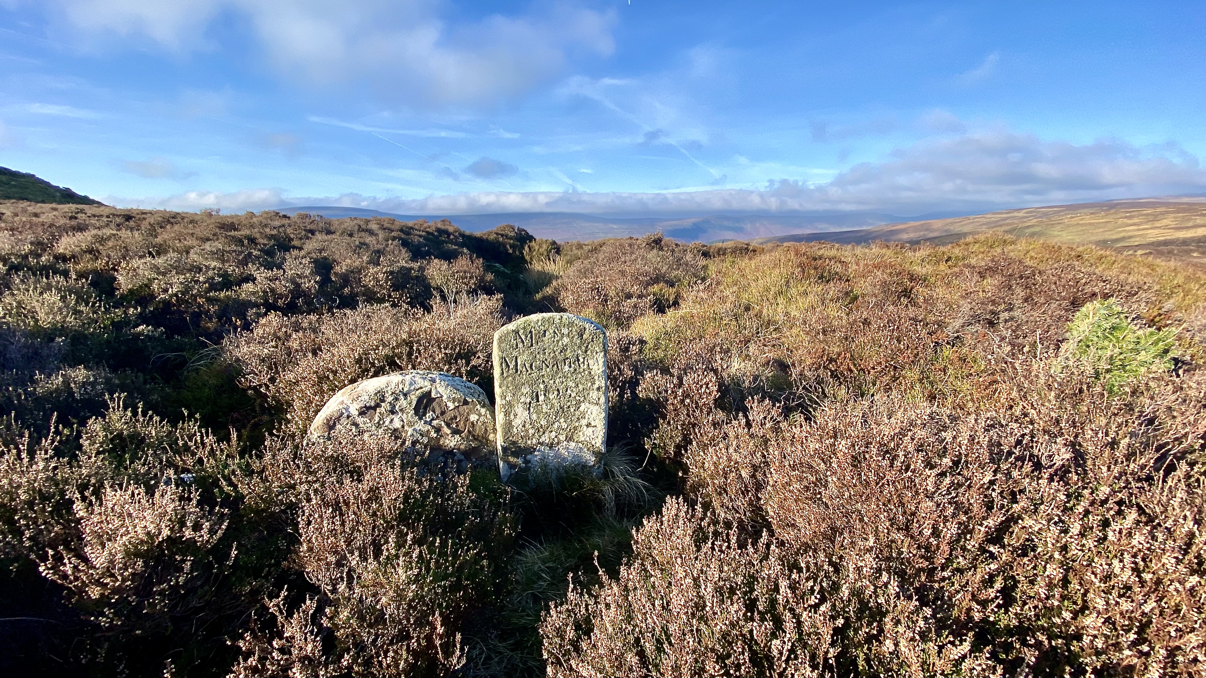
Escaping from the oppressive dark of the forest plantation we seemingly burst out onto the open moorland bathed in cold sunshine. A welcome feeling of space after the slightly claustrophobic murky forest pathway. Just beyond the gate are 3 small stones, boundary markers identifying where one estate ended and another began. These can be found in a number of places around the Brecon Beacons, and were the best way to define limits to ownership of land in remote hills where normal boundaries of streams or forests would otherwise be used. Just visible in one of these stones is the inscription “Mrs Macnamara 1835”. After her husband had died Mrs Macnamara was able to buy and own land in her own right. There is a very interesting piece about the history of the stones and what they record here
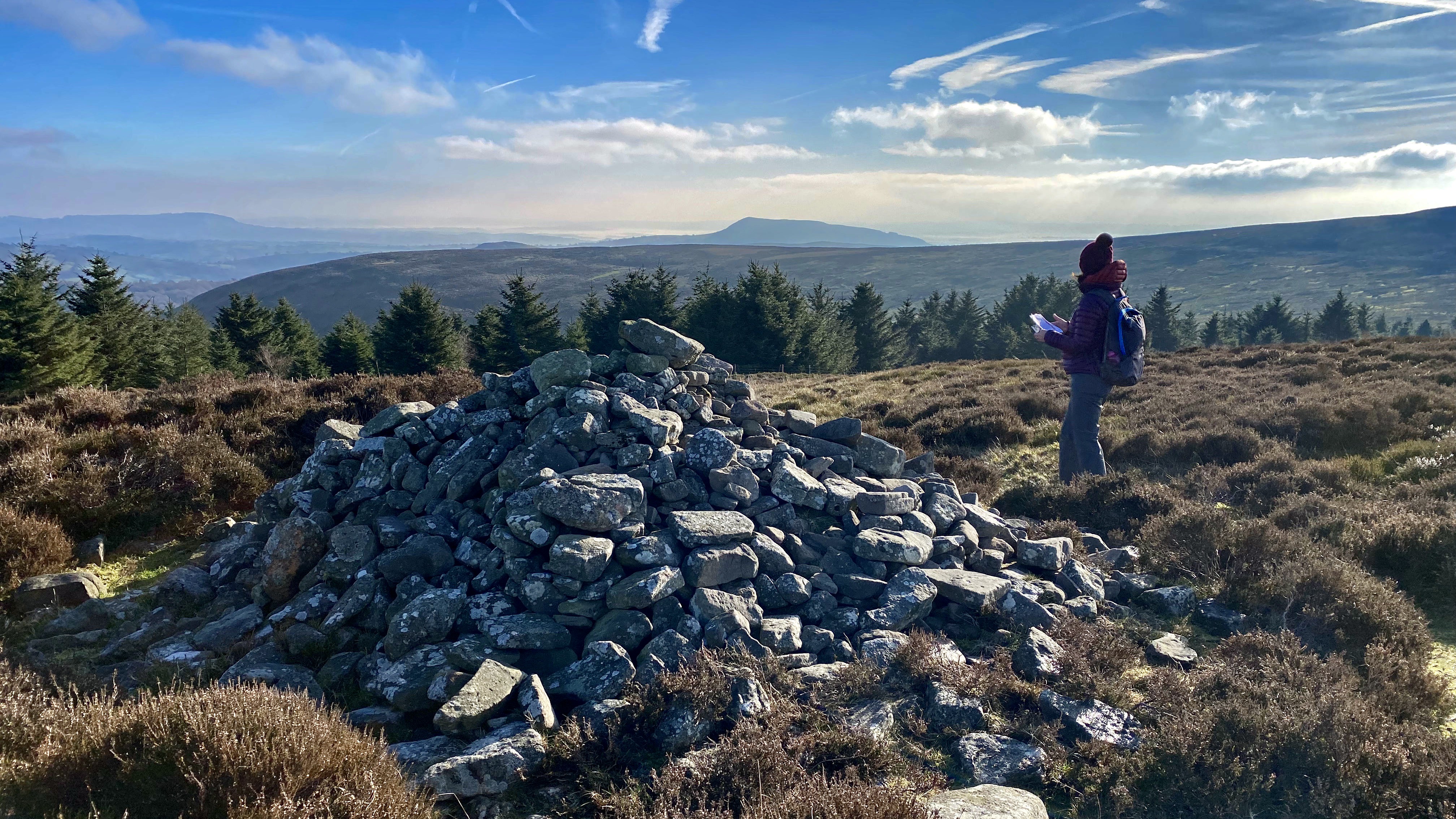
From the boundary stones it is just a short detour to Carn Disgwylfa. Standing here it felt as if we were as high as could be, though in reality it’s not that elevated but the views are always worth the effort when you stand on top of the hill. The wind was keen and the air was buoyant enough to allow a clear view south over Cwm Grwyne Fach across the ridge opposite. It’s clear why this small summit received its name as it seemed we soar over the summits of Pen Cerrig-calch and Pen Allt-mawr. Carn Disgwylfa is just one of a series of six Bronze Age burial cairns along the ridge between Pen y Gader Fawr and Disgwylfa, each marking a prominent position. It is conceivable that these sites may have served the community as more than burial sites and could have had a territorial function. So many along the same ridge and in such a prominent situation surly must have been making a wider statement than just ‘here are my ancestors’.
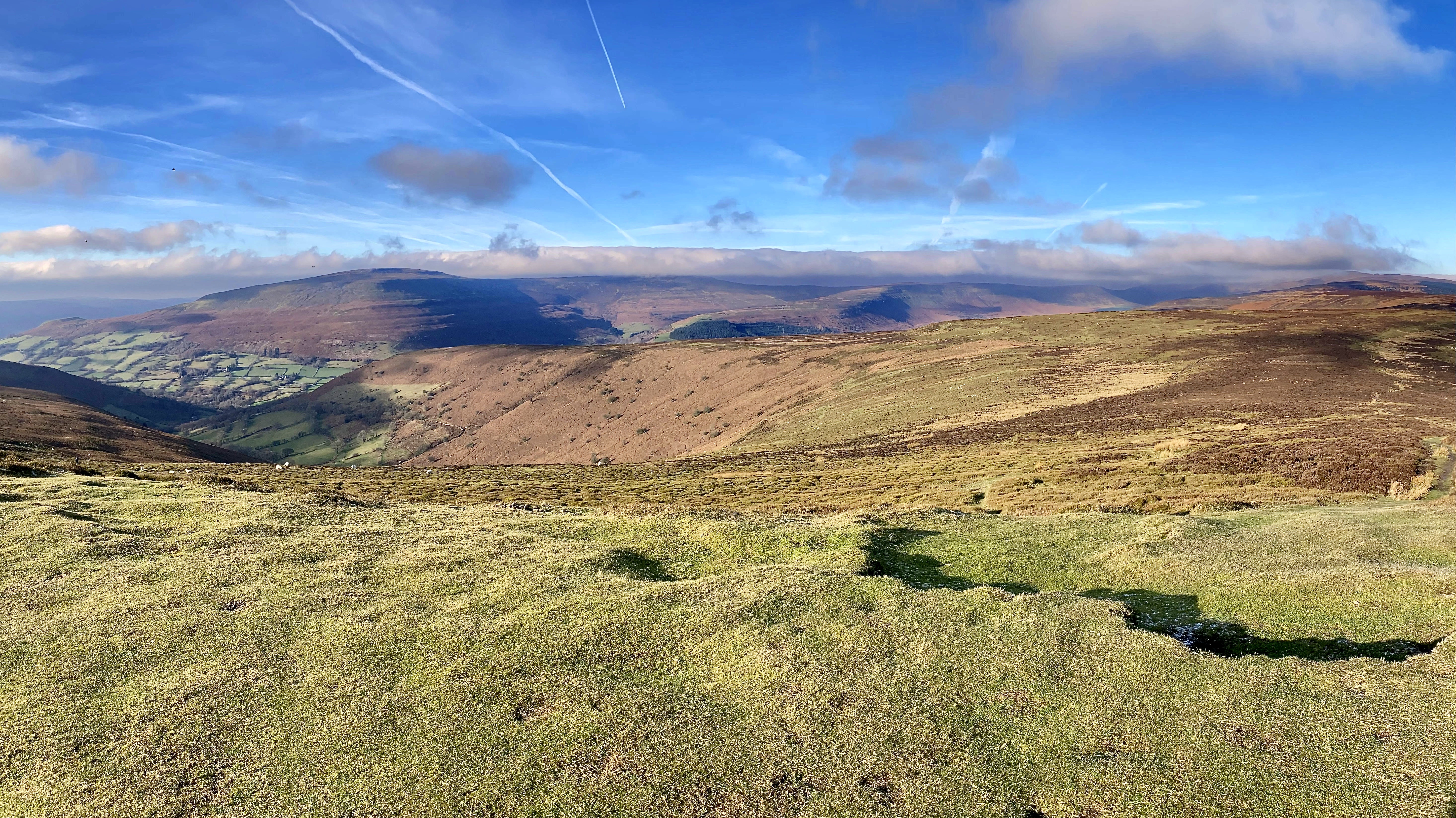
After a short but cold sojourn on Dysgwlfa we followed the ridge eastwards that separates the two river valleys of Grwyne Fawr and Grwyne Fechan which drain the Old Red Sandstone hills above them. The underlying rocks are the Brownstones and Senni Formations which date from the Breconian stage of the Devonian period. The dry stone walls delineating the fields on the lower slopes clearing show the rocks. The lower reaches of the river run through an area blanketed with glacial till, a legacy of the last ice age. However, up here it is open moorland blanketed in heather and bilberry, hosting a few depressed looking sheep. Lunch was on Crug Mawr the most eastern summit on the ridge. By this time the wind was picking up, and we had to shelter lower down on the northern side. But not before Barry was given the opportunity to pose on the Trig Point. Despite the cold wind it was still great to be outside. The opportunity to sit and reflect while looking out over the hill tops cannot be beaten.

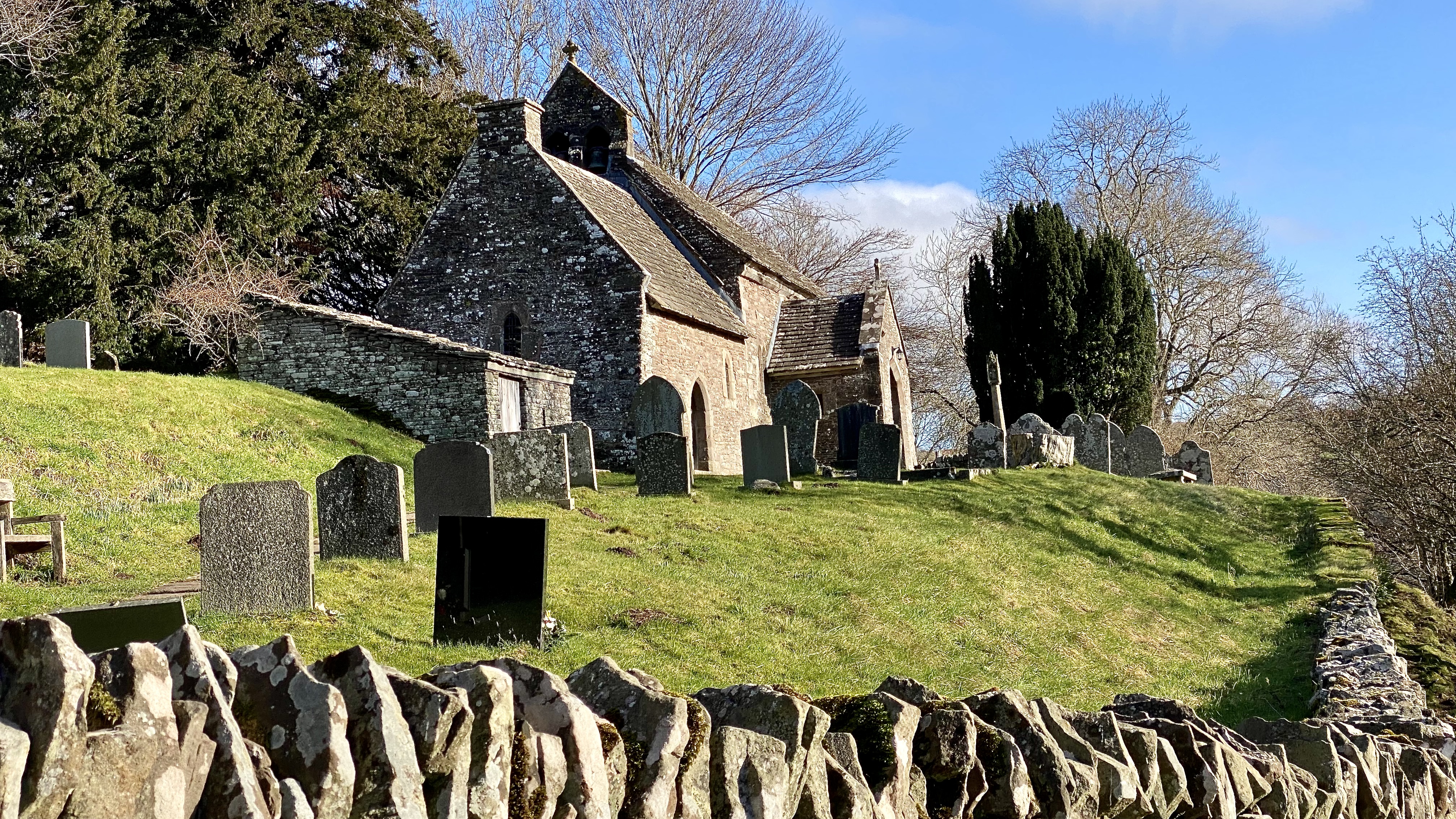
All too quickly the walk leaves the lights behind and from Crug Mawr the path descends quickly back down and joins a small road that leads to the old St Issui Church. If you are unable to walk the hills, this delightful and intriguing church is a must visit. The oldest part dates to around the 11th Century, but this has been a religious pilgrimage site for many centuries before. Pilgrims would visit Ffynnon St Issui just below the church. The story is that a grateful French visitor was cured of leprosy and gave a ‘hatful of gold’ to pay for the foundation of the church.
After closing the Afon Grwyne Fawr the path follows the road past the Tabernacle Chapel. Built in 1837, the Baptist Chapel serves the community of Gwryne Fawr and Fforest Coalpit. Today like many old rural chapels it has an air of desertion, emphasised by the almost derelict manse attached to the side of the chapel. The Chapel and manse are both listed as being a relatively unaltered example of a Baptist Chapel of its time.

We then climbed up the north slopes of the valley to follow the ridge back towards the car. This route follows an old trackway used for years, and was the site a ambush of the Norman Lord of Cardigan, Richard de Clare. During the year 1135 Wales was going though an =other period of turmoil as the Normans continued to exert their influence and take control of more areas of Wales. The Welsh continued their resistance to the occupation never really let up and Richard unwittingly found himself a target for a band of Welsh guerrilla fighters led by Iorwerth ap Owain of Caerleon, grandson of the last Welsh king of Gwent.
Having visited the Welsh Marches and Abergavenny he was returning to Cardigan on the 15th of April. As the approached the valley Richard de Clare dismissed the escort from Abergavenny Castle, and continued on west towards Cardigan.

Richards certainty of his safety despite the protestations of the escort led his small band of only a minstrel and a singer. This turned out to be not the best decision. Iorwerth ap Owain and his brother knew which route Richard was taking, either through watching his progress or through informers and lay in wait, ruthlessly dealing with a Norman in a way that Normans often dealt with them. This seemingly small skirmish led to major war across Wales. Owain Gwynedd, son of Gruffudd ap Cynan, king of Gwynedd took the opportunity to to invade de Clare’s land in West Wales. In alliance with Gruffydd ap Rhys of Deheubarth, he won a crushing victory over the Normans at the Battle of Crug Mawr, just outside Cardigan. The town of Cardigan was taken and burnt, and Richard’s widow, Alice, took refuge in Cardigan Castle, which was successfully defended by Robert fitz Martin. She was rescued by Miles of Gloucester, who led an expedition to bring her to safety in England.
The site of of the ambush is marked with a stone called Cerrig Dial – The Revenge Stone. Though we bypassed this on our way back into Mynydd Ddu Forest. Then all too quickly the car park appeared in the forest and the walk was over.

Leave a comment