
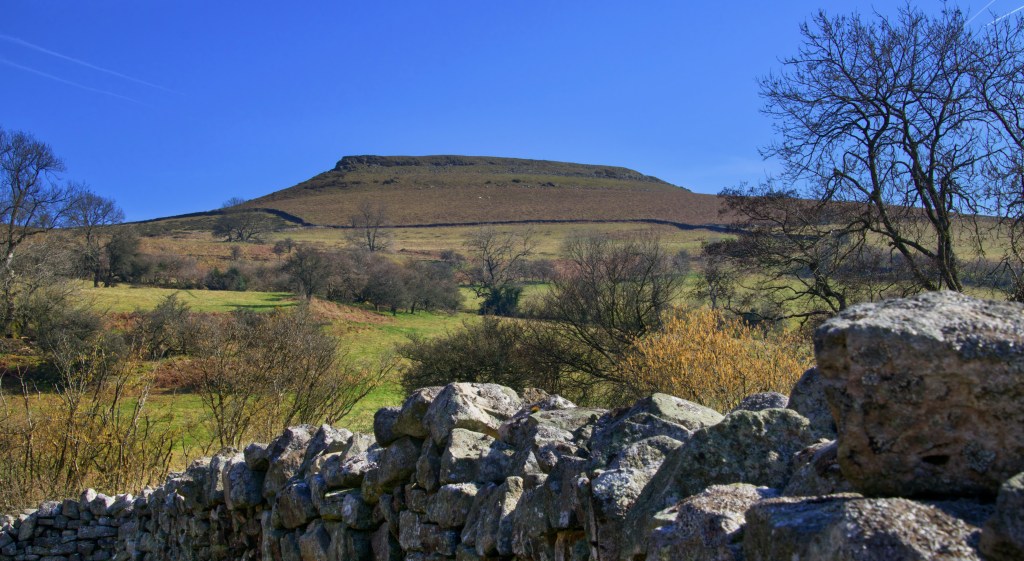
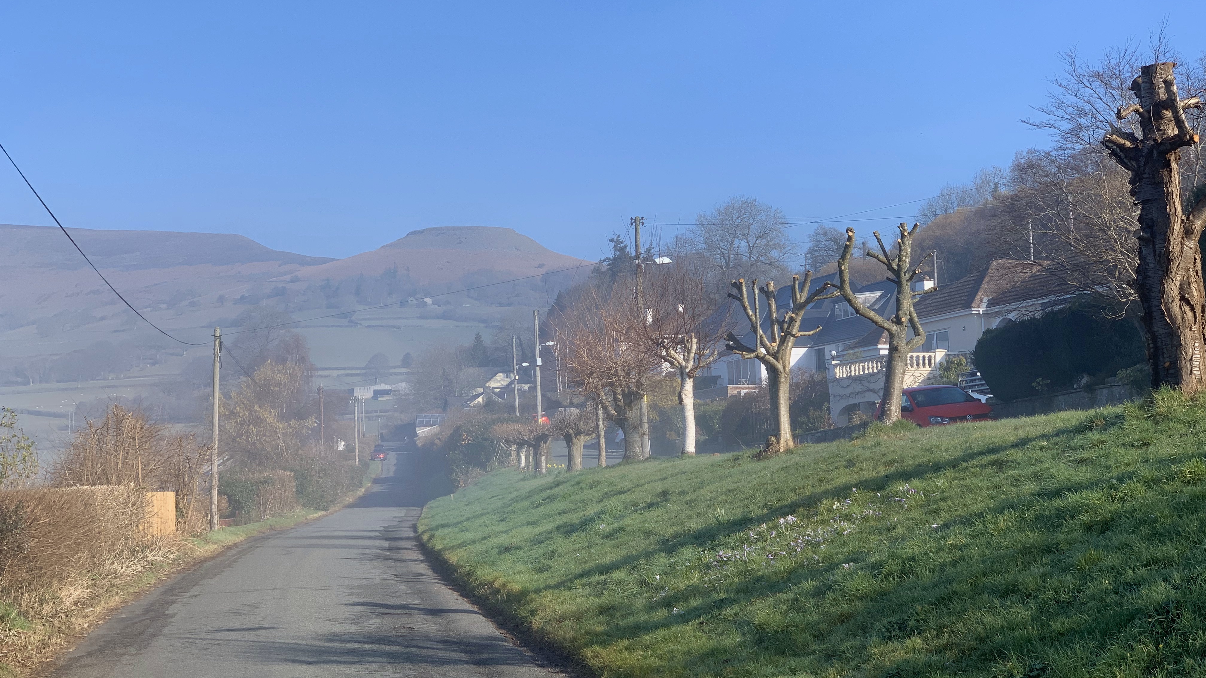
We starting driving from home through thick fog, and were not very optimistic it would lift. The closer we got the more pessimistic we became that we would get many views during our walk, especially as the fog thickened the closer we got to Crickhowell. But not to be deterred we left the car in the car park in the centre of town, however the surrounding hills were invisible. Climbing out of the town along Great Oak Road the fog started to thin and we spied the steep sides of Crug Hywel ahead, doing what it was intended to do, dominating the surrounding area. Named after Hywel Dda, one of the major Welsh kings from the early 10th Century Wales. However, the likelihood of Hywel Dda building here is uncertain. But what is certain is that this is an Iron Age fort, and therefore was built much earlier.
Towering over Crickhowell is Pen Cerrig Calch (701m), a terminal spur of one the Black Mountain ridges and it is here the original builders decided that the southern flank of would be a good place to place a hill fort more than 2000 years ago. Today the fattened area of the fort has given rise to the name of Table Mountain, 451 m above sea level. It is a bit of a blow walking up the steep slopes to the slopes but worth it. Once in the fort we were afforded superb views across the Usk Valley all the way through to the Brecon Beacons, giving an appreciation of the why the fort was perhaps sited here, giving visibility of the surrounding area for the incumbents, but also providing a clear visual clue to those in the valley as to the power base that the fort represents.

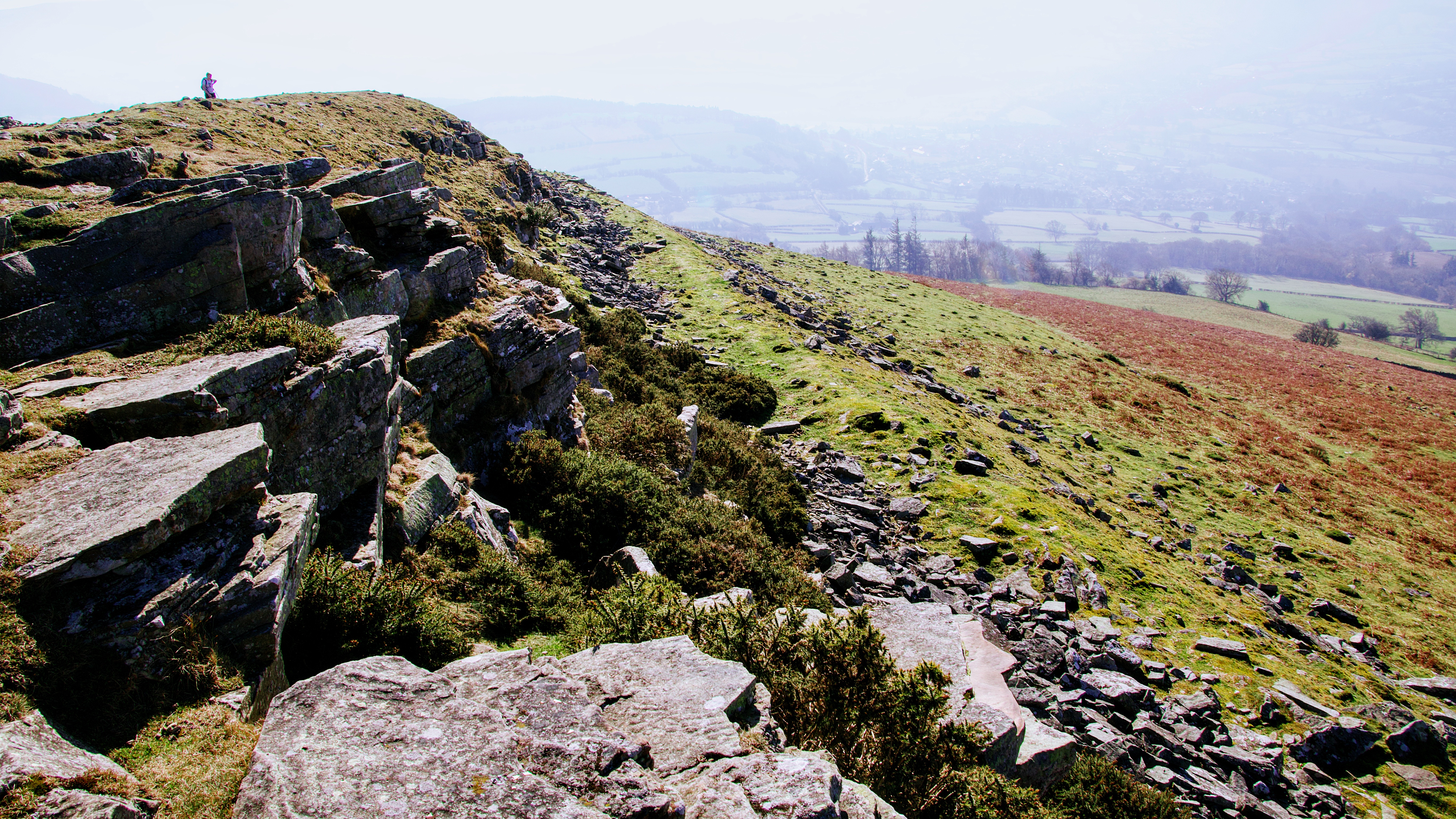
The fort is shaped like a tear-drop in plan, tapering towards the northwest end, and enclosing an area roughly 100 metres northwest-southeast and 50 metres northeast-southwest. The interior slopes towards the southeast end. The fort is entered through the northeast side, through a gap in the rampart and inner defensive wall roughly 8 metres wide. This seems to be the only entrance. The inner defensive wall has collapsed to 5 metres wide and approximately 0.3 metres tall. The rampart wall is better preserved, standing to a maximum of 2 metres high, although it has become flattened on the south and southwest sides. The vertical distance between the bottom of the rampart and the top of the inner wall is roughly 10 metres. Despite the deprivation over the years it is clear to the eye where the main defensive walls were, and it is easy to imagine how impressive they must have been when complete.
Coflein has identified that there are at least two hut platforms and a hut circle located against the inside face of the inner wall on the northwest side of the fort. If they are there they are well hidden under the current turf as I couldn’t see anything. What was clearly evident were the number of circular walker’s shelters scattered around the enclosure, probably built from the fallen rock blocks in the ditch. Not sure I approve of this, but I suppose any shelter from the wind is welcome on a cold day. But it does mean that the original archaeology has been despoiled.
As we were following a circular walk the path led us down the western side of the fort along well defined paths and green lanes. We even met a Muppet driving a JCB. I’ve always wondered what they did when not filming.

The purpose of hill forts have baffled archaeologists for decades, and perhaps the term “hill fort”is misleading as it contours up images of defensive needs and the concepts of defensive needs within the community that the hill fort serves. However, there is little consensus on their true function. Not all would have served any real defensive purpose, and many do not have evidence certainly of long term or permanent residential structures within them Many of have this evidence, and others have complexes of defensive ditches and walls, which are designed to funnel potential visitors or attackers towards a single entry point into the protected area. The variations in fort design, their placement, sometimes within line of sight of each other confuses me. We’re they purely defensive, symbols of power, places of refuge during periods of tribal strife, markets or places of exchange or maybe safe and secure places to keep cattle or store grain. They may have been all of these, but possibly at different times. Hill forest have been dated back to the Bronze Age, though most were built during the Iron Age before the Romans arrived. Now that is a long time span, and it is not inconceivable that across those years the needs of society and their people changed, and the reason for the hill forest changed with them. But whatever the reason, in order to create them needed major investment in resources and time, possibly taking up the whole community.
Bibliography
Coflein. https://www.coflein.gov.uk/en/site/92128/details/crug-hywel-camp
Silvester, B , 2007 , Defended Enclosures in Brecknock: Project Report. http://www.walesher1974.org/herumd.php?group=CPAT&level=3&docid=301363492
Welsh Office Ancient Monuments Branch , 1980 , Scheduling map – Br128(POW) http://www.walesher1974.org/herumd.php?group=CPAT&level=1&docid=301308620
Visited Feb 2019

Leave a comment