
Did you know Rhayader had a castle? We certainly didn’t. Over the years we must have driven through Rhayader hundreds of times, always on the way to somewhere else or gong back home. When I was young and fit, able to run more than 20m, I’ve even played rugby a number of times against Rhayader Town – but that was a different life. Despite all these visits over the years, we’ve never stopped and had a look around. This time was different, and we stayed here in the motorhome at the camp site on the edge of town during October this year. In fact the campsite was closing down soon after for the winter so we able to make the most of the dry and sunny weather. During this stay we also had Wilf with us, our daughter’s dog, which we have as a dog share on a regular basis. This means we have all of the fun, but no vet bills. But that is a different story.
This time I want to explore the history of the castle that I had no idea existed. However, I think first we need to manage expectations. There are no massive stone walls, intimidating towers or battlements. If you want to see Rhayader Castle you have to look and use your imagination, because there is nothing left.
Rhayader (Rhaeadr Gwy in Welsh) is a small market town in Mid-Wales on the east bank of the River Wye. Immediately above the river in the town are the earthwork remains of Rhayader Castle, a motte-and-bailey site that survives today as low banks, a rock-cut ditch and a grassed promontory. And that is it! OK let’s move on, and in reality there is much more to this story and it is not just a disappointing lump in a small grass field. The banner photograph shows a satellite view (from Apple Maps), which really only shows modern houses as the only identifiable feature rather than a stonking big castle we are used to seeing in Wales and the UK.

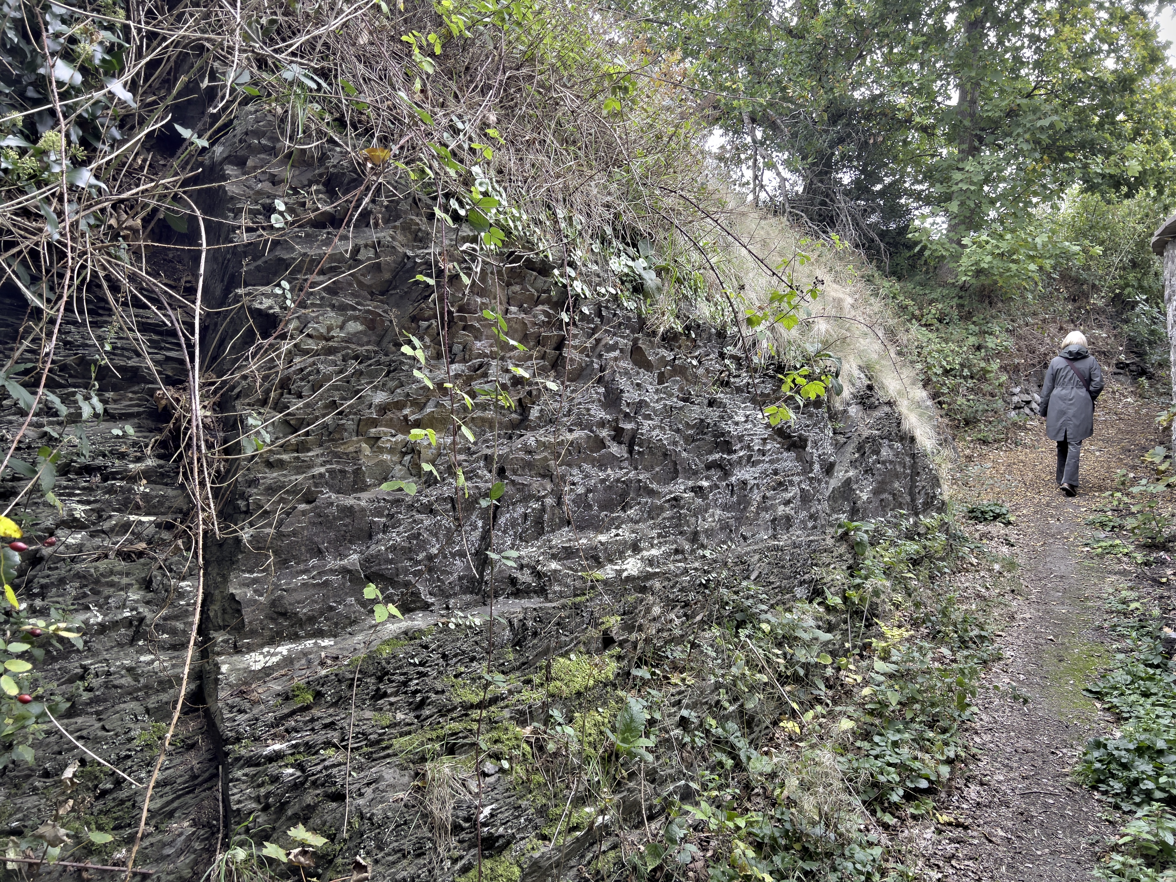
The visible remains are largely earthworks, and it would be easy to miss these if you didn’t know they were there. It also helps that there is a notice board outside the gate telling you it is here. The site of the castle covers a roughly rectangular flat-topped mound (the motte or platform) about 40–50 m across and a deep rock-cut ditch (recorded as at least 4 m deep and up to c.10 m wide) protecting the approach on one side. The adjacent river valley and steep slopes were part of the natural defences. 
The name Rhayader derives from the Welsh Rhaeadr Gwy, meaning “Waterfall on the Wye”, a reference to the cascades that once existed where the River Wye cuts through the bedrock beneath the town bridge. These falls, now mostly tamed by 18th- and 19th-century bridge construction, gave the settlement its identity. The site occupies a natural crossing point of the Wye, commanding routes through central Wales — northwards toward Llanidloes and Machynlleth, and southwards to Builth Wells and Brecon. It is this crossing point that made Rhayader an important point for navigating across the landscape. There is evident of settlement in the area for thousands of years, a time period that I often find difficult to comprehend.
Although there is limited archaeological evidence for prehistoric settlement within the modern town itself, the surrounding uplands are rich in Bronze Age cairns, standing stones and Iron Age hillforts, implying that the Rhayader basin has been part of a settled and utilised landscape for at least 4,000 years. Roman activity is less clearly attested here than in neighbouring valleys, though the region lay near minor Roman roads and trackways linking the forts at Castell Colten (Llandrindod Wells) and Caersws.
By the early medieval period, Rhayader lay within the Kingdom of Powys, later falling on the fluctuating boundary between Powys and the southern realm of Deheubarth. The river crossing was of sufficient importance that it became a frontier point between these competing Welsh kingdoms and, later, between the native Welsh princes and the incoming Norman marcher lords.
If you wander the earthworks at Rhayader today you’ll find a quiet mound and a sense of weathered boundary rather than the drama the place once hosted. The story begins in the late 1170s when Rhys ap Gruffudd — the Lord Rhys, a very active and ambitious southern prince — is usually credited with putting a timber stronghold here. Building a castle at Rhayader was political theatre as much as defence: it sealed control of a key river crossing and announced that Deheubarth’s reach now brushed against the Marcher lords and the petty Welsh polities of mid-Wales. In plain terms, it was Rhys saying, “this ground answers to me,” and in that borderland a statement like that often led to a war.
Not long after, around 1190, the castle was violently contested — not by Normans this time but by other Welsh rivals. Forces from Maelienydd, associated with the sons of Cadwallon ap Madog, attacked and destroyed the fortification and Rhys himself was captured in the fighting according to the chroniclers. This episode is a useful corrective to the popular picture of medieval Wales as simply Welsh versus Norman: the period was full of internecine rivalry. Princes competed over land, marriages and honour, and alliances turned on a whim. Local dynastic feuds were every bit as lethal as cross-channel ambitions, and a forward base like Rhayader was a perfect target for a neighbour wanting to roll back an encroacher.
The castle’s fate continued to swing with the political weather. In the early 1190s it fell for a time into Norman or Marcher hands; then Rhys, once released and back on his feet, recaptured and rebuilt it by about 1194. That tug-of-war captures the essence of Marcher politics: powerful local magnates — families like the de Braoses and Mortimers — exercised enormous autonomy, building and seizing castles whenever opportunity and royal distraction (think Richard I away on crusade) allowed. For Rhys to rebuild was an act of resilience and reclamation; for the Marchers to seize it was a move to project authority inland and to create a foothold for influence and extraction.
Rhys’s death in 1196 ushered in the familiar medieval hangover: succession struggles and opportunism. Competing sons and kin — Gruffydd ap Rhys, Maelgwn ap Rhys and others — quarrelled over the spoils of their father’s power, and Rhayader again found itself caught in the scramble. Marcher lords like the Mortimers didn’t miss the chance to press their advantage, backing pliant claimants or simply moving in when Welsh unity frayed. The castle’s repeated burning, rebuilding and capture in this phase shows how fragile political order could be after the loss of a strong ruler.
At the turn of the century the Mortimers are often credited with rebuilding or reinforcing a fortification here, only to have it retaken by Welsh forces around 1202. That ebb and flow is typical: the Marchers erected strongpoints to anchor administration and economic control, while Welsh princes and warbands responded with strikes and sieges to deny them those bases. These contests weren’t just military; they were statements about who could collect tribute, who could claim justice and who could move unmolested through the landscape. Holding Rhayader meant controlling movement and influence across a contested patch of mid-Wales.
Finally, in 1230–1231, the castle’s long run of shifting ownership came to an end with a different logic: Llywelyn ap Iorwerth, known to history as Llywelyn the Great, campaigned in the region and levelled the site. Llywelyn’s aim was not mere conquest of every motte; it was consolidation. He wanted a more coherent Welsh polity and the destruction of small, vulnerable frontier garrisons made sense strategically — remove the little nests of opposition or Marcher projection and strengthen larger centres that could actually be governed from Gwynedd. After this deliberate dismantling Rhayader fades from the chroniclers as an active fortress; its military life is over.
A couple of caveats if you like to dig into sources: the medieval record is terse and place-names shift in the manuscripts, so some modern accounts conflate different earthworks or read slightly different names (Rhaeadr, Rhaeadr-gwy, Gwrtheyrnion). That said, the broad pattern — foundation by the Lord Rhys, local Welsh destruction, Marcher capture, recovery, dynastic turmoil after Rhys’s death, Mortimer activity, and eventual destruction under Llywelyn — fits the fragmentary evidence we have and matches the political currents of the time. In the end, Rhayader tells a story much bigger than its sparse remains: it is a small stage where the competing logics of local dynastic rivalry, marcher expansion, and later Welsh centralisation all played out.
If you visit the site now, bring a good map and a little imagination. The ridge and the river hint at the strategic value; the quiet today is exactly what makes the place feel like a palimpsest of those loud medieval struggles.

Although the remains of the motte and bailey were a bit underwhelming, the rock cut ditch was pretty impressive.
LikeLike
Deep but short.
LikeLiked by 1 person
Lol!
LikeLike
I was impressed with the level of detail in your post by the way, Paul.
LikeLike
Thanks – I get carried away sometimes. But I learnt so much about the town, a place I have driven through so many times…..
LikeLiked by 1 person