
Laugharne to Amroth
Late September day in 2019, just a few months before the whole world was turned upside down by the COVID-19 Pandemic, we completed the next section of the Wales Coast Path starting in Laugharne. There are places that feel less like destinations and more like pauses in time—little pockets where history, landscape and imagination drift together like estuarial tides. Laugharne, tucked quietly on the Carmarthenshire coast, is one of those places. If you go, expect a pretty Welsh town and you’ll leave feeling as though I’d stepped through someone else’s dream. Those dreams will be shadowed by the voice of Dylan Thomas (more here when we spent the day in Laugharne: https://paulchallinor.com/2014/10/25/dylan-thomas-and-laugharne-100-things-to-do-in-wales-14/).
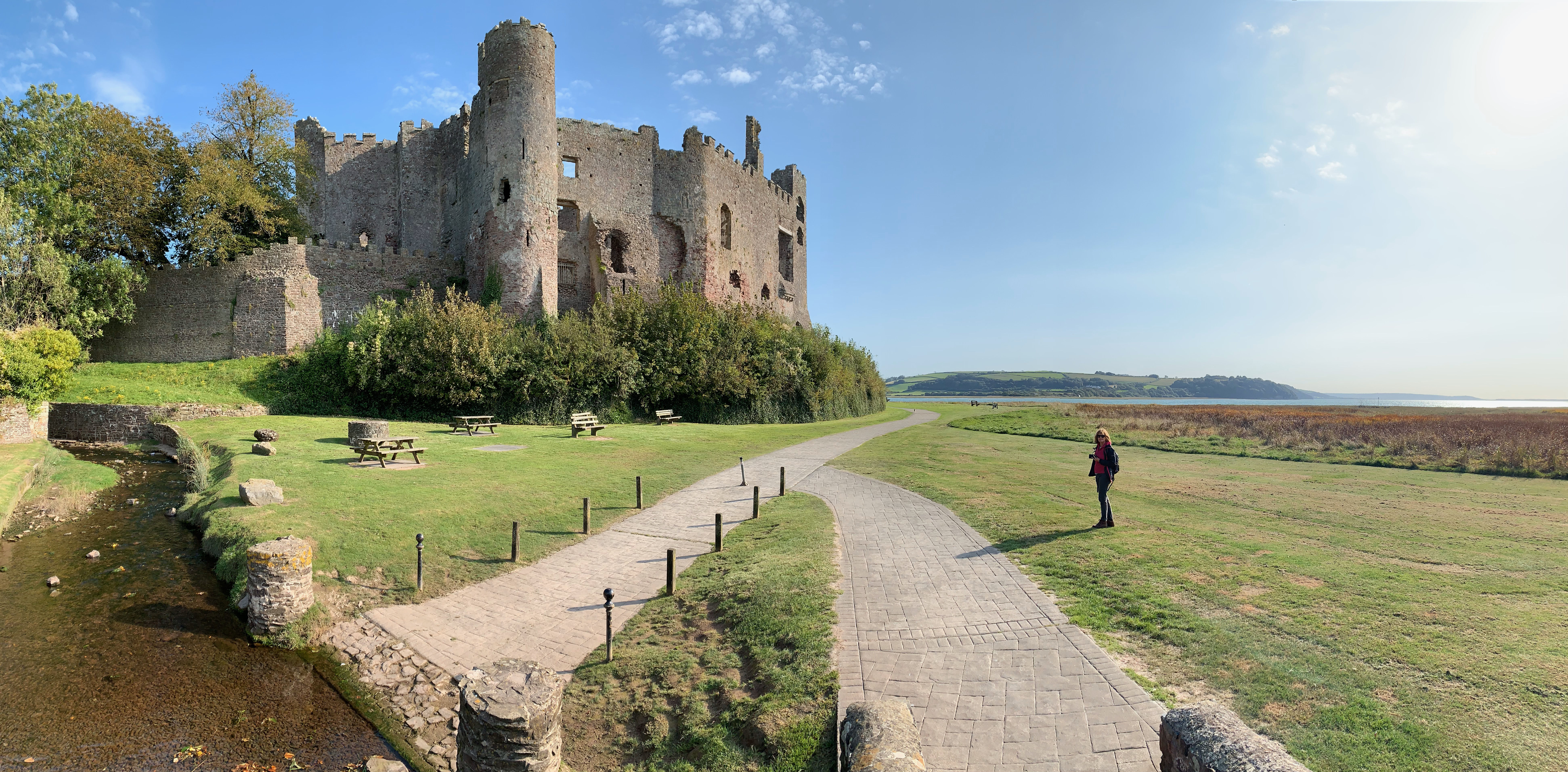
Laugharne sits on the Taf estuary, a wide, shimmering sweep of water and mudflats that seems to breathe in and out with the tide. There’s a subtle magic to it: even before you see the town’s most famous landmarks, you sense you’re somewhere that has inspired many before you. The streets curve gently, more interested in following the lay of the land than any modern grid. Pastel cottages lean together as if whispering over centuries of local gossip. Everything feels slightly sun-bleached, slightly softened, and completely enchanting.
It is impossible to miss Laugharne Castle which dominates the landscape like a brooding poet who never quite finished their last stanza. Perched on the water’s edge, the castle is part Norman fortress, part Elizabethan mansion, and entirely atmospheric. Its jagged silhouette is both dramatic and oddly comforting. Walking around its grounds, the salt wind curling around the stone, you can understand why so many writers and painters felt drawn here. It’s the kind of ruin that doesn’t feel dead—it feels as though it’s still waiting and listening for something to happen.
Laugharne Castle has a history that spans nearly a millennium. Its origins trace back to the early 12th century, during the Norman expansion into Wales. The earliest structure on the site was likely a timber ringwork fortification, erected around 1116 by Robert Courtemain, a Norman lord and one of the vassals of the powerful Marcher Lord Henry de Beaumont, Earl of Warwick. The original timber fortification was designed to control the Tâf estuary and oversee the strategic route into south-west Wales. Its early role was that of a defensive outpost in the newly conquered lands, symbolising Norman authority over the native Welsh population. By the late 12th or early 13th century, the castle had passed into the hands of the de Brian family, who were of Breton origin. Guy de Brian, a significant figure in the early development of the castle, began the process of converting the timber structure into a stone fortress. The transformation marked a major shift in both defensive capability and architectural style.
Significant rebuilding occurred in the late 13th century, likely under the orders of Sir Guy de Brian IV, a prominent soldier and courtier under Edward II and Edward III. He was responsible for constructing much of the stone structure that can still be seen today, including two massive round towers and the curtain wall. Further remodelling took place in the late 16th century, when Laugharne Castle was transformed into a Tudor mansion. At this time, it was owned by Sir John Perrot, who was allegedly an illegitimate son of Henry VIII. Perrot undertook major renovations, converting the medieval fortress into a fashionable Elizabethan residence, complete with large windows, decorative stonework, and landscaped gardens.
In 1189, during the unrest following the death of King Henry II, Lord Rhys (Rhys ap Gruffudd), the powerful Prince of Deheubarth, captured the castle from the Normans. This was part of his wider campaign to reclaim Welsh lands. However, the castle was soon retaken by the Normans, and control shifted back and forth during this period of near-constant conflict. Although there are limited records of Laugharne Castle playing a central role in the rebellion of Owain Glyndŵr, the uprising caused widespread unrest in south Wales. The castle was likely on alert and may have served as a garrison or refuge during these years of Welsh resistance against English rule.
One of the most dramatic episodes in the castle’s history occurred during the English Civil War. In 1644, Laugharne Castle was held by Royalist forces loyal to King Charles I. It was soon besieged by Parliamentarian troops under the command of Major-General Rowland Laugharne (ironically sharing the name of the town). After a short but intense siege involving artillery bombardment, the Parliamentarians captured the castle. As was common after such victories, Parliamentarian forces slighted (intentionally damaged) the castle to prevent its further military use. Much of the structure was destroyed, particularly the curtain walls and interior buildings, leaving the ruins that are visible today.
Laugharne has been shaped by everyone from medieval lords to mariners, from English marchers to Welsh rebels, but it never lost its sense of place. The town once buzzed with ship-building and coastal trade, though the estuary eventually silted too much for serious commerce. Rather than fading into obscurity, Laugharne simply settled into itself—quirky, historic, and content to be quietly remarkable.
The original medieval layout still guides your wanderings. You can stroll from the castle through narrow passages and end up in front of modest Georgian houses, or follow a slip of a lane that leads you unexpectedly to the waterside. It’s a landscape built slowly, by many hands, but somehow still cohesive.
Of course, Laugharne’s most famous resident is Dylan Thomas, who spent his final years here and found in this small town a universe of inspiration. Thomas once described Laugharne as “the strangest town in Wales,” and once you’ve been, you understand the affection behind the remark.

Although we didn’t complete the Dylan Thomas pilgrimage this day, we have down so before You can read more on this here https://paulchallinor.com/2014/10/25/dylan-thomas-and-laugharne-100-things-to-do-in-wales-14/. And if you are doing the walk the other way and finish in Laugharne, then you must visit Browns for a drink at east. But it is a short walk to the Boathouse, perched on stilts above the estuary, and you can imagine Thomas leaning out of the window, watching birds skim the water or listening to the chatter drifting from the town. His writing shed is still there—small, cluttered, and utterly evocative. You’re not just looking at a preserved space; you’re peering into the working mind of a poet who saw magic in the everyday.
“Under Milk Wood,” perhaps his most beloved work, reads differently after visiting Laugharne. Suddenly the mythical Llareggub feels rooted in real cottages, real faces, real tides. Laugharne didn’t just inspire Thomas—it seems to have seeped into him, every bit as much as he has seeped into the town’s identity. The original inspiration for Llareggub has been variously attributed to laugharne and Newquay among others. Which ever it is doesn’t matter. What does matter is the fantastic story of the characters, people we can all identify within our own lives. A little hint here – spell Llaregubb backwards and see what you get.
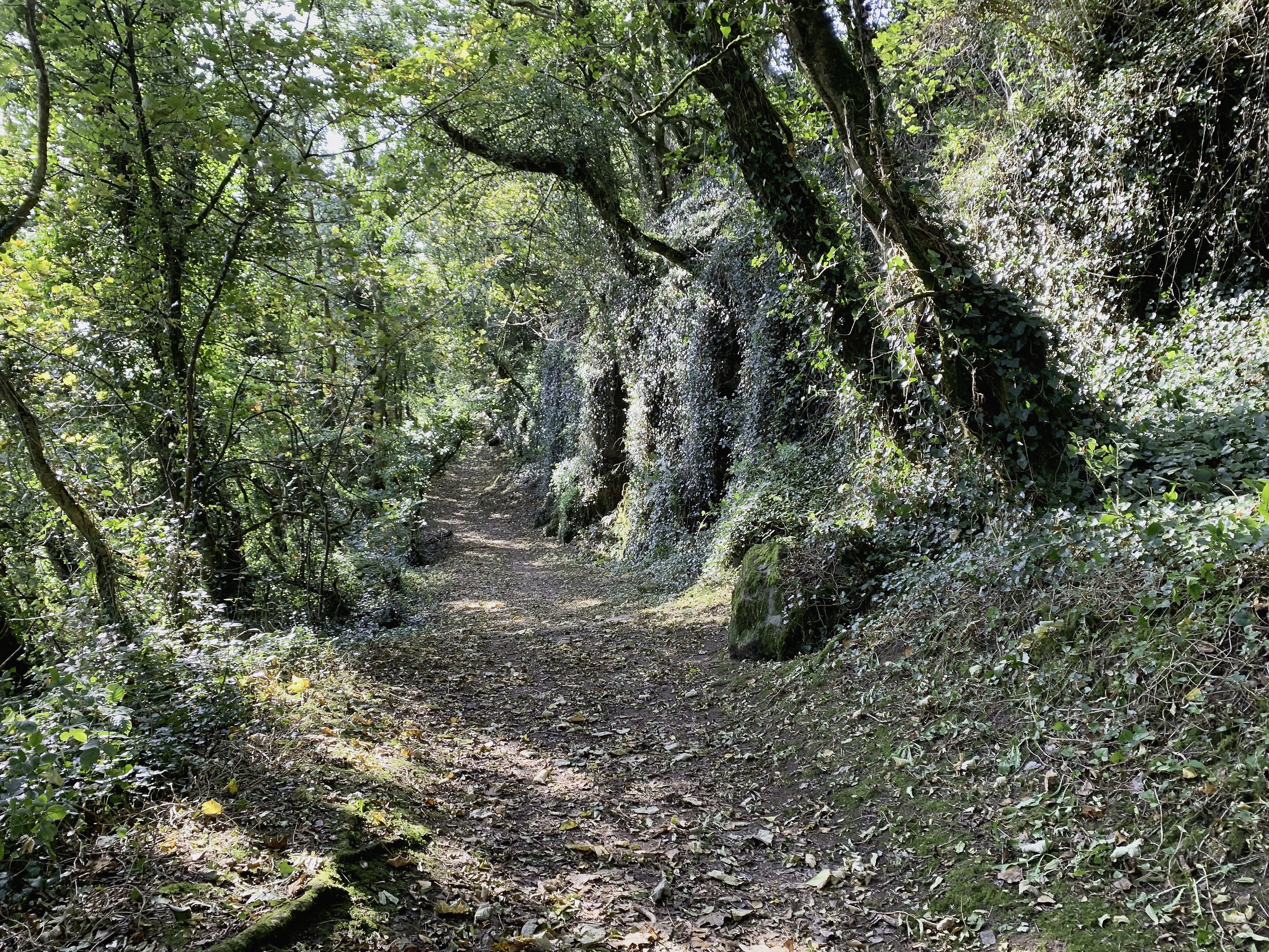
The Wales Coast Path leaves Laugharne pushing ever westwards, and it shares the first part with the Dylan Thomas Birthday Walk. It’s not just a footpath; it’s a slow unfurling of landscape, language and memory. Every time I walk it, I’m struck by how deliberately unhurried it feels — as though the path itself wants you to take your time, and soak up the views and the air around you.
The route takes its name from Thomas’s birthday tradition: on 27 October he would wander up the hillside above Laugharne, pausing at spots that offered the most generous views of the estuary. From this vantage point he wrote lines that would end up in his poem “Poem in October”, capturing a kind of luminous autumn joy.
The poem is full of dew-wet fields, dawn light, and a sense of rebirth. When you follow the same path, it becomes startlingly clear that Thomas wasn’t exaggerating — the landscape really does feel like it’s waking up around you.
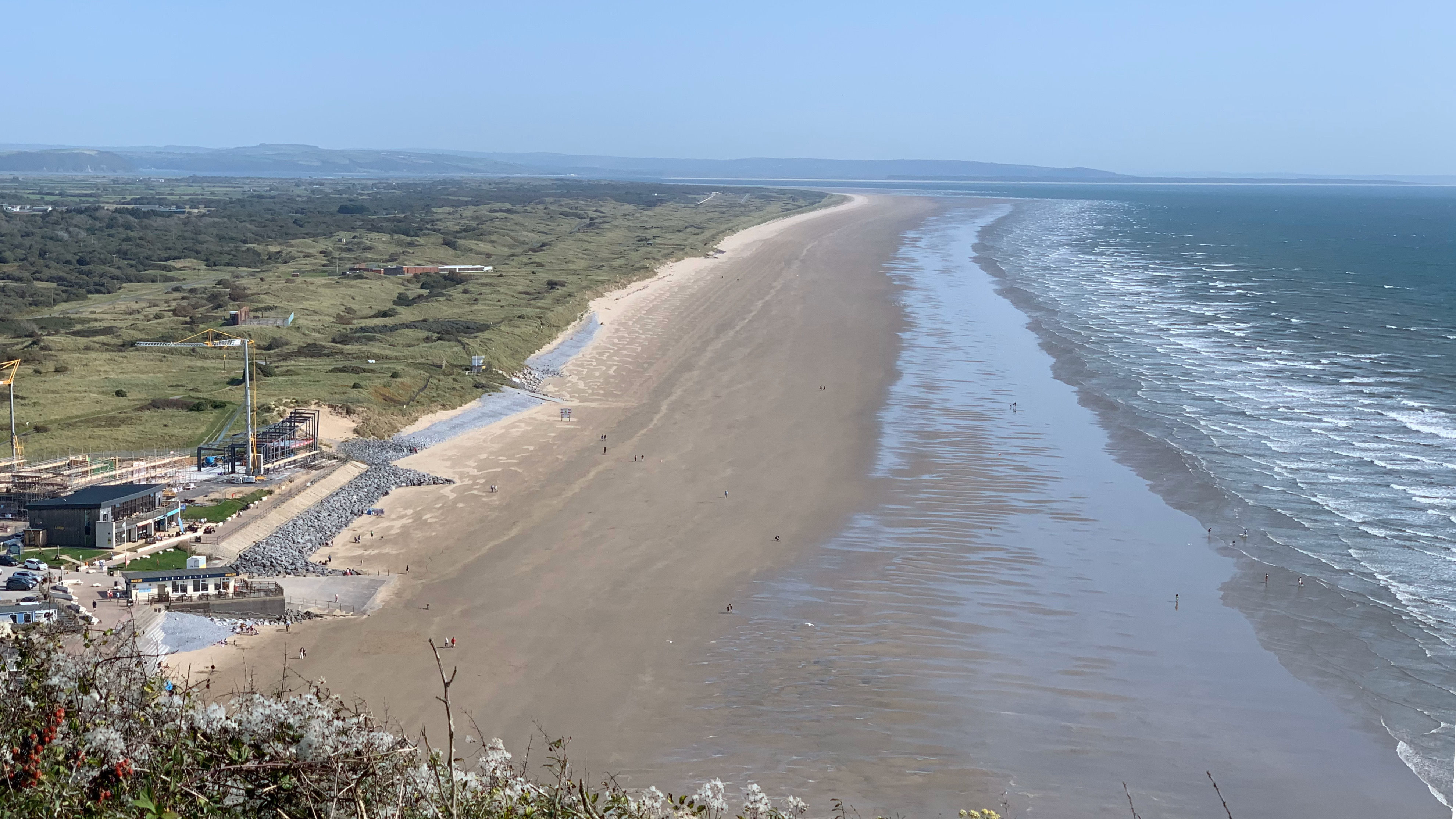
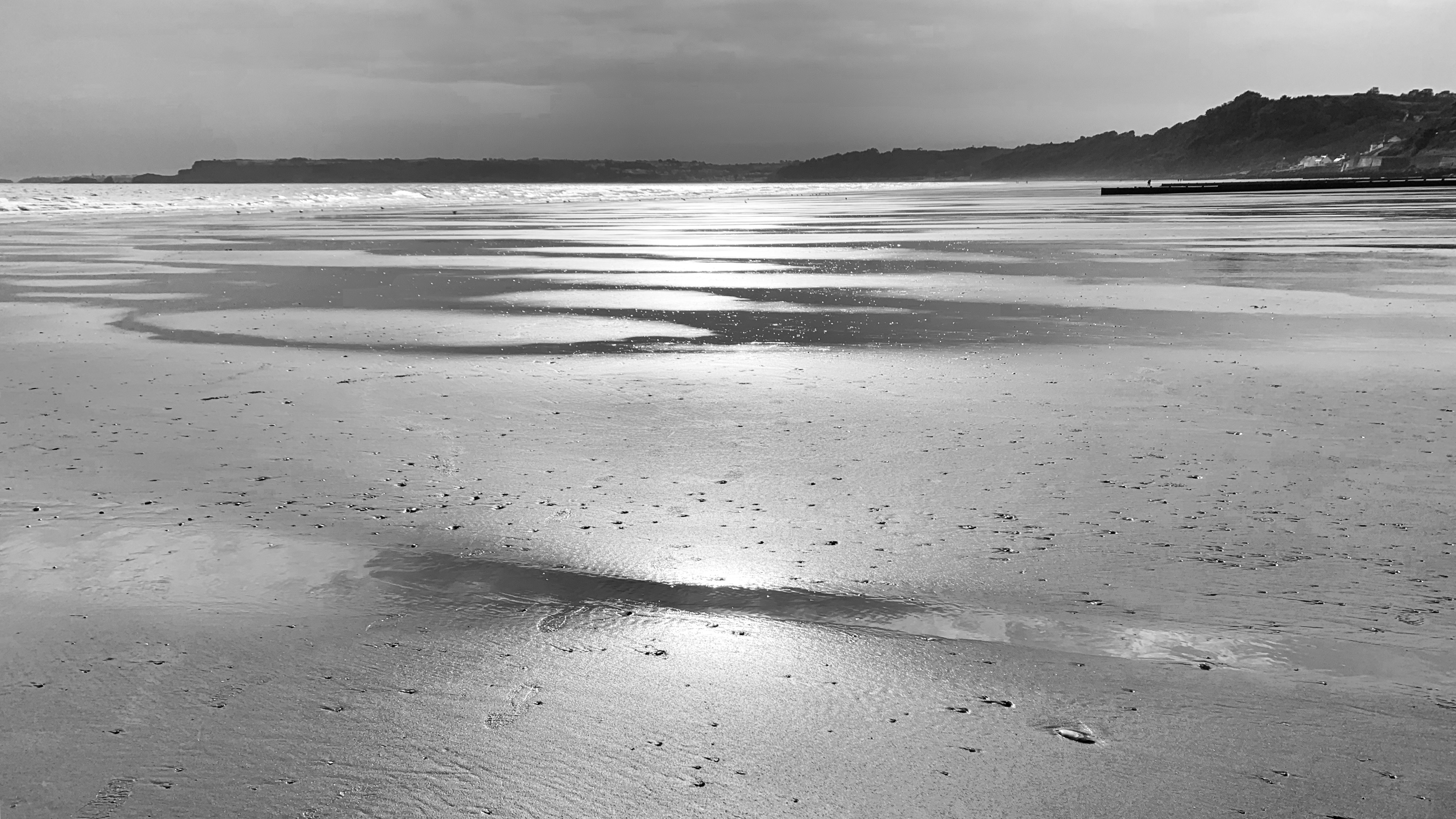
After the intimacy of the Laugharne streets, and initially the close woodland the shift into views of open estuary and wide sky is almost cinematic. This stretch of the Wales Coast Path, unfurling westwards towards Amroth, is not the most dramatic in terms of cliffs or surf — but it’s one of the most quietly beautiful. It’s a walk shaped by tides, birdsong, salt wind and long views that slowly evolve rather than shout for attention.
The stretch of marshland below the path has a wonderfully patchwork feel to it — a landscape shaped over centuries by both seasonal flooding and the long, slow breath of the tides. As you look out, you can see how the salt marsh blends into rougher pasture on the slightly higher ground, all stitched together with glinting pockets of fresh and brackish lagoons.
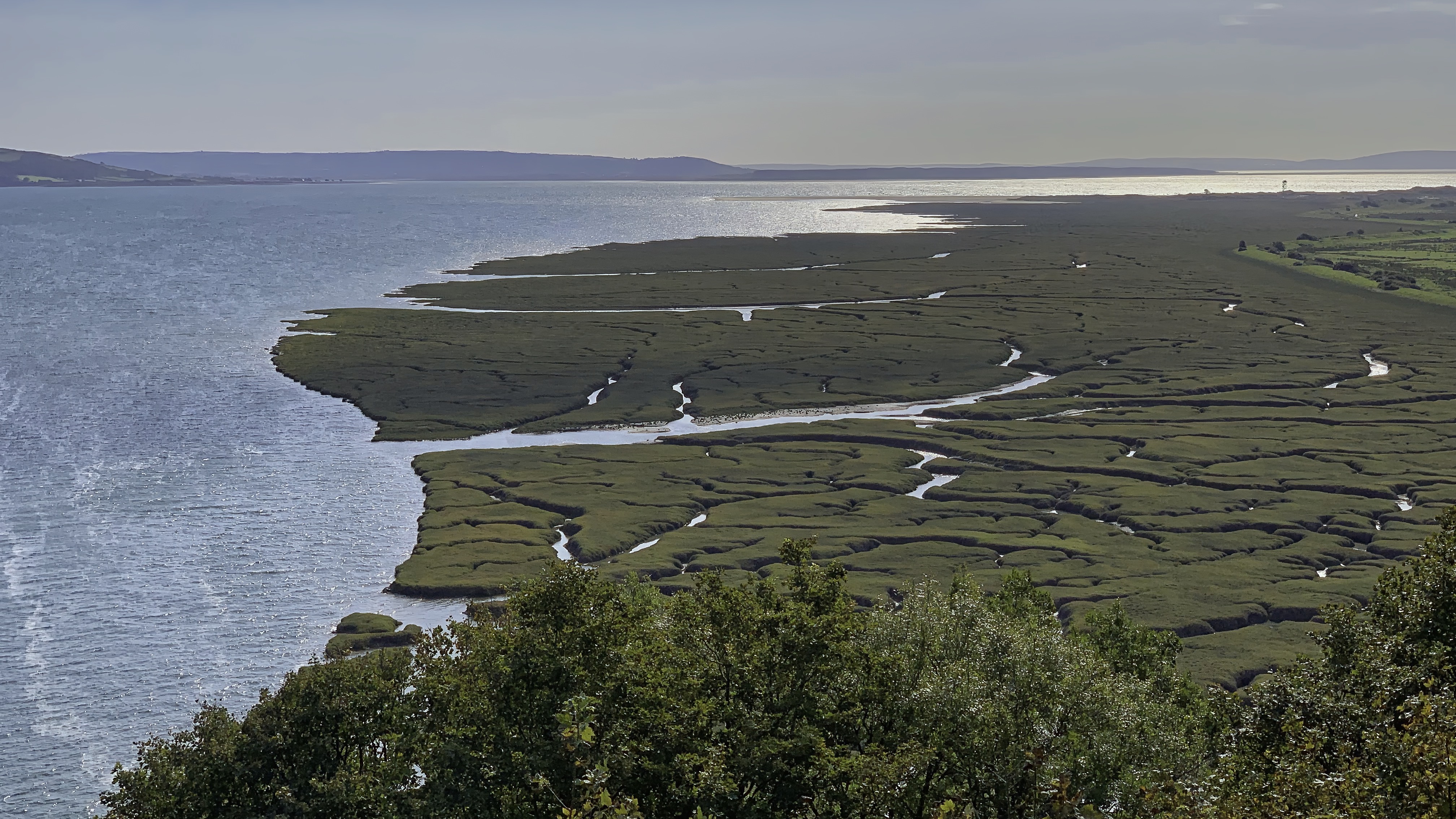
It’s hard to imagine now, but back around 1660 people began an ambitious effort to tame this watery sweep. They introduced drainage channels and raised sea walls, gradually turning what had once been shifting marsh into workable land. By the time the tithe surveyors came through in the 1840s, the transformation was complete, and by the late eighteenth century Laugharne Marsh had become some of the most prized farmland in the whole county.
Evidence of those ambitious engineering efforts still echoes through the landscape. In 1810, a hefty seawall — reinforced with stone — was thrown across the eastern end, complete with a quay linked by tramway to the quarries at Coygan. A few decades later, in 1840, another wall went up across the Witchet Brook. But today it is difficult to see the evidence of these industries. Walking here today, with the estuary light flickering across the fields, it’s fascinating to think of how much quiet human determination lies beneath what looks, at first glance, like a perfectly natural scene.
However, all too soon we loose the views and need to follow a rather uninspiring stretch into Pendine. Much of the path follows fields and then alongside the A##, forced away from the coast by the MOD Firing range. But eventually we reached Pendine, and all was well. Pendine Sands has long been associated with land speed records. In the 1920s, this flat and firm stretch of beach became an ideal natural racetrack for speed enthusiasts. Sir Malcolm Campbell famously set a world land speed record here in 1924 driving his car, Blue Bird, reaching speeds of up to 146.16 mph. The following year, J.G. Parry-Thomas broke the record again with his car Babs, reaching 171.02 mph. Tragically, Parry-Thomas died attempting to reclaim his record in 1927 when Babs overturned. The car was buried in the sands and later excavated and restored in the 1960s.
Today, Pendine’s main focus is on tourism. Its long sandy beach continues to attract visitors for leisure activities such as walking, picnicking, and beach sports. The village itself offers a variety of amenities including cafes, shops, and holiday accommodations. However, when the MOD Range is active it is not posable to walk east along the beach, but when the tide is out there is a lot pf beach still available. Motoring events are still held on the beach, celebrating its unique heritage and significance in the world of racing. The Sands of Speed event, for example, commemorates the history of land speed racing with live demonstrations and exhibitions. Unfortunately we didn’t have time to visit the museum which now houses ‘Babs’ after been reclaimed from the sand and restored.
After playtime on the sands at Pendine beach is was back to serious walking.
The path climbs steeply, very steeply from the beach to the top of Gilman Point before almost immediately dropping down an even steeper incline to another small sheltered beach. One of the most fascinating chapters in Gilman Point’s wartime story involves a secret military exercise known as Exercise Jantzen. According to local walking guides, troops practiced landing craft manoeuvres, tanks and soldiers storming the sands in preparation for the Normandy landings.  Imagine watching from the headland as craft slid in toward the beach, as soldiers advanced, learned angles, and rehearsed fate-changing moments in the long shadows of the dunes.
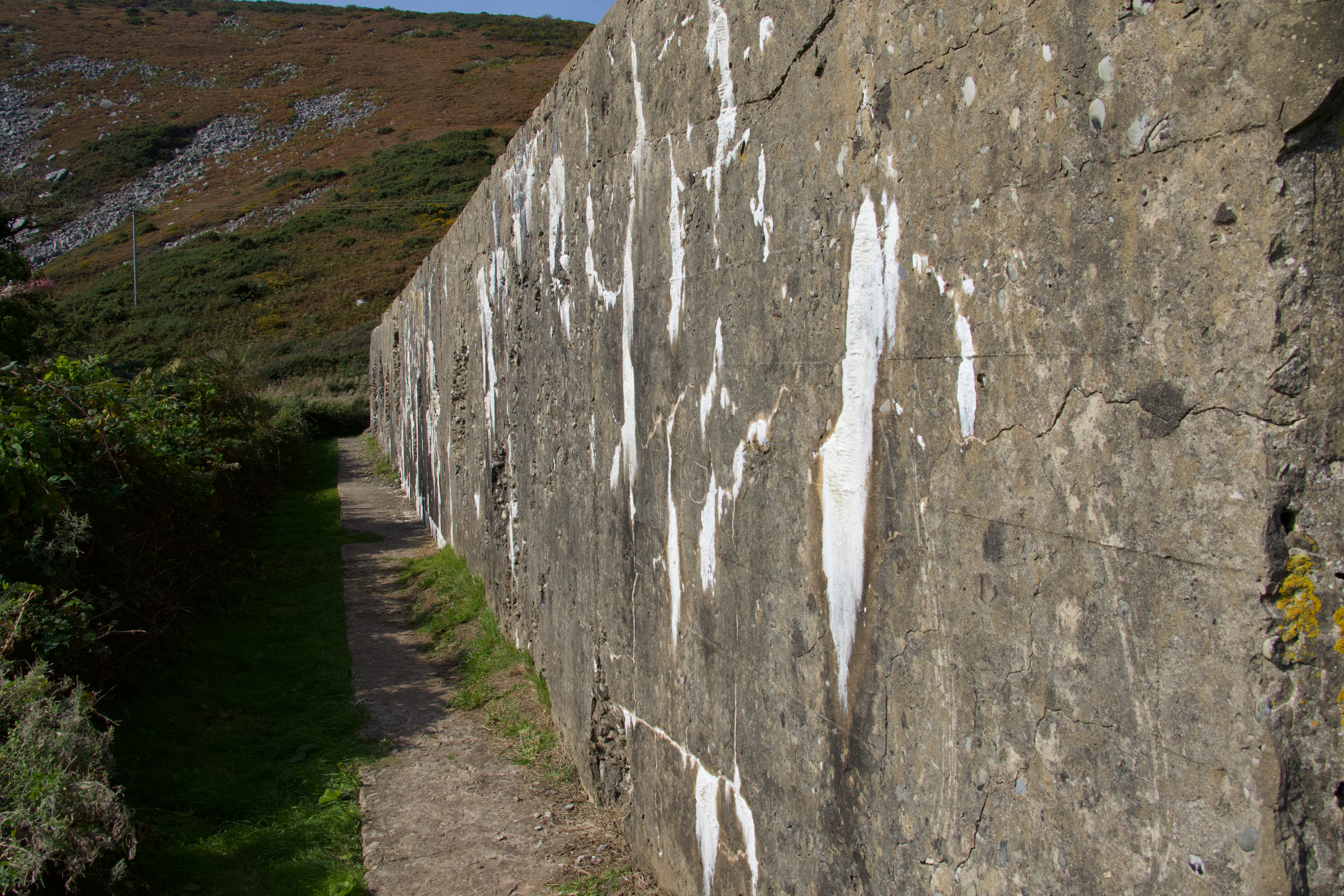
The geography here made it perfect for such training: flat sands cut by water, dunes behind, and easy access from the sea. The cliffs at Gilman Point must have provided natural observation points — ideal for officers mapping out movements, giving orders, or simply watching the waves. The only evidence for it now is a section of wall that stands isolated just above the beach that appears to be pockmarked with bullet and shell holes.
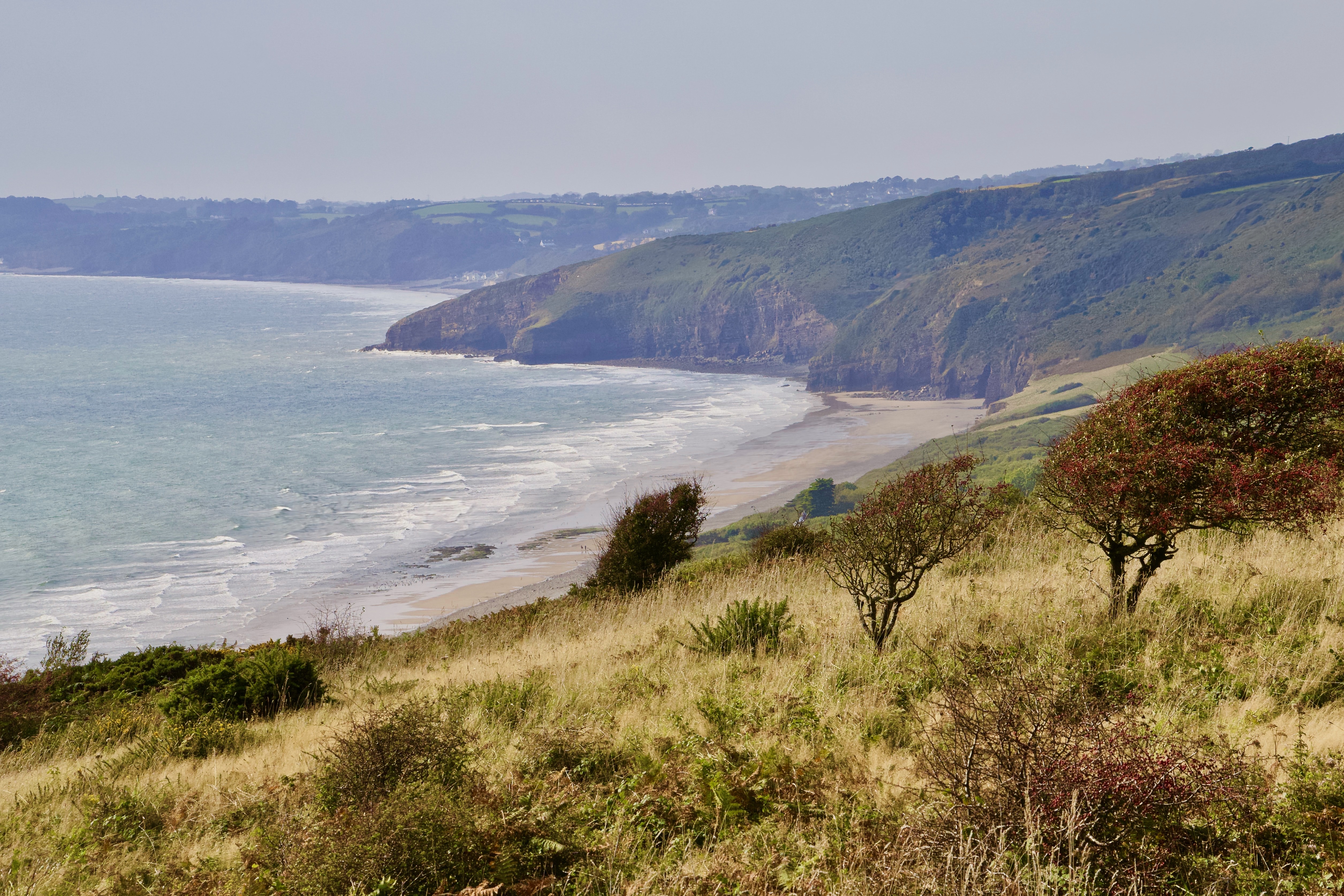
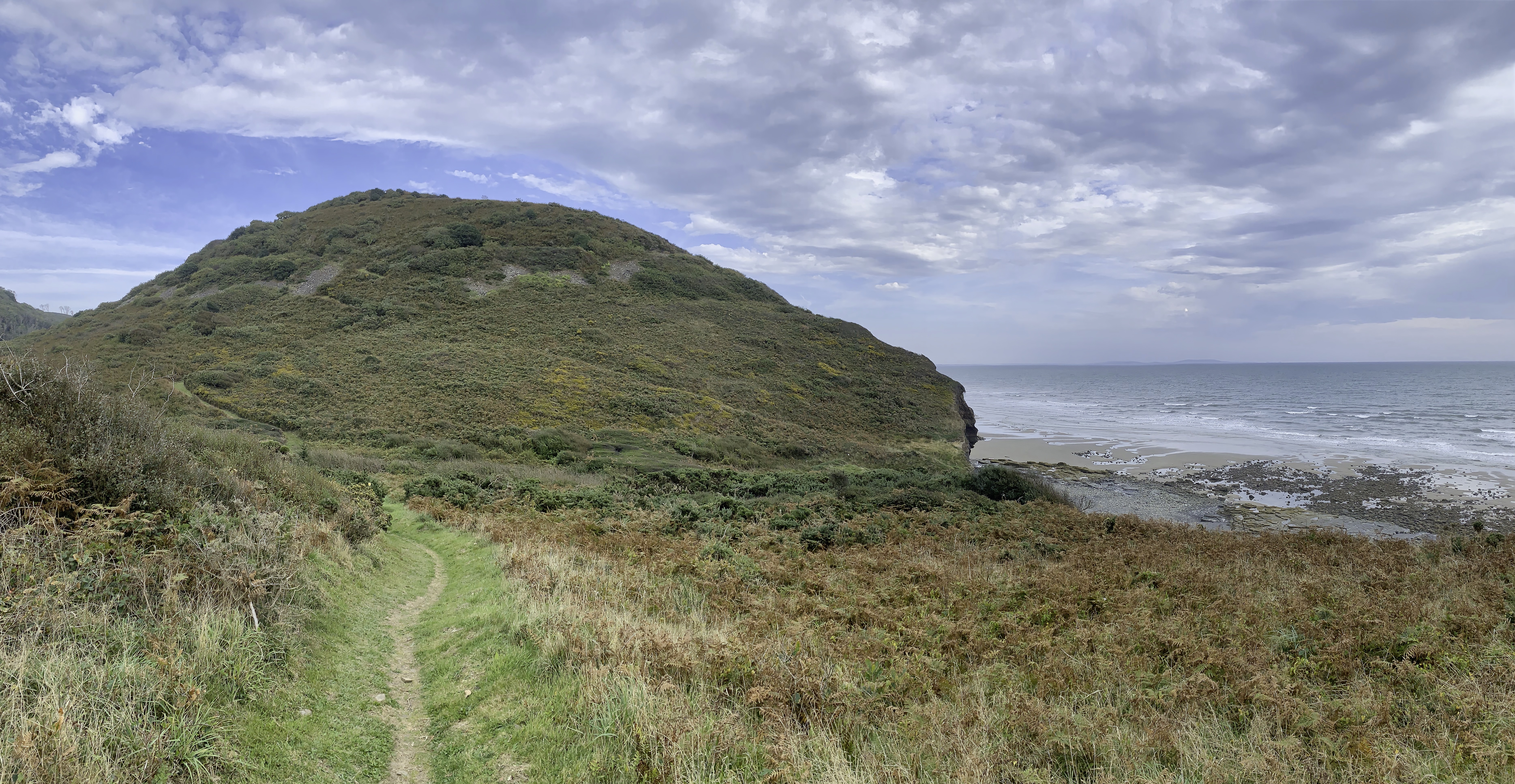
Then it was another steep climb up again! This was another breathless climb but we made it to the top before following the path past a series of neolithic chambered cairns )more here ########) and then the glorious view of Marros Sands stretching below us. No time for a stop unfortunately we had to carry on to Amroth. This section of the path has a number of Iron Age hill forts hugging the cliff tops. The largest is Top Castle. Age and growth of natural vegetation allows the fort to blend into the landscape, and unless you have looked at the map it is easy to pass by without realising there is anything man made here. The fort is sub-circular in shape, with a single bank forming the rampart: internally the bank is relatively low (c. 0.25 m), but externally it rises to around 2.5 m. A ditch runs around part of the fort but I did not see it at first it is soo indistinct. There is a scarped terrace on the southwest side, which could be part of the defensive design. As with all hill forts their main function is uncertain, might be defensive, or it might be a focal point for the area allowing the people to meet on special occasions and trade. We may never know.
Eventually we started to descend onto the beach east of Amroth. Amroth’s main attraction is its expansive sandy beach, stretching for a mile and offering spectacular views of Carmarthen Bay. The beach is renowned for its Blue Flag status, ensuring clean waters and well-maintained facilities. However, a recent storm stripped much of the beach of this luscious golden sands. Approaching Amroth from the east the cliffs backing the beach present a striking geological tableau. Rising prominently from the coastline, these cliffs are predominantly composed of limestone and sandstone, sculpted over millions of years by the forces of nature. Limestone, a major component, is a sedimentary rock predominantly formed from calcium carbonate, typically compressed from marine organisms. This reveals that the area was once submerged beneath ancient seas, allowing the accumulation and compression of marine life skeletons and shells into rock.
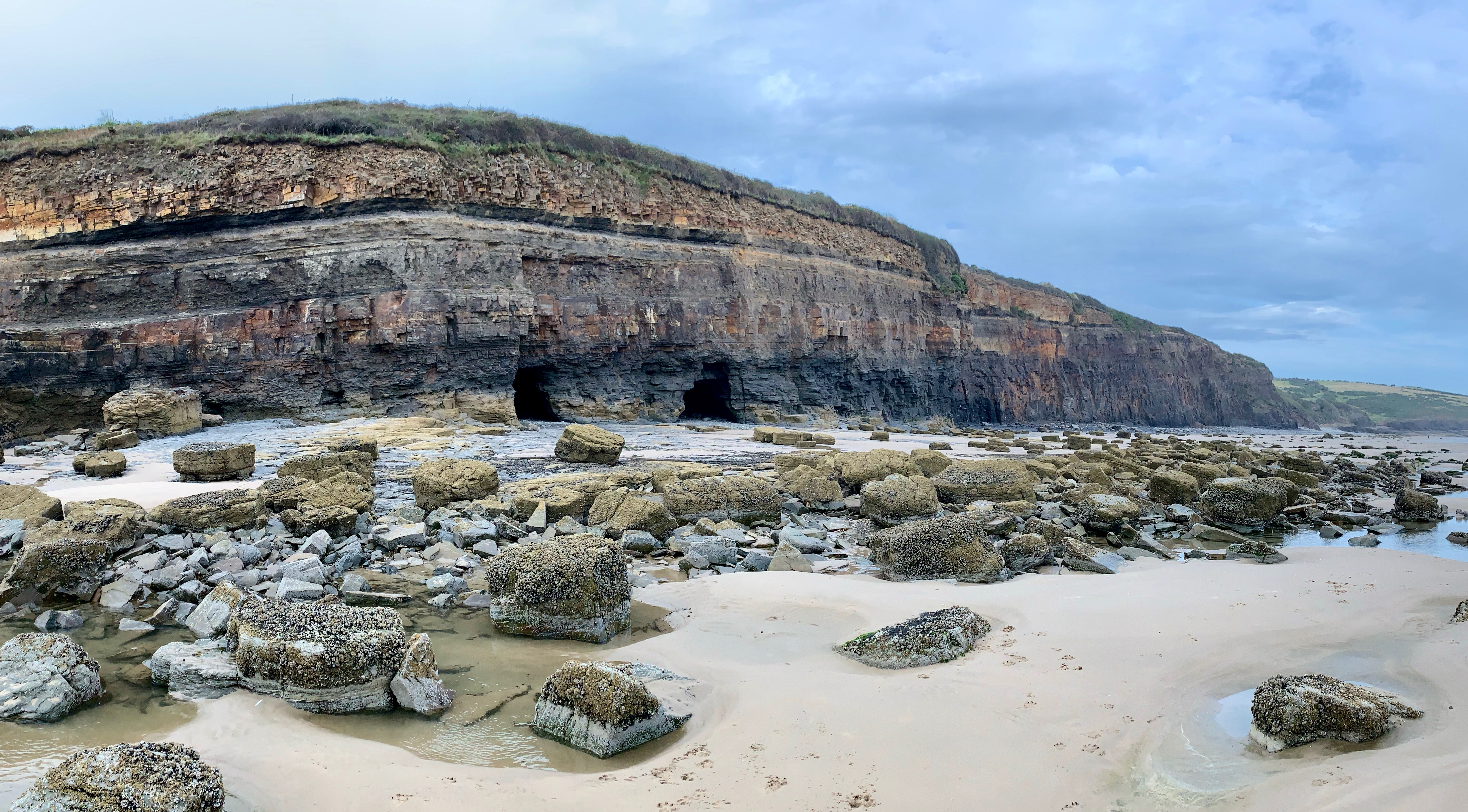
Sandstone, another significant component, is formed from compacted sand grains, typically deposited in layers by wind, water, or ice. The presence of both limestone and sandstone indicates a dynamic geological past involving fluctuating sea levels and varying depositional environments. Fossils embedded within these layers offer tantalising glimpses into past ecosystems, making the cliffs a rich field of study for palaeontologists.
The village itself hosts a series of charming 19th-century cottages and buildings. The story of Amroth is also enriched by its mining heritage, once a bustling coal-exporting village in the 19th century. Amroth, now a serene coastal village known for its picturesque beach and charming scenery, once thrived as a bustling coal-exporting hub during the 19th century. This vibrant history of mining is a significant, yet perhaps lesser-known, facet of Amroth’s past.
The industrialisation of the 19th century saw a surge in coal mining across South Wales, and Amroth was no exception. The demand for coal, driven by the expanding iron and steel industries, as well as the burgeoning rail networks, led to the development of several mines in and around the village. Locally, mining at Amroth took a few forms. Small cliff and beach workings exploited accessible coal and ironstone outcrops; inland, shallow pits and adits followed seams into the hillside. Before large-scale transport links existed, extracted mineral could be launched from small boats or taken short distances to local quays — later, more organised tramways and rail links greatly expanded capacity. By the 19th century Amroth and the nearby Saundersfoot area were recognised as a significant anthracite and ironstone producing region, with coal shipped to ports such as Saundersfoot and beyond.
As mining expanded, so did the infrastructure. Narrow-gauge tramways (sometimes called dramways) were built to carry coal and iron from the pits and ironworks in the valleys (notably around Stepaside and Kilgetty) down to Saundersfoot harbour for shipment. On the coast between Saundersfoot, Wiseman’s Bridge and Amroth the route was forced to hug the shore; in several places engineers drove short, stone-lined tunnels through the cliff so the tramway could keep a low, sheltered line.
It is possible to walk through tunnels today that are the remnants of that industrial network. They’re typically short (roughly on the order of a hundred metres or so in places), arched and lined where they pass through firmer rock, with evidence of historic surfacing and later repairs. Some are listed and protected because of their role in the 19th-century industrial landscape. Walking them gives a strong sense of how constrained and ingenious coastal mineral transport had to be.
Where the coal seam outcrops in the cliffs it was economical to work it directly from the foreshore or by short adits driven into the cliff face. At low tide you can still see features in the rocks and small hollows where miners once removed seams near the waterline; in places the seam is visible as a darker band running through the cliff strata. These were not vast underground networks like the deep collieries of the South Wales Valleys, but rather a mix of surface removals, short adits and shallow drift workings linked into the local transport system. Because they were coastal and often shallow, these workings were vulnerable to cliff erosion and storm action. Over time many small adits and cliff galleries have been lost or made unsafe by collapses; where cliff-face mining has left obvious scars they are often best admired from a safe distance.
Amroth was our destination for the day, and gave us a varied walk through time encompassing industrial endeavours that have left almost invisible reminders of what has happened along this stretch of the coast line. Nature has hidden any scars, and today it is now a beach haven playground for kids both young and old. This has ben a long blog, but there was so much to say. If you are interested we walked 12 miles, and with the steep cliffs in our way, we climbed a total of 1608 feet. But it was worth every step.
Previous Section: https://paulchallinor.com/2025/01/11/llansteffan-to-black-scar/
Next Section:

I have never been to Amroth, Laugharne yes. I loved your photo of the marshlands – I am a big fan of marshs for some reason. Perhaps its beacuse they are inaccessible (and therefore peaceful)
LikeLike
Amroth for the beach and cliffs, Laugharne for the pubs and castle. I’ve got very muddy a few times in marshes when doing my wildlife thing!
LikeLiked by 1 person