
I had never been to Longtown before Auntie took me there to relive some of her childhood holiday memories with her parents and two sisters. It must have been a long drive from their home in Lewes to Longtown, this was a time before the current motorway network existed. Even today, it is not a place you pass, you have to go looking for it. It is a small village stretched along the road that follows the Afon Monnow as it flows north to south.
Longtown is tucked into the green bowl of the Olchon valley, with the Black Mountains rising like a dark horizon to the west. Today it is a quiet place, but for almost 2000 years it’s been a frontier town. A place on the edge between two competing political powers and societies. Over the years those competing powers have changed, but the need for dominance over the area did not. The border with Wales is just to the west, Today though peace exists but the evidence of conflict still exists in the guise of castle ruins.

The Romans left lighter footprints in Longtown than in the nearby towns of Kentchester or Abergavenny, but their presence still lingers in the landscape if you know where to look. Longtown sits in a strategic notch at the edge of the Black Mountains, right where several upland passes funnel movement between Wales and the fertile Herefordshire plain. For the Romans, masters of logistics and visibility, this would have been an irresistible perch. Even today, standing on the ridge beneath the medieval castle, you can see why, with long views down the Monnow Valley, an easy sweep across the eastern slopes, and clear lines towards the high routes of the Gospel Pass to the west and Wales. The Roman army’s role here would have been twofold. This was an area where the Silures, a powerful Celtic tribe, held their territory. Policing the borderlands with unconquered or semi-autonomous Welsh tribes, especially the Silures and Ordovices was an important function, until the tribes were eventually subdued. And this conquest took 20 years to complete. Being situated here also allowed the Romans to control movement through upland passes between the Golden Valley, the Monnow Valley, and the high routes into Wales.
Although Longtown was never a Roman town and there’s no evidence of a permanent stone fort, there’s a strong likelihood that the Romans used the site for something more temporary but still important. The motte of the later medieval castle sits on what many archaeologists think is a pre-existing Roman earth platform: straight-edged, evenly graded and rectangular in a way that feels suspiciously Roman. It has the quiet regularity of a marching camp or small patrol base—nothing grand, just the sort of practical engineering the army used all over frontier regions. To be clear, no excavation has ever confirmed Roman defences beneath the motte, so this remains “probable”, and not proven. But it fits neatly with what the Romans were doing in this fracture zone between tribal Wales and and increasingly Romanised provincial England.
It also helps that bits of Roman life turn up in the surrounding fields. There have been discoveries of scattered sherds of second- and third-century pottery, the odd iron nail, even a small copper alloy fitting noted in a 1970s survey. None of these artefacts came from sealed archaeological layers, so they can’t tell a precise story, but they hint at low-level Roman activity, soldiers passing through, native farmsteads trading with the frontier, or simply the everyday spillage of life along a busy transit corridor.
The broader landscape makes the picture clearer. Ten miles south, the fort of Gobannium (at Abergavenny) anchored Roman control of the western routes. To the north-east, Kentchester flourished as a proper Roman town with all the comforts—baths, public buildings, administrative life. Between these hubs stretched a web of small installations, signal points, patrol stations and temporary camps. Longtown fits perfectly into that middle space: a watchful outlier guarding the approaches to the mountains, a place where soldiers could rest, regroup, or simply keep an eye on movement along the borderlands.
What we can say with confidence is that Longtown wasn’t a Roman backwater; it was part of a lively frontier landscape knitted together by roads, tracks and human traffic. And while the grand stone walls came centuries later with the Normans, the choice of this exact spot—this platform with its commanding views—suggests that medieval builders were recycling a location first appreciated by Roman surveyors. In a region where history tends to stack itself in layers, Longtown’s Roman chapter may be faint, but it still shapes the way the land looks and works today.
For several centuries—from around the 600s to the Norman Conquest—the Monnow Valley formed a kind of see-saw border between the Welsh kingdoms to the west and the expanding Anglo-Saxon kingdom of Mercia to the east. The line didn’t stay still for long. It moved back and forth with politics, raids and shifting alliances, which means the whole region carries the memory of tension even when the sources are silent on specific villages.
The early Saxons pushed westwards into what’s now Herefordshire, creating settlements along the river valleys. Meanwhile, Welsh kingdom centres like Gwent and Brycheiniog held the uplands and resisted Mercian pressure whenever they could. The valley became a natural meeting point—sometimes for trade and travel, but just as often for trouble. Raids went both ways: Welsh warbands occasionally swept eastwards to test Mercian strength, and Saxon forces retaliated just as sharply. Chroniclers mention these flare-ups around Hereford and the Golden Valley, and although they don’t name Longtown (which didn’t really exist yet), the geography makes it clear the wider Monnow corridor was part of this lively frontier zone.
By the late 700s, things were heated enough for the Mercian king Offa to build Offa’s Dyke, the spectacular earthwork that still marks the borderlands today. It doesn’t run beside Longtown, but its presence very close by shows that Mercia felt threatened along the whole Welsh frontier. A few years ago my good friend and I, also called Paul, finished the Offas Dyke walking from Chepstow to Prestatin covering 187 miles. I think I remember looking down at Longtown from the dyke on top fthe ridge. The Monnow Valley was one of several obvious “gateways” where movement between Wales and English territory was easiest—and therefore most contested.
Through the 9th, 10th and early 11th centuries, this pattern continued. The Book of Llandaff records land disputes and shifting loyalties in the district of Ewyas (the wider region including Longtown), while English chroniclers describe Welsh raids into Herefordshire on more than one occasion. Nothing in the written record pinpoints Longtown itself, but the surrounding landscape was clearly a place where borders were negotiated not just with treaties but with armed excursions and defensive building.
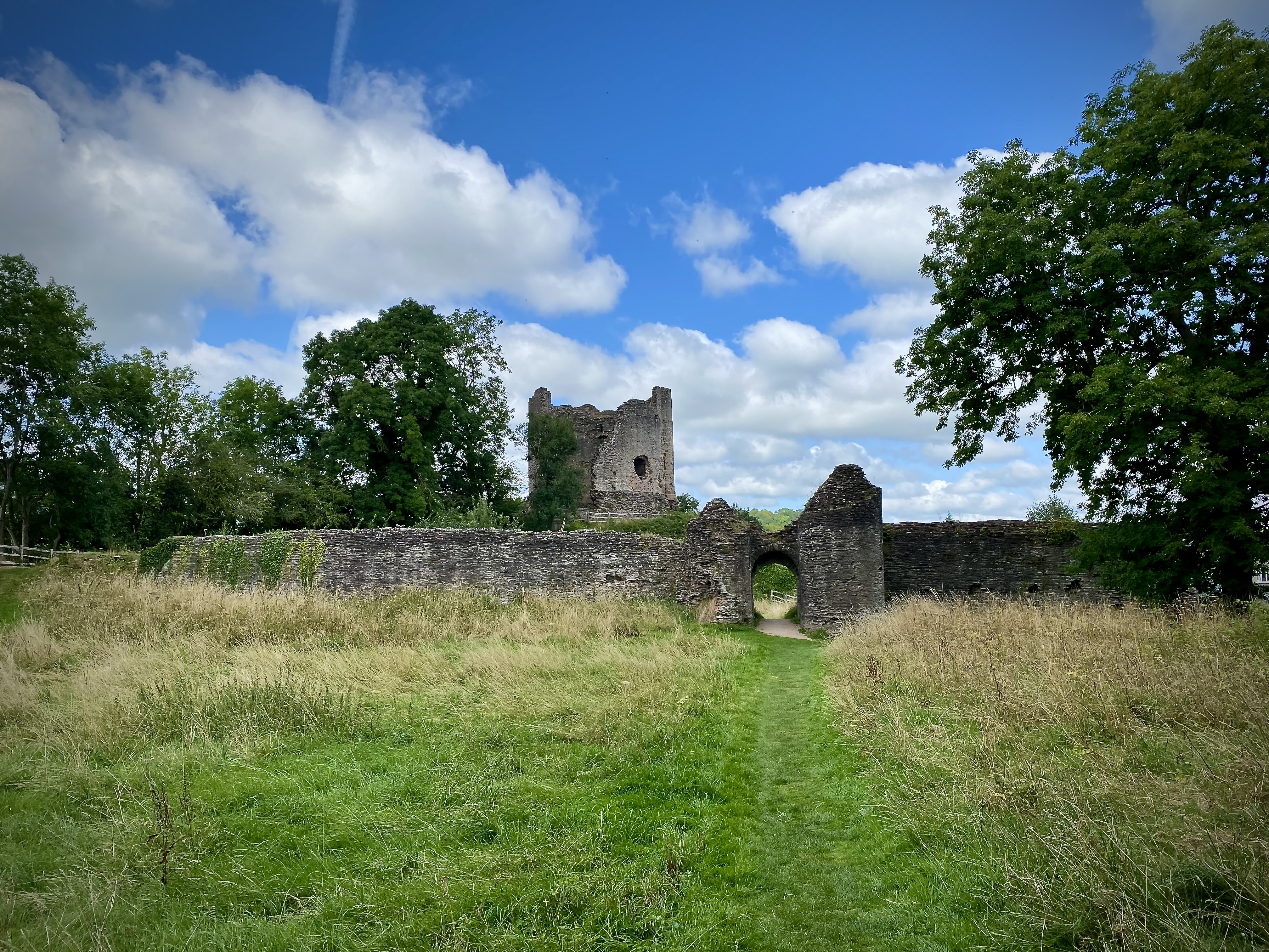
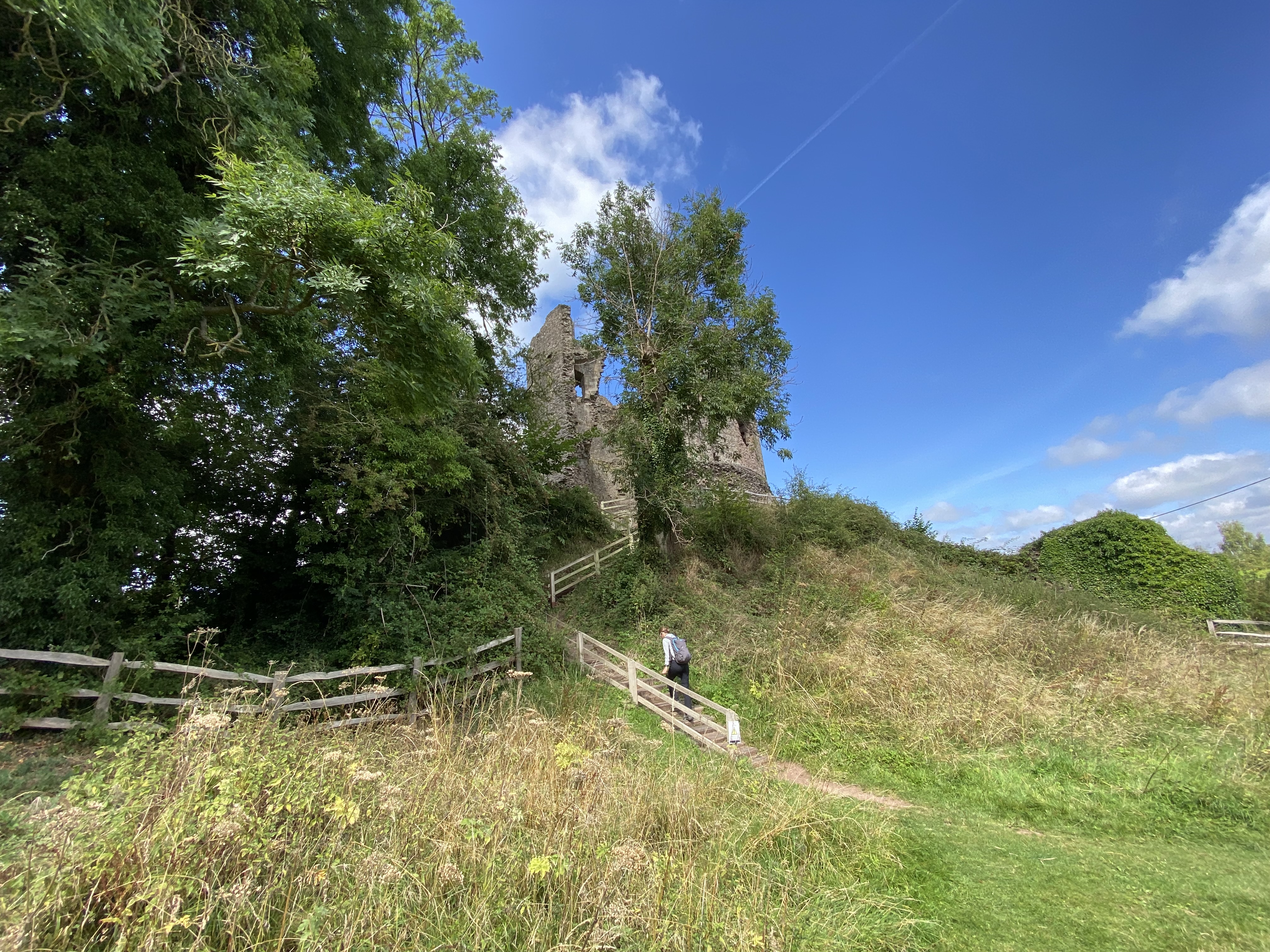
Then the Normans arrived! Longtown Castle perches on an earthen motte that has watched the Welsh Marches for nearly a thousand years. From the lane the first impression is tactile: the heavy, hulking silhouette of a mid-12th-century round keep, its weathered stone smelling faintly of lichen and damp earth; gulls circle above; sheep graze on the surrounding commons. The site reads as a palimpsest — Roman earthworks beneath Norman turf, medieval masonry atop earlier timber defences — and that layeredness is the castle’s story.
Longtown’s foundations belong to the age of the Norman advance into the Welsh borderlands. The site was appropriated in the aftermath of the Conquest by the de Lacy family — prominent Anglo-Norman marcher lords whose career across England, Wales and Ireland made them major territorial players (notably Walter de Lacy and his descendants). The first stronghold here is attributed to Walter de Lacy in the late 11th/early 12th century, placed to control a river crossing and to secure newly conquered territory against Welsh resistance. The castle’s early alternative name, Ewias Lacy (Ewias or Ewyas being a local placename), records that ownership and lordship explicitly.
The motive was straightforward marcher politics. A castle allows the owner to project authority, protect a trans-border route (the River Monnow corridor), and create a focus for settlement and revenue — hence the later establishment of a borough adjacent to the castle to help finance masonry works.
Archaeology and documentary material show a multi-phase building history. A Roman fort or defended enclosure pre-dates the Norman works; the Normans created a motte (a man-made earthen mound) set within those older ramparts and topped initially by timber defences (motte and bailey form). Timber defences gave way to stone during the 12th century: the distinctive cylindrical (round) keep and substantial curtain wall appear to be mid-12th-century works, probably completed under Gilbert de Lacy after c.1148 when the family reasserted control. The keep’s walls are very thick (c.5 m at base) and incorporate three external turrets — a local variety common in Welsh border keeps.

Materials used to build the castle and walls were local sandstone and rubble, dressed where needed; the technology is typical of high medieval masonry — coursed stonework, vaulted internal spaces and an elevated hall on the first floor of the keep — reflecting both military and residential functions.
A compact timeline helps here, but briefly: the timber motte was probably founded in the late 11th century; major stone rebuilding (including the round keep and curtain) dates to the mid- to late 12th century under Gilbert de Lacy (post-1148) financed by borough revenues (town chartering was a common funding method). The curtain and gatehouse were improved in the 13th century as marcher tensions persisted. By the later Middle Ages the site saw occasional refortification (notably during the Owain Glyndŵr rising, 1403), but after the 14th century it slipped into partial disuse and stones were quarried for local building.
Where dates are uncertain the archaeological report (English Heritage / Ewyas Lacy surveys) guides modern estimates; some documentary gaps mean precise years for smaller repairs are “probable” rather than certain.
Longtown’s military significance comes from its border location rather than from being the scene of great pitched battles. Its roles were defensive and administrative: containing Welsh raids, securing crossings, and acting as a marcher stronghold. The castle was refortified at moments of crisis — for example, Henry IV’s response to the Glyndŵr uprising around 1403 saw the castle temporarily garrisoned — but there is no clear record of a prolonged, famous siege that reduced it in a single campaign. Cannonballs of 17th-century date have been found on site, which suggests activity (or local fighting) during the English Civil War era, but this evidence is ambiguous: local tradition claims slighting in the Civil War, yet documentary proof is thin, so this remains probable rather than certain.
Strategically, the castle’s siting beside the River Monnow allowed control of movement and the imposition of tolls or justice; its large rectangular bailey and multiple enclosures created inner defences enabling gradual withdrawal if frontier pressure intensified. The round keep, while imposing, offered more a statement of lordly power and residence than a new defensive technology.
Alongside the military functions, Longtown was a market centre — a borough was laid out beside the castle to generate income and supply the garrison. Household life in the keep would have included an elevated hall (the first-floor hall in the keep is recorded), private chambers and service rooms; the bailey contained workshops, storage and artisans who serviced both lord and town. Over the 13th–14th centuries the borough declined (as happened to many small medieval towns after the Black Death and shifts in trade), shrinking the economic base that originally paid for masonry works. The castle passed through several hands by inheritance and royal grant — de Lacy, Verdun, Burghersh, Despenser and Beauchamp families are all recorded — reflecting the complicated politics of marcher inheritance.

From the later medieval period Longtown declined: by the 16th century it was no longer a functioning market town in the way it had been, and stone robbing for local building further reduced the standing fabric. In the 18th–19th centuries domestic and commercial buildings encroached into the outer bailey. The Ministry of Works (mid-20th century) and later English Heritage undertook cleanup and conservation; extensive conservation and archaeological research in the late 20th and early 21st centuries stabilised the keep and exposed key features. Today Longtown Castle is cared for by English Heritage, open to the public (free entry), and scheduled as an ancient monument; visitor access is informal but managed.
The round keep type seen at Longtown — thick-walled with exterior turrets — is a local Marches form also visible at places such as Skenfrith and Caldicot; these keeps make a visual statement of lordship as much as military sense. Today, the Monnow Valley is more about walkers’ boots than warring kingdoms, but the story of Saxon–Welsh friction still shapes its character. Every ridge and pass has acted, at one time or another, as a gateway between cultures, languages and claims to the land. That layered past still gives the valley its quiet sense of depth, as though the hills remember more than they show.
Well if you made it to the end then I think you deserve a medal. I think I got carried away again here, but I certainly learnt a lot about the area researching and writing this blog.
Further Reading
Buteux, Victoria; Archaeological Assessment of Longtown, Hereford and Worcester, English Heritage & Worcestershire CC (report summary online). 
Castles in Wales. Longtown. https://www.castlewales.com/longtown.html 
The History of Longtown Castle. English Heritage. https://www.english-heritage.org.uk/visit/places/longtown-castle/history/
Longtown Castles Project, “The new castle and borough” https://longtowncastles.com/the-new-castle-and-borough/
English Heritage. Archaeological Investigation Report Series AI/26/2003. ISSN 1478-7008. https://www.ewyaslacy.org.uk/Longtown/Longtown-A-Medieval-castle-and-Borough-an-Archaeological-Investigation-Report-by-English-Heritage/2003/rs_lon_0245
Smith, N. (2003) Longtown, Herefordshire A medieval castle and borough.

I have never been there although my maternal granfather’s family are meant to hail from there – Reece. The anglicized spelling of their name is evidence of the influence of Welsh/English border,
LikeLiked by 1 person
That’s right. Reece, Rhys, Rice are all variants. And are also the root of Price, coming from the patronymic Ap Rhys.
LikeLiked by 1 person
I didnt realise it was also connected to Price!
LikeLiked by 1 person