
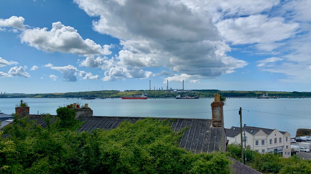
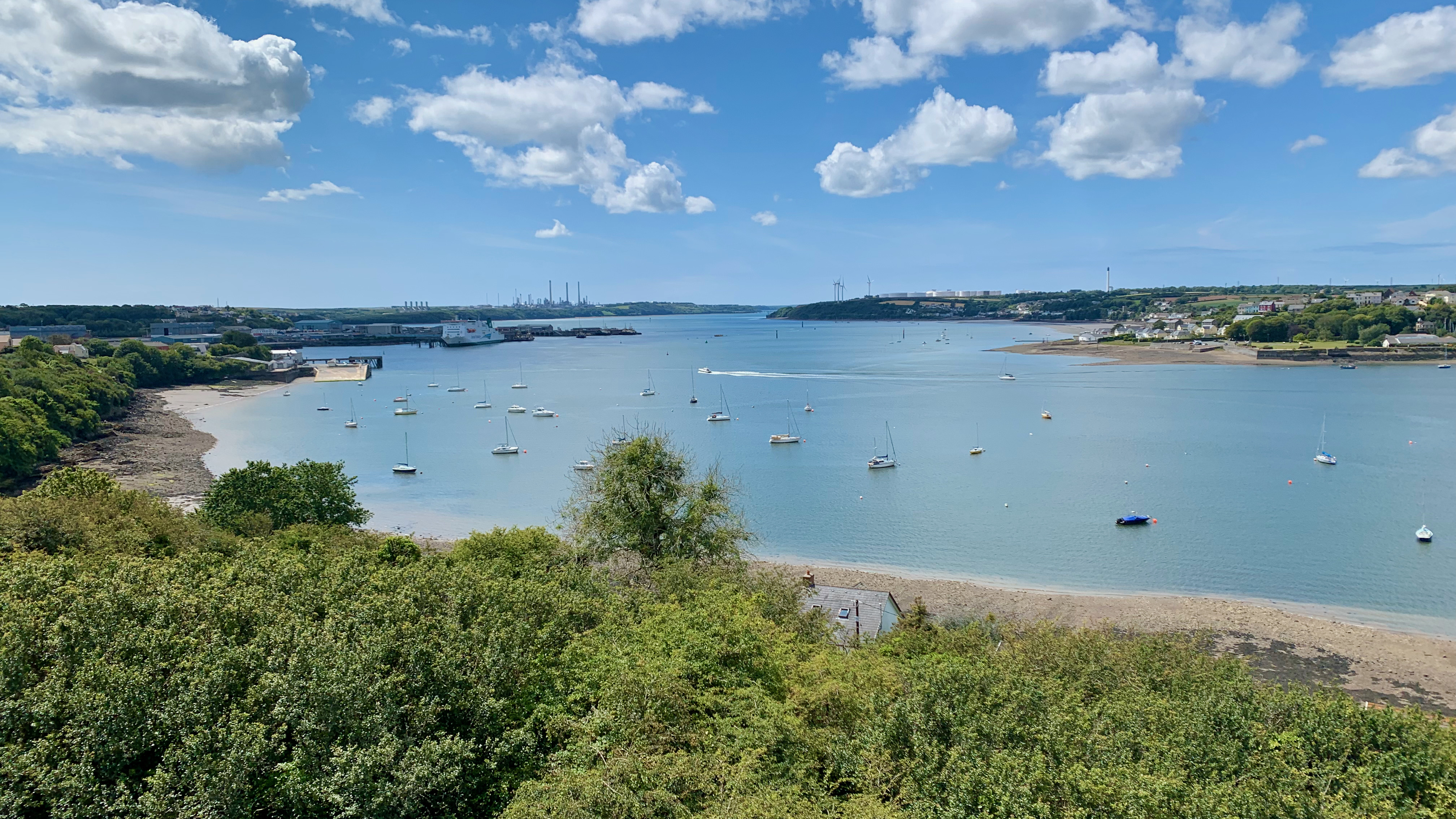
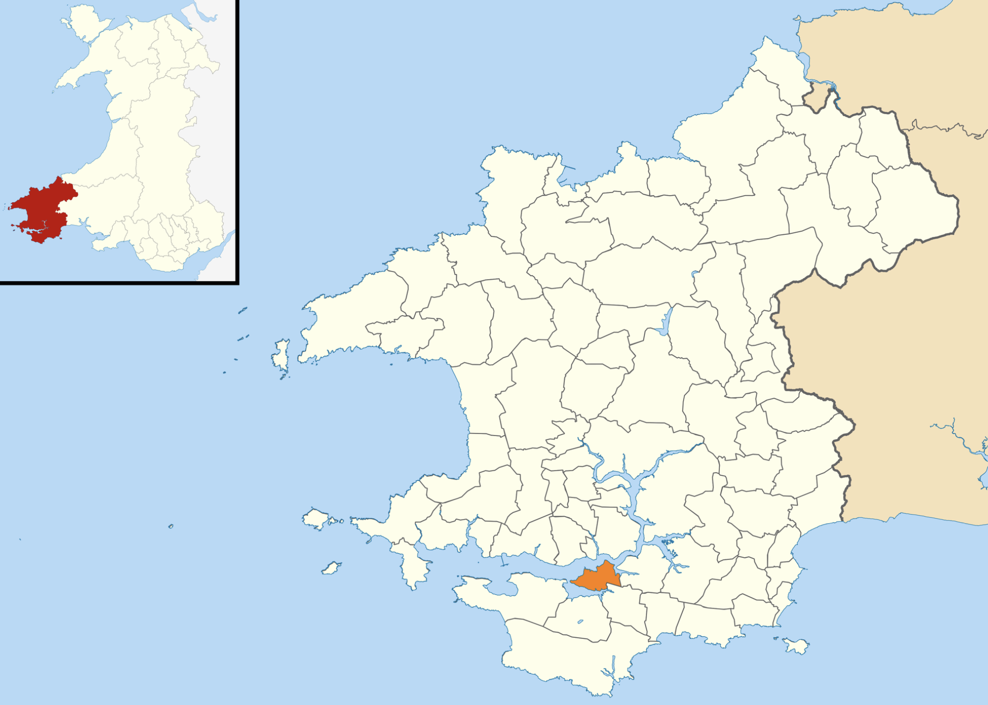
Milford Haven was one of those towns I was aware of growing up in Mid-Wales, but never had any cause to visit it, and so awareness was as far as it got. One of the delights of undertaking this epic journey around the coast of Wales is that it has taken us to places we may never had any cause to visit. Milford Haven certainly fits that bill. My ignorance of the area perhaps also led to me being unaware of the town, it’s size or history. I’d only ever thought of the Haven itself, along with Pembroke, but never the town nor the port of Milford Haven. I’d always known that this was an important haven for shipping, and one of the best deep water ports in the UK, so much so that the Royal Navy had a shipyard in Pembroke Docks for a long time. Today it is used by large tankers to bring in oil and liquified natural gas to the refineries flanking both sides of the waterways. Therefore it was a surprise to learn more about the town was we walked past the small old port and along the cliff edge east along the Haven towards Pembroke Dock.
So on a sunny July day we set off from the town of Milford Haven to walk along both sides of the haven to Pembroke.
Perched on the northern shore of one of the world’s finest natural harbours, Milford Haven is a town whose story has always been shaped by the sea. So much so It’s just not possible to ignore the haven and the surrounding ports as we walked. The origins of the town of Milford Haven stretch back far beyond its formal founding, with the deep ria of the Milford Haven Waterway formed at the end of the last Ice Age, creating a sheltered anchorage that would draw traders, invaders and settlers for millennia. Vikings are recorded as wintering here as early as the 9th century, while later figures such as Richard II and Oliver Cromwell used the Haven as a strategic embarkation point for military campaigns. 
The modern town, however, is largely a product of the late 18th and early 19th centuries, when Milford Haven was established as a planned settlement built on a grid pattern, complete with elegant Georgian terraces. Its early economy was rooted in whaling, with Nantucket Quakers using the port as a base for their fleets. Yet this initial prosperity proved fragile. The transfer of the Royal Dockyard to nearby Pembroke Dock in 1814 dealt a serious blow, leaving Milford Haven struggling to define its economic role. 
Recovery came later in the 19th century through infrastructure and industrial expansion. The arrival of the railway in 1863 connected the town to wider markets, while new docks and shipbuilding facilities encouraged maritime trade. By the turn of the 20th century, Milford Haven had reinvented itself as a major fishing port—at one point the sixth largest in the United Kingdom. Fishing dominated local life so completely that contemporary observers described it as the town’s “sole industry,” fuelling rapid population growth and urban development. 
The 20th century brought further transformation. During the First World War, the Haven served as a convoy assembly point and naval base, highlighting its strategic importance. Between the wars, the town expanded with new housing and public services, reflecting a broader pattern of modernisation. Yet it was the post-war period that reshaped Milford Haven most dramatically. The decline of fishing coincided with the rise of heavy industry, particularly oil refining and energy infrastructure. By the late 20th century, the Haven had become a nationally significant hub for oil and gas, with large refineries and terminals dominating the landscape. 

Today, Milford Haven stands at another point of transition. While energy remains central to its identity—the port handling a substantial proportion of the UK’s gas supply—the town is actively diversifying. Regeneration projects along the waterfront have introduced tourism, leisure and hospitality into the local economy, while initiatives such as the Celtic Freeport and renewable energy developments signal a shift towards a low-carbon future. 
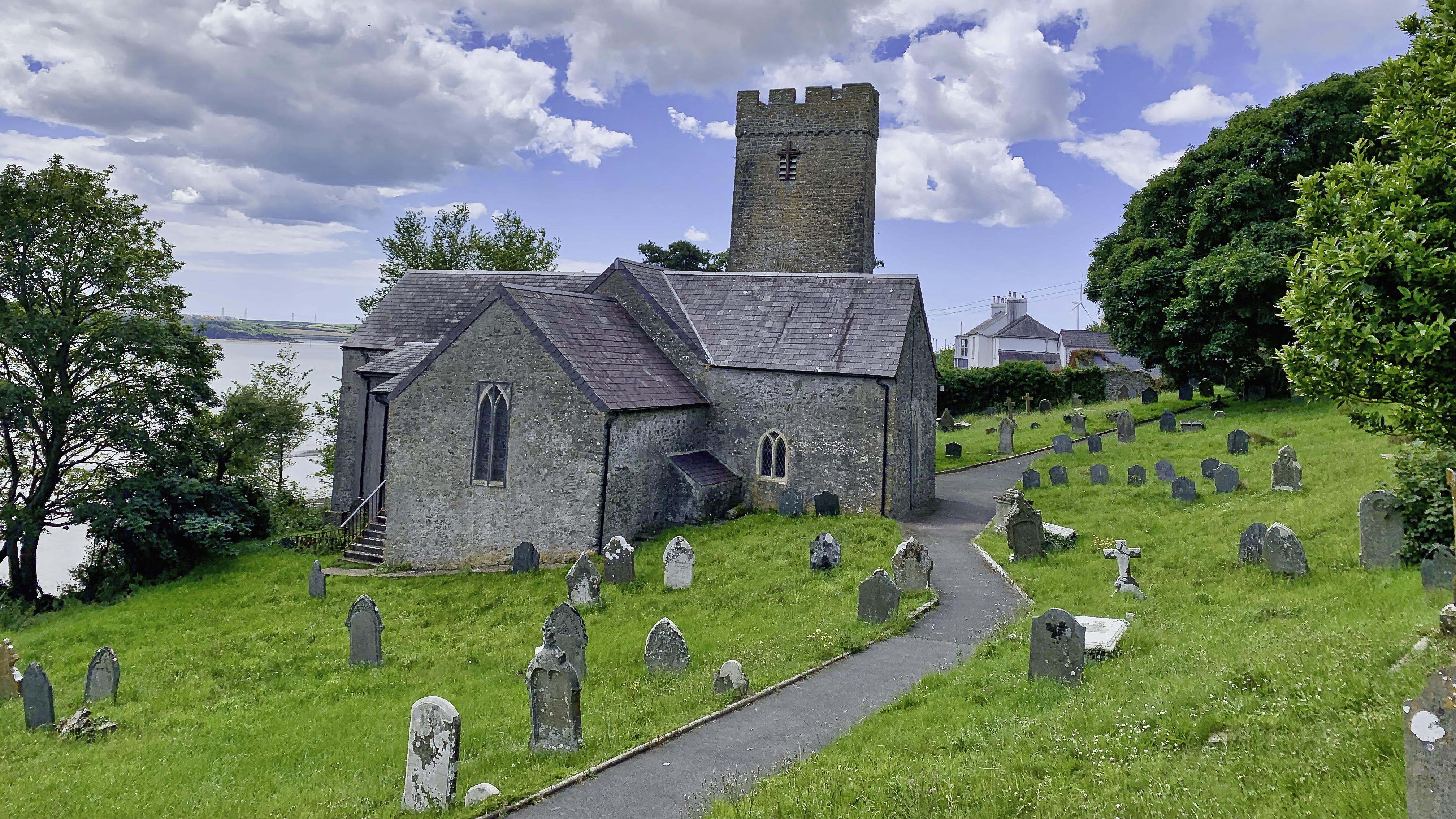
The path took us further away from the sea further inland along the northern shore of the Cleddau towards Llanstadwell. Set quietly on the north shore of the Milford Haven Waterway, St Tudwal’s Church, Llanstadwell is one of those Pembrokeshire churches where landscape and history feel inseparable. Its churchyard curves gently above the tidal edge, and at high water the sea seems almost to lap at its foundations—an evocative setting that has shaped both its character and its long story.
The church is dedicated to St Tudwal, a 6th-century Breton saint, and its origins stretch back to at least the 12th century. By tradition and association, St Tudwal is generally regarded as a protector of seafarers and coastal communities. This reflects both his Breton connections—linked to the seafaring monastic networks of Brittany and western Britain—and the coastal locations of many churches dedicated to him, such as Llanstadwell overlooking the Milford Haven Waterway. In this sense, he may have been invoked for safe passage at sea and protection from storms, though this is more a matter of regional tradition than formal hagiographical attribution.
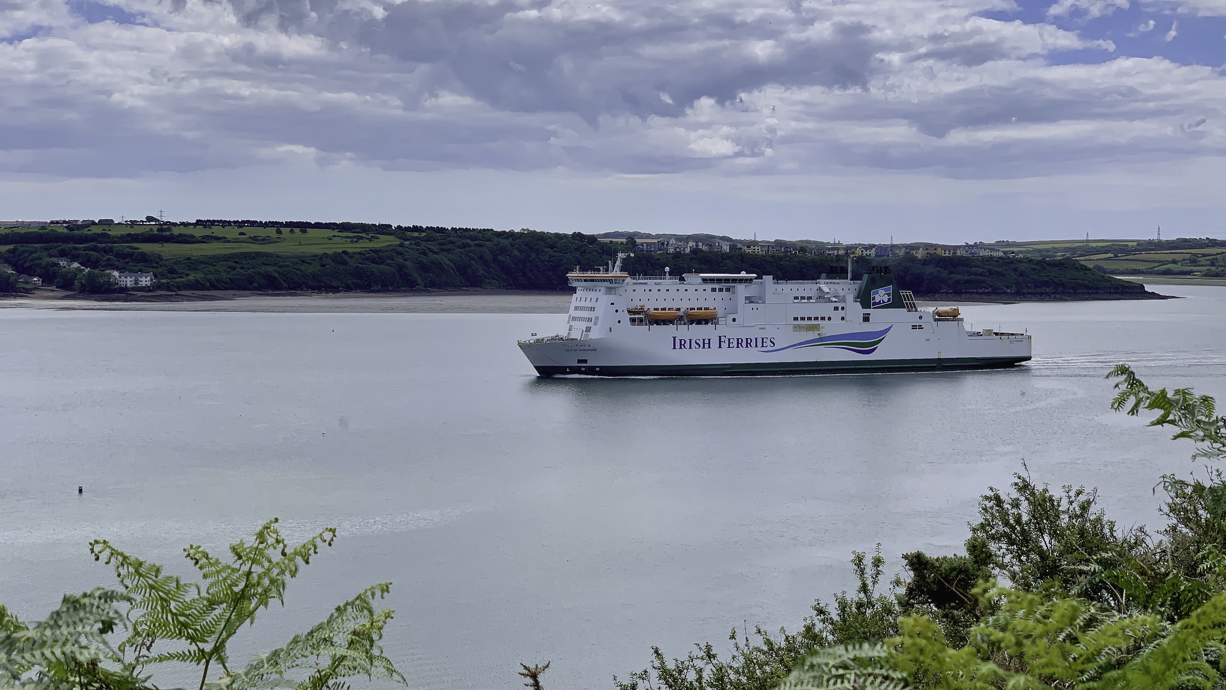
Just before we cross the bridge to the other side of the Cleddau we arrived at Neyland. Unlike many older Pembrokeshire settlements, Neyland is largely a creation of the 19th century. Prior to this, the area consisted of scattered farms and small coastal holdings, with little to distinguish it from the surrounding rural landscape. Its transformation began in earnest in the 1850s, when the expansion of the railway network reached the western extremities of Wales. Neyland was chosen as the western terminus of the Great Western Railway line, a decision that would fundamentally shape its destiny.
With the arrival of the railway in 1856, Neyland quickly developed into a strategic transport hub. A rail-linked ferry port was established, connecting passengers and goods across the Haven to Pembroke Dock and onward to Ireland. For a time, Neyland became one of the principal gateways between London and the south of Ireland, with transatlantic ambitions even briefly entertained. The town grew rapidly around this infrastructure, with housing, hotels and services emerging to support railway workers, dock labourers and travellers passing through.
The later 19th century saw Neyland diversify further. Shipbuilding and ship repair became important local industries, supported by the deep, sheltered waters of the Haven. The construction of dry docks and engineering facilities brought skilled labour to the town, fostering a distinct industrial identity. By the late Victorian period, Neyland was a bustling, if compact, maritime settlement, its fortunes closely tied to the rhythms of rail and sea.
However, this period of prosperity proved relatively short-lived. By the early 20th century, strategic priorities shifted. The development of alternative ports—particularly Fishguard, which became the primary Irish ferry terminal in 1906—reduced Neyland’s importance as a transport hub. The decline of railway ferry traffic had a marked economic impact, and although ship repair and local industry continued, the town never fully regained its earlier prominence. While nearby Milford Haven and Pembroke Dock became centres for oil refining and large-scale energy infrastructure in the post-war period, Neyland remained somewhat on the periphery of these developments. Today the redevelopment of its marina and waterfront has reoriented the town towards leisure and tourism, with sailing and boating now central to its identity. But we stayed only long enough to have a coffee in Neyland before climbing up the steep incline to cross the Cleddau Bridge.
Spanning the wide estuary of the River Cleddau, the Cleddau Bridge is a defining feature of the landscape around Milford Haven. Opened in 1975, it was built to improve connections between the south and north sides of the Haven, replacing reliance on ferries and lengthy road detours. However, its construction was marked by tragedy. In June 1970, a catastrophic collapse of part of the unfinished structure occurred during cantilevering works. Four workers lost their lives, and several others were injured. The disaster led to a major inquiry, which identified weaknesses in the design and construction process, contributing to wider changes in engineering safety standards across the UK. Following a redesign and strengthened construction methods, work resumed, and the bridge was eventually completed.
Stretching over 800 metres, and a main clearance of about 37 metres (121 feet) above high water at its highest navigational span. it provides a vital transport link, reshaping local travel and commerce. Without the bridge you would need to rely on ferris or a long detour up the Day Cleddau and back down the other side. With the bridge, the journey from Neyland to Pembroke Dock is only is only about 3–4 miles (5–6 km) and takes roughly 10 minutes. Without it, the route extends to approximately 25–30 miles (40–48 km). So it was worth it, even though when it was first opened there was a toll to pay. Today, if you are able to walk across the view on such a clear day is absolutely fantastic.
As soon as we arrived in Pembroke Dock it became obvious that the town had grown up as a major naval centre. After passing the ferry port we walked past the East Martello Tower. Rising from the shoreline beside the old dockyard entrance, the tower was built between 1848 and 1851, at a time when Britain feared attack from abroad and the Royal Navy’s dockyards were considered vital national assets. Pembroke Dock itself had grown rapidly after the establishment of the Royal Naval Dockyard in 1814. Within a few decades the town had become an important centre of naval shipbuilding, launching warships, gunboats and royal yachts for the Admiralty. Protecting this strategic harbour became increasingly important, and a chain of defensive structures was created around Milford Haven, including barracks, batteries and two distinctive Martello towers.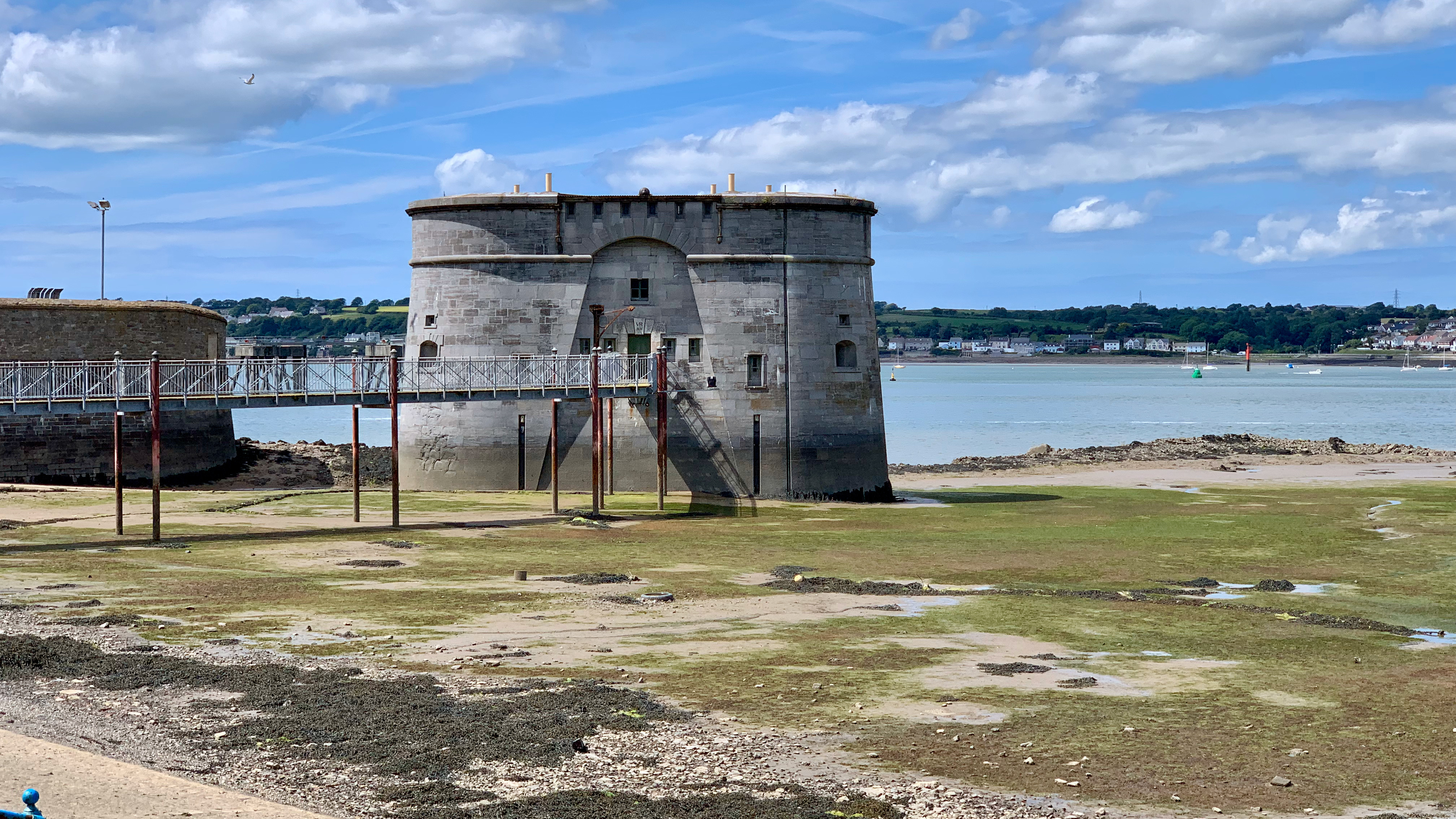
Unlike the earlier Napoleonic Martello towers found along the south coast of England, Pembroke Dock’s towers were later Victorian interpretations of the design, built from dressed stone and intended to withstand artillery attack. The East Tower was designed to house around thirty soldiers and an officer, with heavy guns mounted on the roof commanding views across the waterway. Although the tower never fired a shot in anger, its presence was part of a wider defensive network protecting the dockyard from possible French attack during a period of intense naval rivalry. While we there the tower was up for sale with an asking price of £70,000. Sounds cheap, but I doubt it would be cheap to run or maintain. The new owners would be responsible for its upkeep. WalesonLine has some photos of what it looks like inside. But it is tempting, but not right ihere maybe. The western tower around the corner is already in private ownership.
Next on the long list of things to see on this walk are the remains of the Royal Nay Dockyard. In 1814 when the Admiralty chose the site for a new dockyard on the sheltered waters of Milford Haven, no doubt influence by the fact that this is one of the finest natural harbours in the world. Pembroke Dockyard was unusual among Britain’s naval yards because it was built specifically for shipbuilding rather than repairs. The first ships were launched in 1816, and over the next century more than 260 naval vessels were constructed here, including warships, frigates and royal yachts. As the yard expanded, a new town rapidly grew around it, filled with workers, merchants and marines. The dockyard stood at the forefront of naval innovation during the transition from wooden sailing ships to iron and steam-powered warships. Its importance was reflected in the strong military presence around the Haven, including the impressive Defensible Barracks overlooking the waterfront.
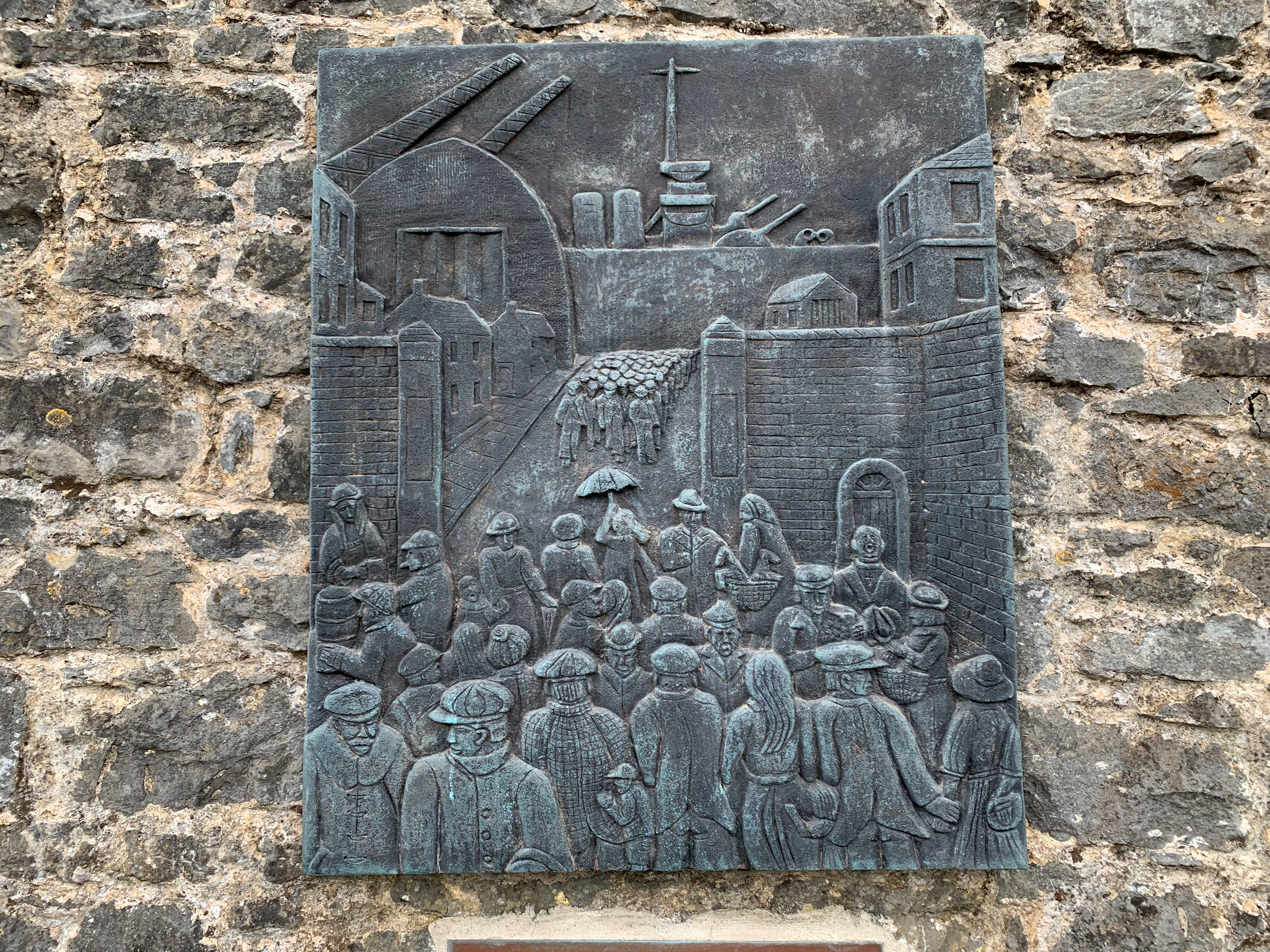
Closure came in 1926 following post-war defence cuts, dealing a heavy blow to the town. However, the site soon found a new purpose as RAF Pembroke Dock, home to famous Sunderland flying boats during the Second World War. Today, traces of the old dockyard survive among the modern port buildings, ferry terminal and waterfront. For walkers on the Wales Coast Path, Pembroke Dock remains a place where echoes of Britain’s naval past are never far from the water’s edge. Along the walls surrounding the dockyard are a series of large plaques illustrating the history of the site.
Following the path through Pembroke Dock the next surprise that confronted us was the Old Defensible Barracks. Wow, I never knew there was so much to see along here. Unfortunately the barracks are not open to tourists and inquisitive walkers, maybe in the future. Built between 1841 and 1846, the barracks were designed to protect the Royal Dockyard at Pembroke Dock, then one of Britain’s most important naval shipbuilding centres. Fears of attack from the landward side led to the creation of a building that was both barracks and fortress, complete with thick walls, loopholes for muskets and a surrounding dry moat crossed originally by a drawbridge.
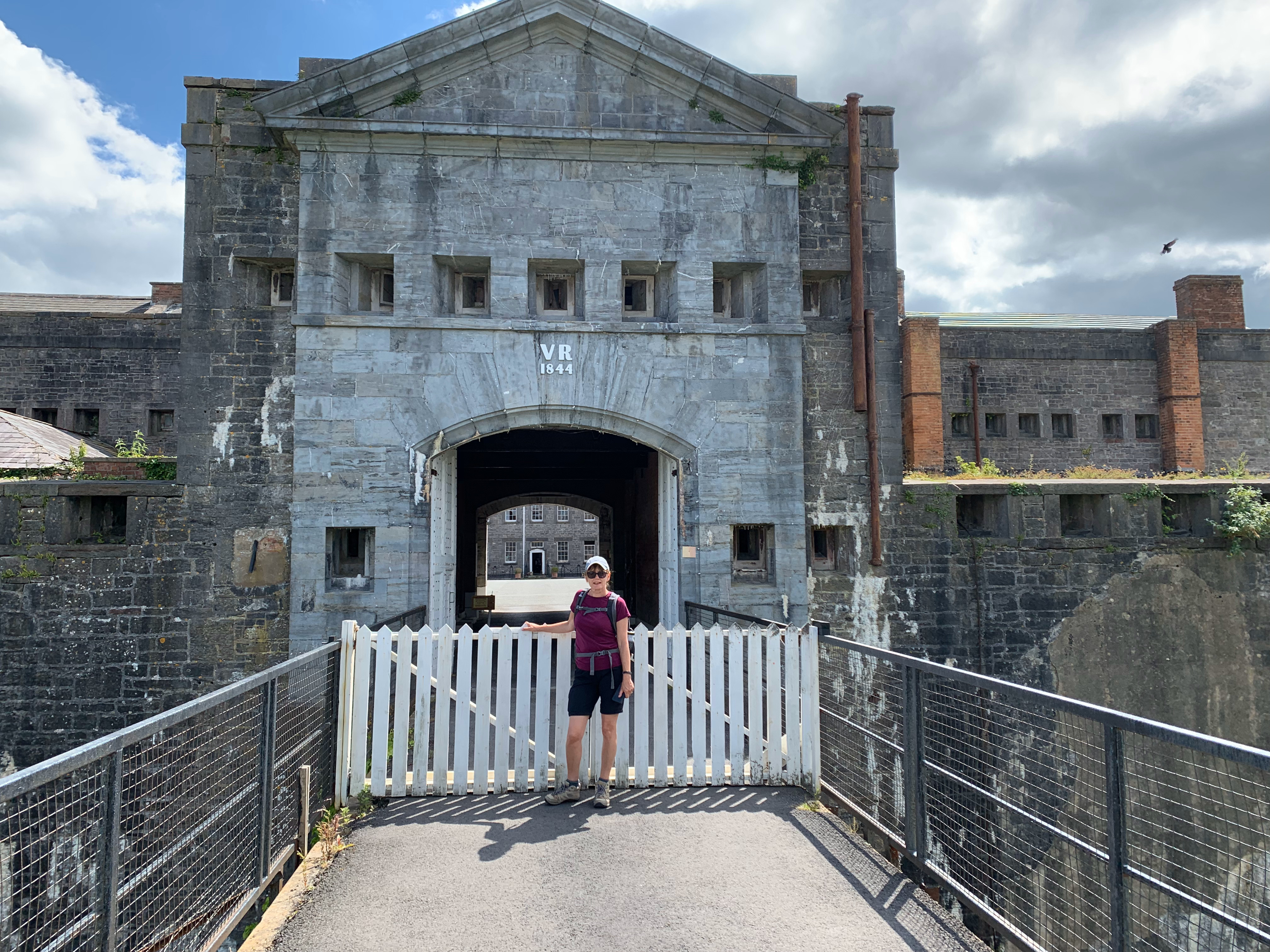
The barracks housed Royal Marines responsible for guarding the dockyard and became a familiar presence in the rapidly growing Victorian town. At its centre lay a large parade ground surrounded by accommodation blocks, creating one of the finest military squares in Wales. During the Second World War the site served as headquarters for the Milford Haven defences. In 1942, tragedy struck when a naval mine exploded during a training exercise, killing nineteen servicemen. Although now privately owned and closed to the public, the Old Defensible Barracks remains one of Pembroke Dock’s most striking landmarks.
We continued on towards Pembroke and eventually arrived under the walls of the impressive Pembroke Castle. This walk was an eye opener for me, I was completely unaware of how much there was to see and learn about in the small area of Wales. The impact that the development of the area as a Royal Navy Dockyard, developing further into a deep sea port to oil and gas imports that is now the major employer in the area. Although this was essentially an urban section of the Wales Coast Path, I really enjoyed it. You have to see if for yourselves. So what are you waiting for, move in from the fantastic beaches that Pembroke has to offer and take in the long maritime and military history the area has to offer.
Date Walked: 2 July 2019. Distance: 12.3 miles (19.8km).
Previous section: https://paulchallinor.com/2026/04/07/pembroke-to-angle-oil-and-whiskey-wrecks/
Next Section: https://paulchallinor.com/2026/06/08/milford-haven-to-dale-industry-forts-and-follies/

Leave a comment