
The weather during Easter Weekend in the UK can be pretty unpredictable and variable. It is not unusual to snow during this time, but this is more likely when Easter is early. This year it’s late, and so it’s reasonable to hope that it wold be warm and sunny. Well sunny it was. Warm it was not. Aunty and I spent the weekend just outside Cardigan on the west coast. Here the coast is rugged and isolated with heavy seas from the Atlantic crashing into the hard cliffs. Over a couple of days we managed to walk from Newport Sands up to St Dogmaels, just short of 20 miles.
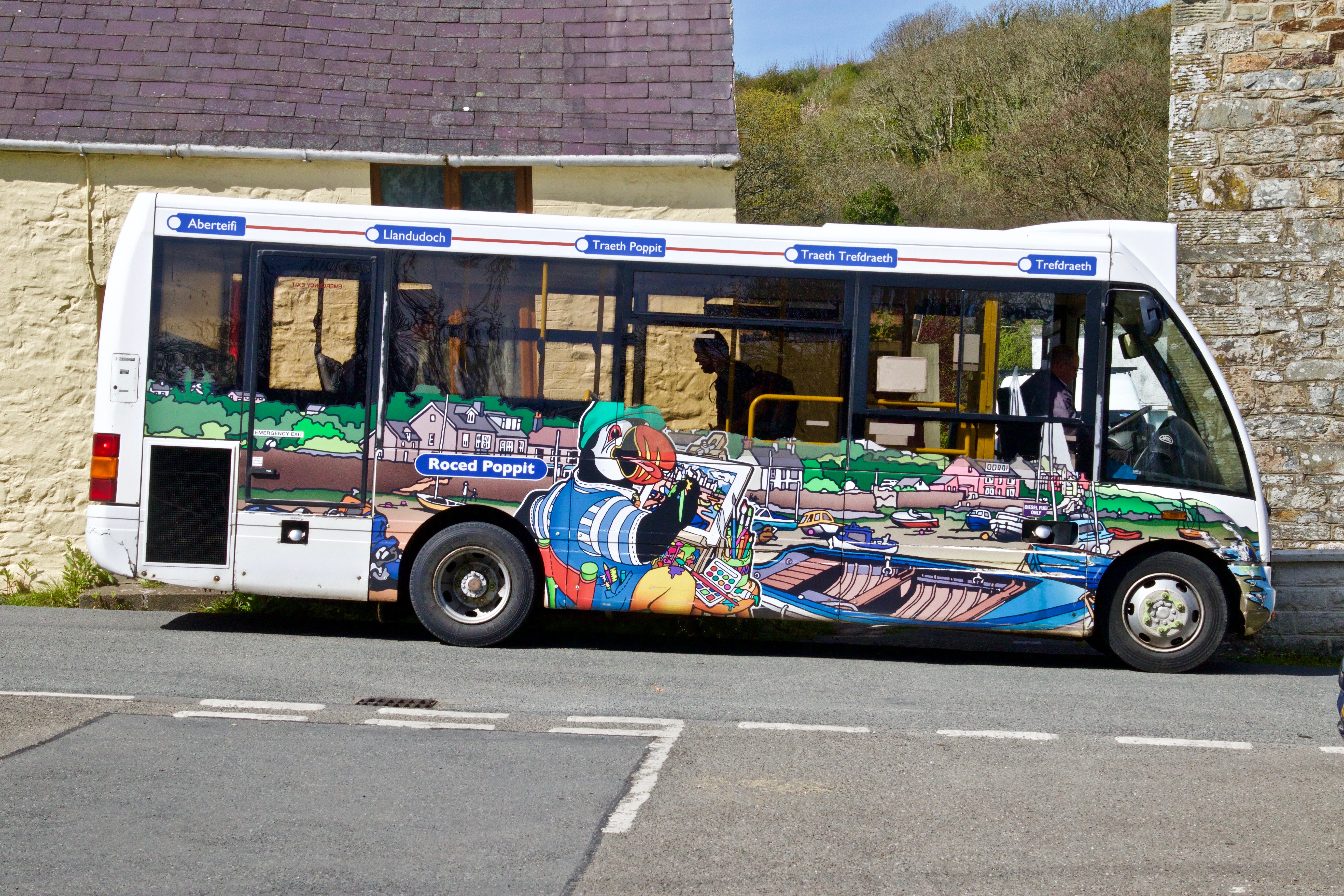
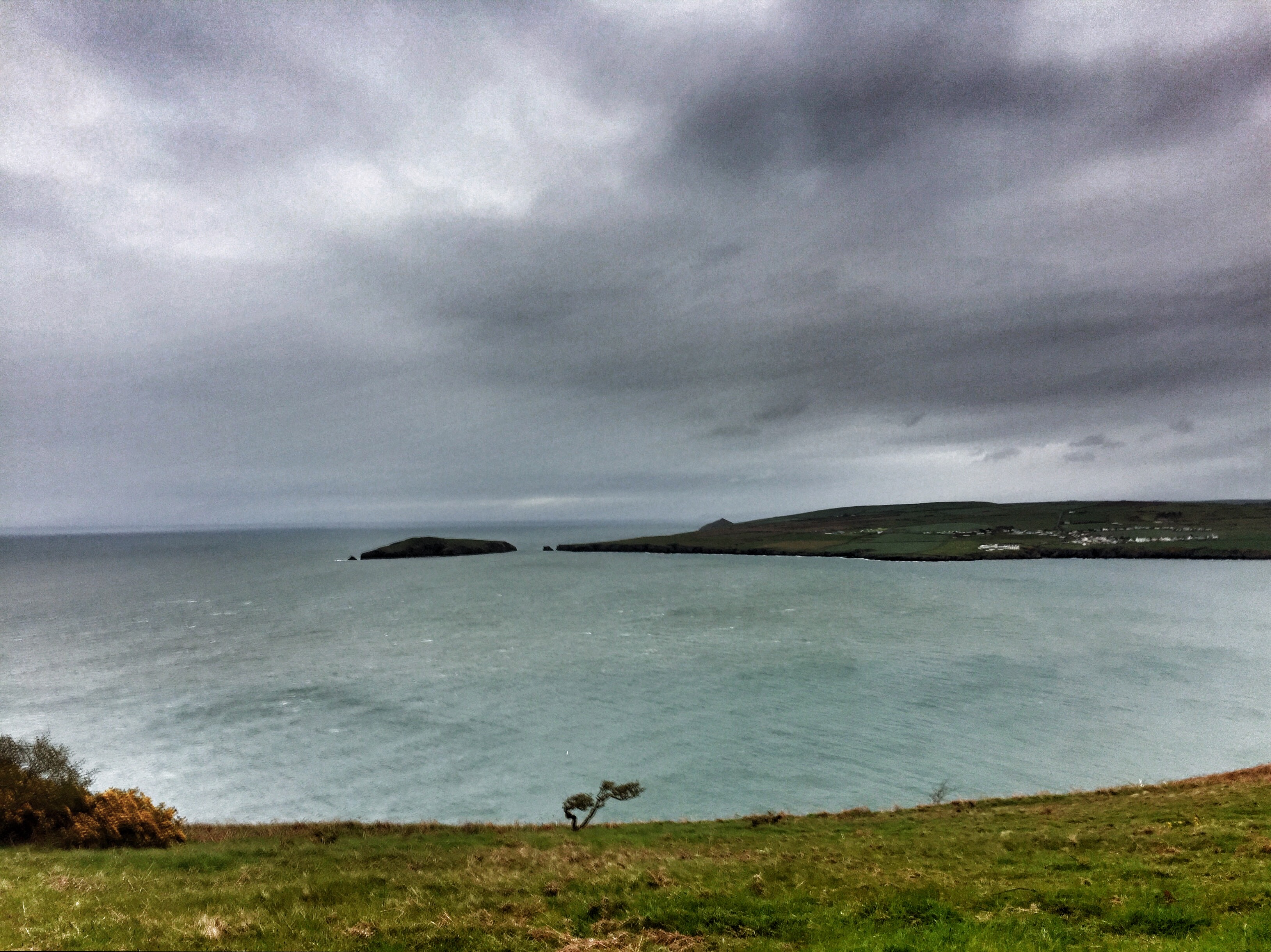
Saturday the sun was glorious, blazing down all day. But there was a bitterly cold wind and I doubt that the temperature got above 9C, but it felt much colder. But it didn’t matter too much the spectacular views made up for it. This time were were organised and parked in Moylegrove, and caught the Poppit Rocket bus down to Newport Sands. This meant that we were able to complete a full stretch of the coastal path in one direction only as we walked back to Moylegrove.
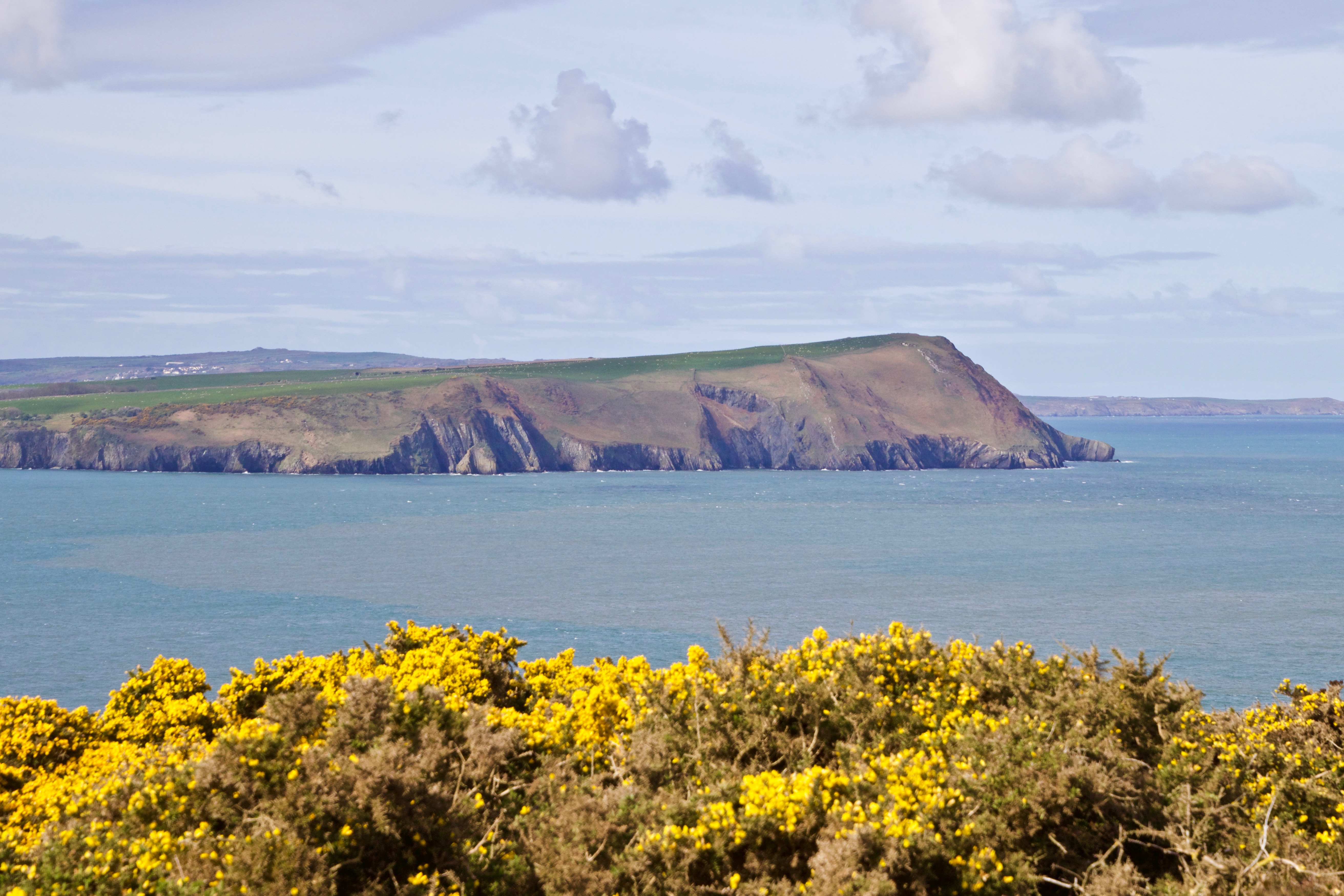
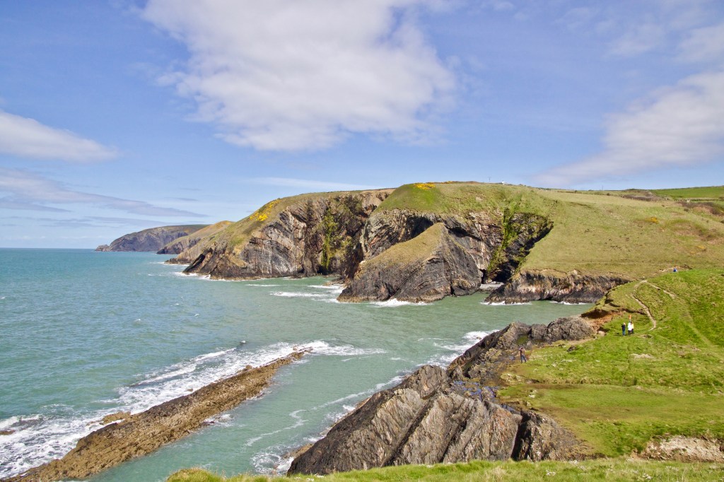
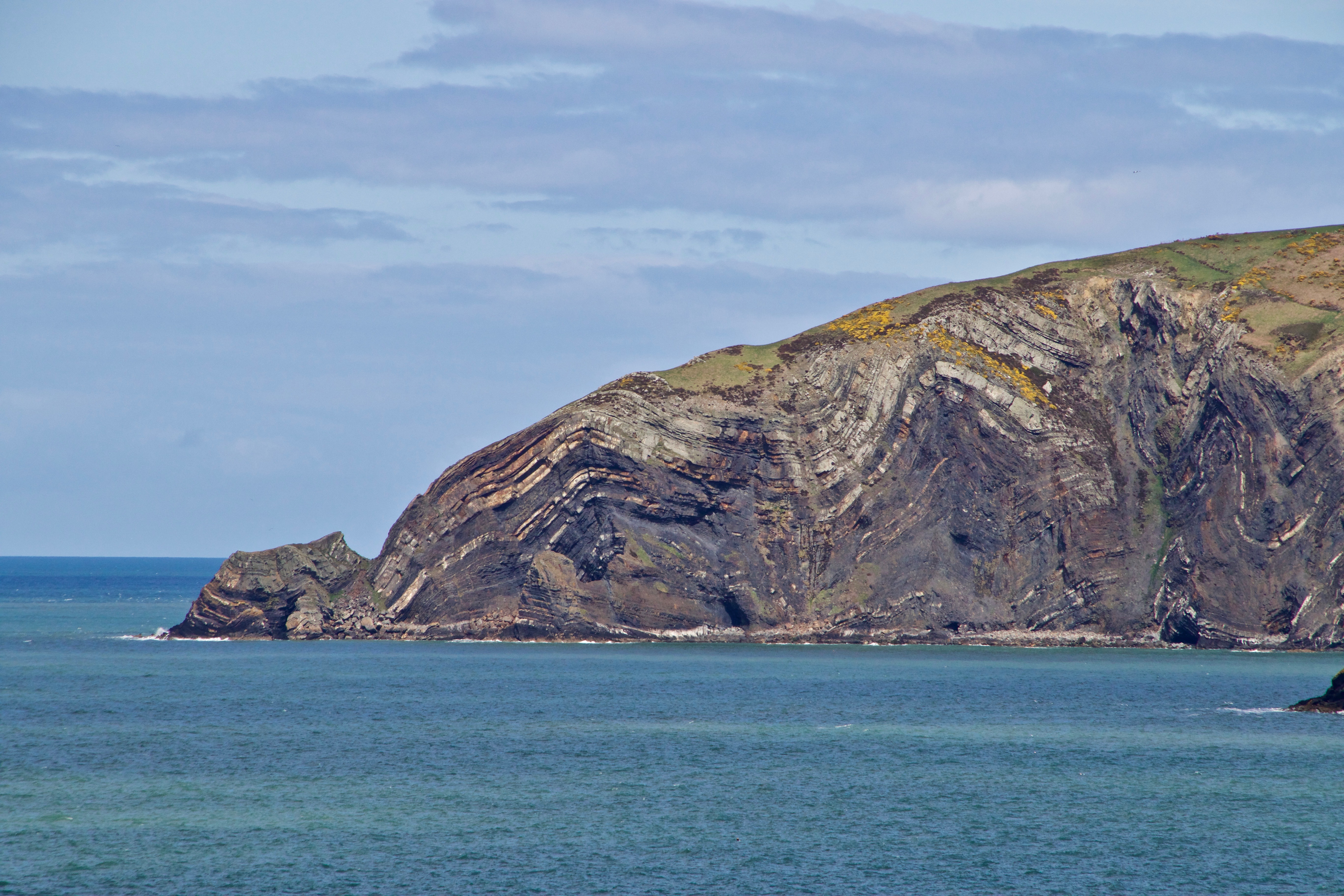
This is a wild and remote coastline with sea cliffs over 100m high and some spectacular geology. The temperature was a challenge until we had warmed up, but with hats, gloves and coats it was a great days walking. Starting at Newport Sands we quickly climbed up from the beach to the cliff tops and were greeted with sweeping views south towards Dinas Head and northwards to Cardiganshire.
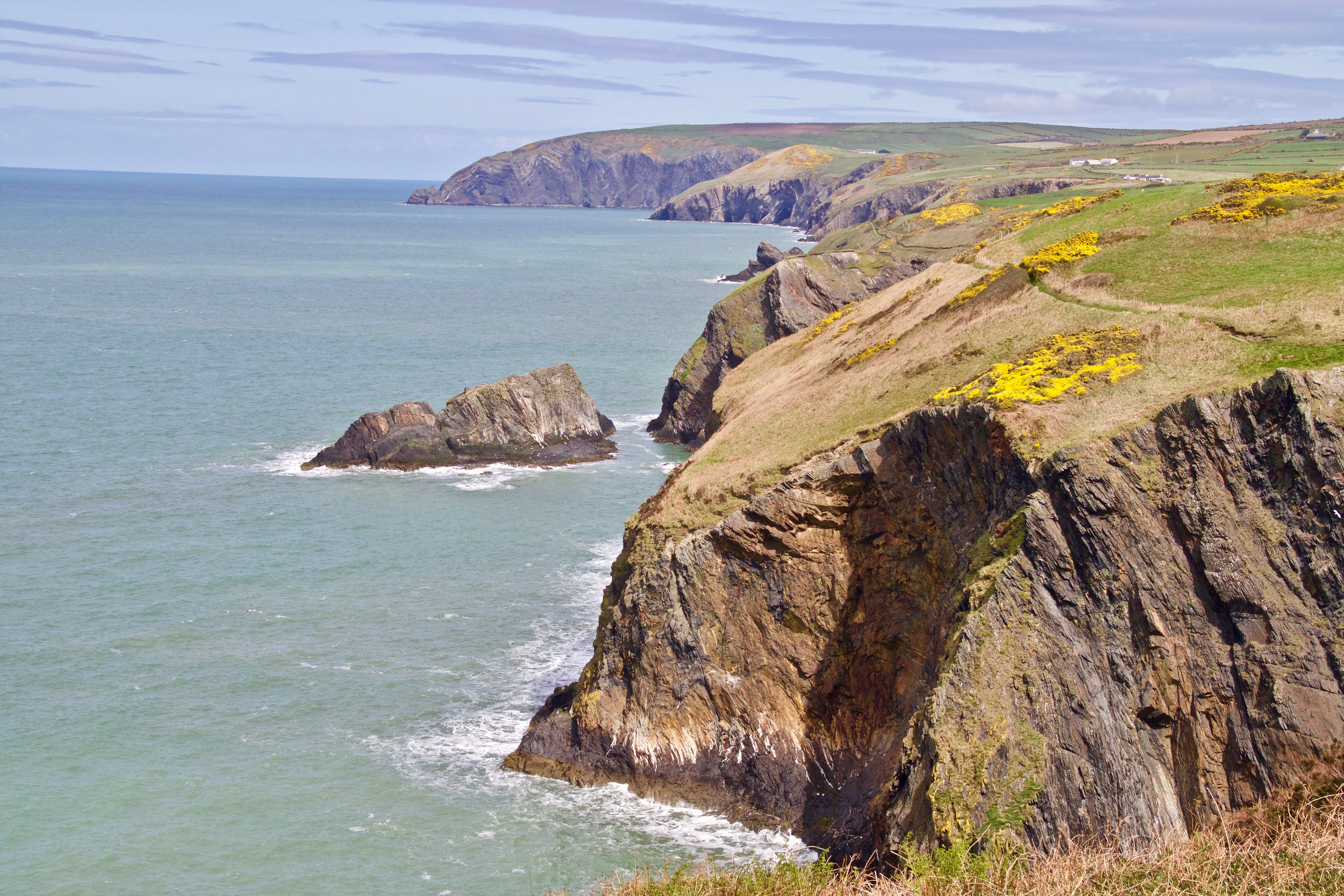
The geology is confusing on this stretch, and with the inaccessibility of the shore coupled with a paucity of fossil records, it has taken the geologists to fully understand what has happened here in the past. But recent work has solved this mystery, and it seems that this stretch of rocks were deposited during a relatively short period 444-446 million years ago. It appears that during the Upper Ordovician this small section of coast was sinking quickly in relation to the surrounding areas, creating a trough into which deep marine deposits were laid. This may have been helped by faults to the south, and possible volcanic activity. The forces involved can be creaky seen in the rock formations along the cliffs at Ceibwr Bay and Cemaes Head.
The weather on Sunday was a bit of a disappointment, no sun, heavy clouds and a strong wind that at times took your breath away as we rounded the headlands. Like yesterday, we hardly met anyone along the length of the walk.
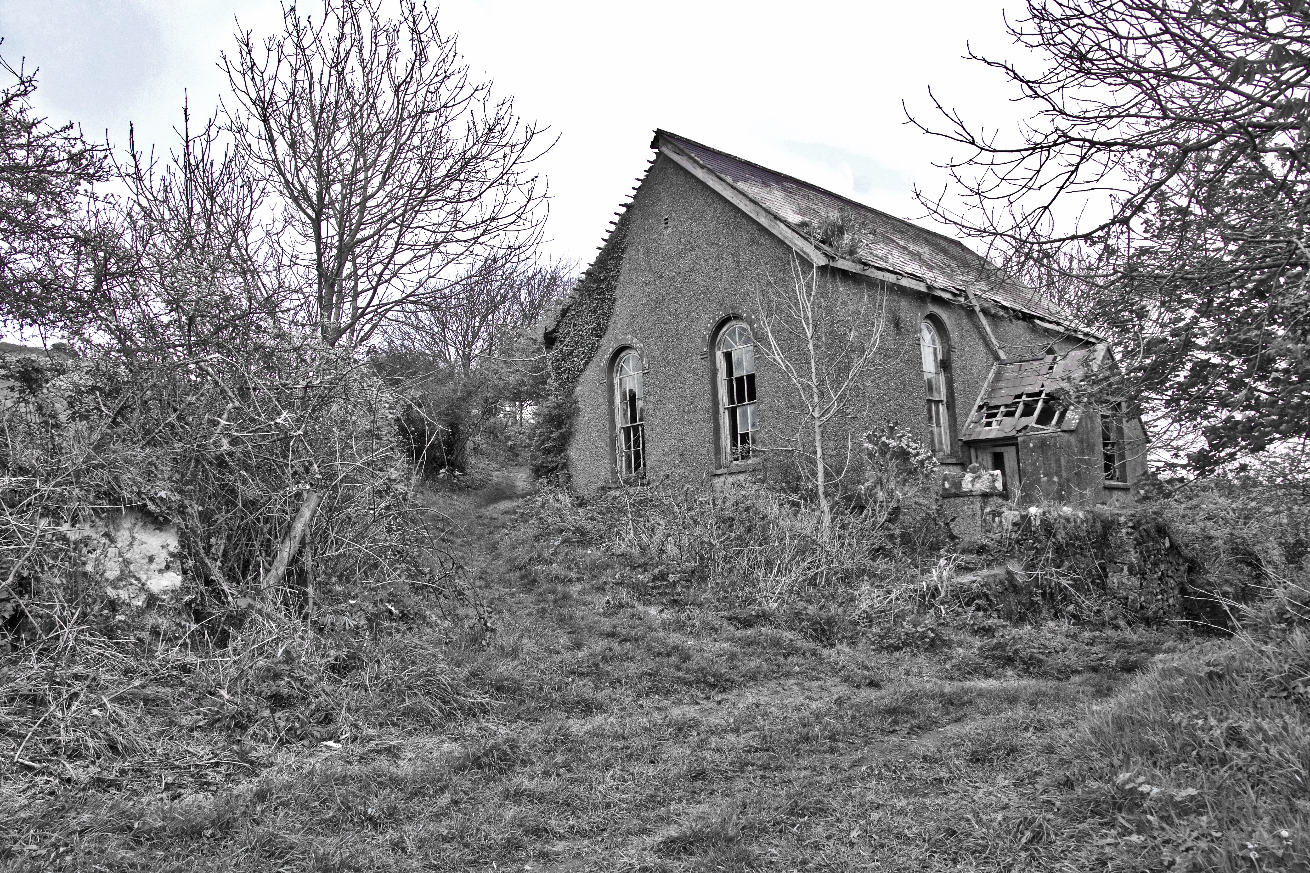
One surprise that we came across was a deserted chapel in the middle of nowhere. The only access is via a green lane. A little research identifies this as Capel Bryn Salem. Built in 1850, it was a daughter chapel of Bethel Congregational Chapel, Moylegrove. With a falling congregation by the late 1970s and early 1980s it closed it’s doors to worship and was offered for sale. Although it was bought, the neighbouring farmers refused access over their land for roads and cesspit and it was never developed. By 2002 the building was delapidated, and continues its decline today.

Leave a comment