
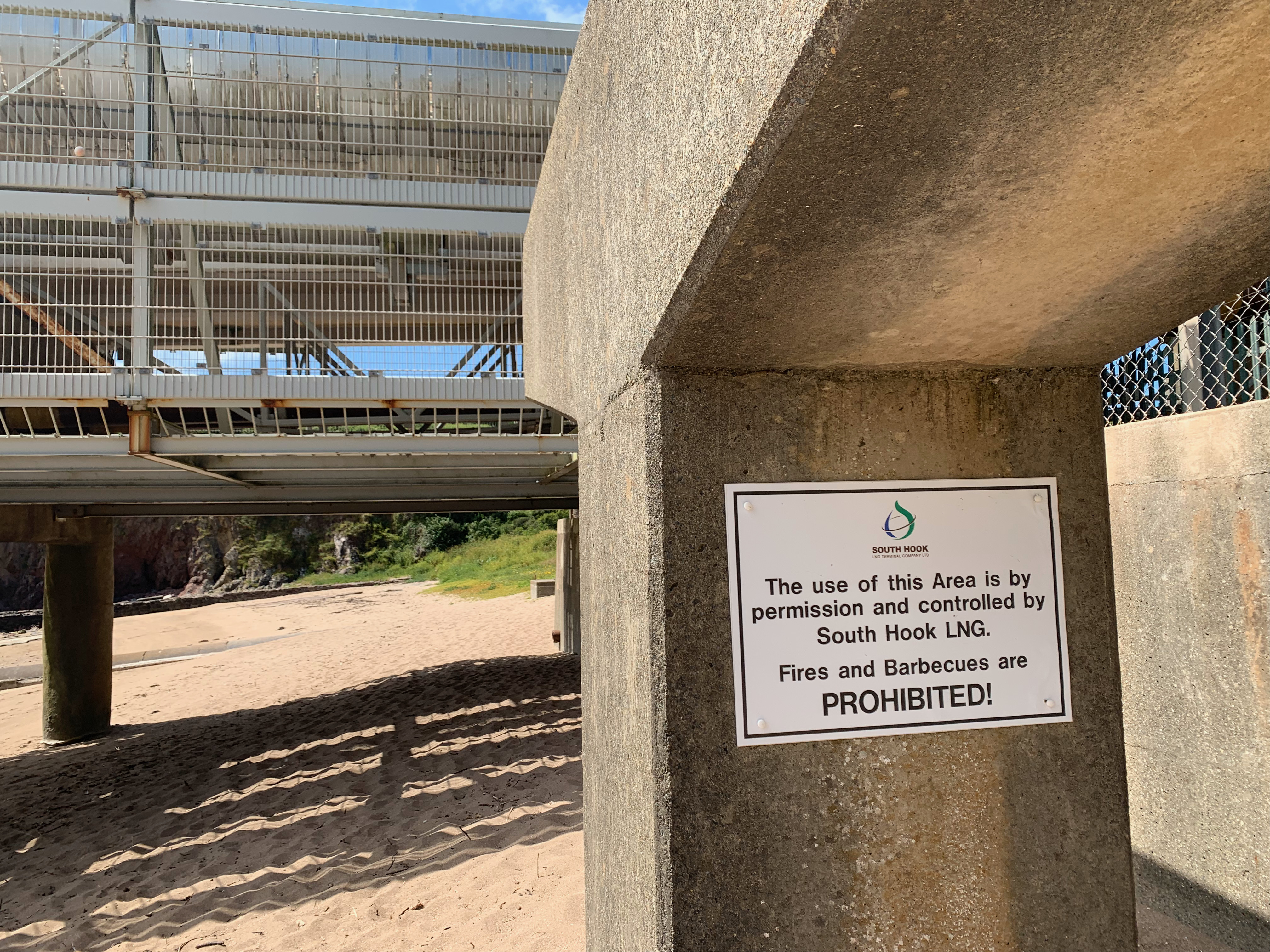
After the urban walk between Milford Haven and Pembroke this next section is far more rural and coastal. Leaving Milford Haven the path still follows an urban route and we pasted a number of refineries. This meant we had a security fence on one side but the other gave us clear and unrestricted views of the Haven, All along the path we passed concrete stands and warning signs extolling everyone not to smoke or wander around with naked flames. Eminently sensible advice considering the amount of gas and oil being moved from the tankers to the refineries in pipes that we passed.
Out in the waters we were given a great view of yet another fortification built to protect Milford Haven from whatever real or imagined threat. Rising starkly from a small rocky islet in the Milford Haven Waterway, Stack Rock Fort appears almost unreal at first glance — a circular stone fortress seemingly adrift between sea and sky. Seen from the path, it evokes the atmosphere of a forgotten stronghold, isolated by the tides and slowly weathered by salt, wind and time. Yet this lonely fort was once part of one of the most ambitious coastal defence systems in Britain. Constructed between 1850 and 1852 during a period of mounting anxiety about invasion from France under Napoleon III. Milford Haven had become strategically vital to the Royal Navy, particularly with the growth of the dockyard at Pembroke Dock, and the British government feared that enemy warships could penetrate the sheltered waterway. To protect the Haven, a chain of forts and batteries was built, with Stack Rock occupying a commanding position near the entrance channel.
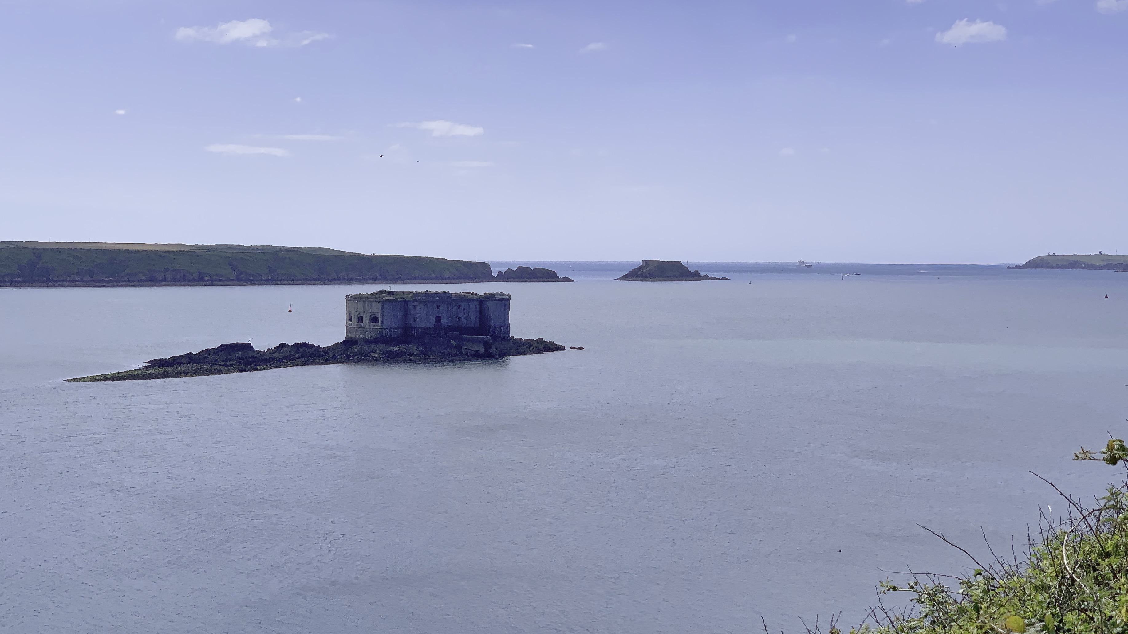
Designed as a compact defensive fortification, the structure was built from limestone and originally mounted heavy guns across several levels. Soldiers stationed here lived in cramped and isolated conditions, surrounded almost entirely by water. Despite its formidable appearance, the fort never saw active combat. Advances in naval technology soon rendered many of these mid-nineteenth-century coastal forts outdated, and Stack Rock gradually lost its military significance. During the twentieth century the fort found occasional use again during both World Wars, when the strategic importance of Milford Haven briefly returned. In the post-war years it had been abandoned to seabirds, tides and decay. Windows vanished, masonry crumbled and vegetation slowly claimed the upper walls. Even so, the fort retains an extraordinary presence — part military relic, part maritime ruin.
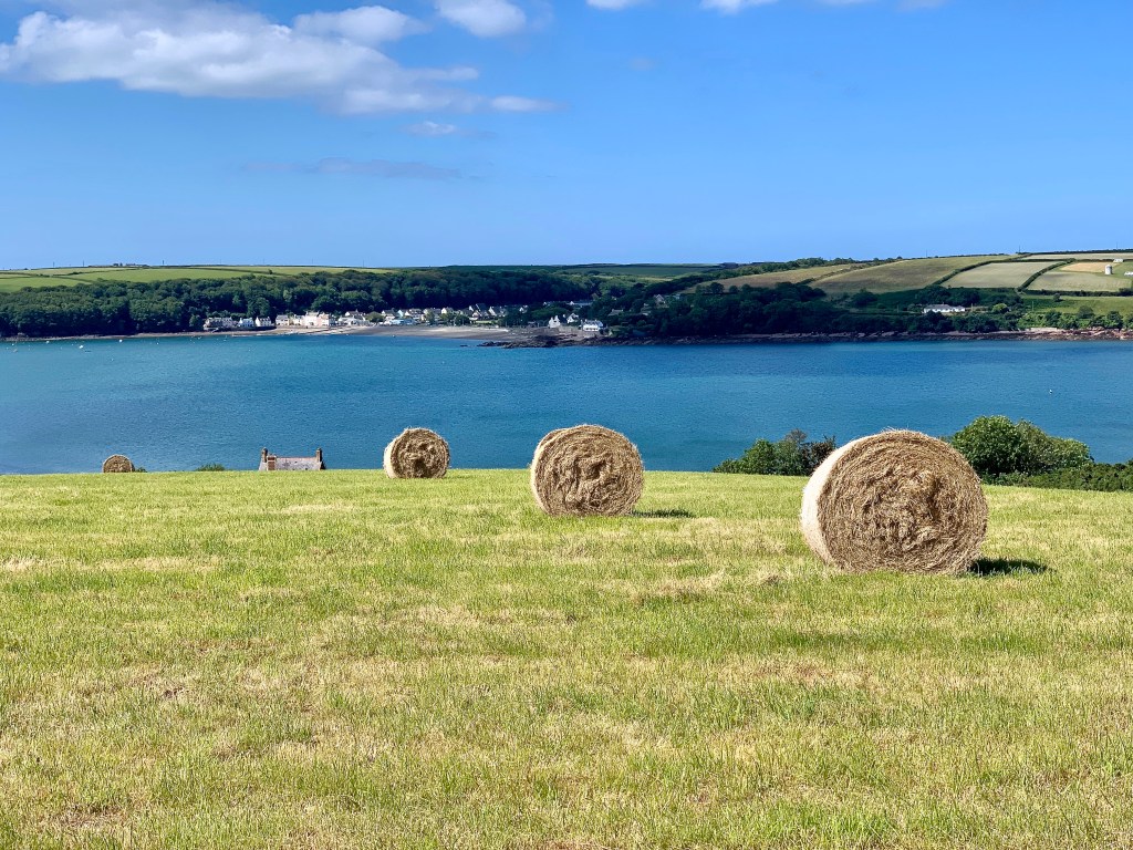
Soon we were past the industrial and into the rural. All along the path there are hints of Iron Age promontory forts at Little Castle Head and Great Castle Point. These are joined by lookout points with names evoking the need for vigilance, Watch House Point. We passed another Victorian fortification at South Hook Point, but this was inside the boundary of the refinery and not accessible. Further along is the site of a radar station. So much in such a short stretch of path almost in contradiction of the beauty of the coast, with the path strewn in glorious wildflowers.
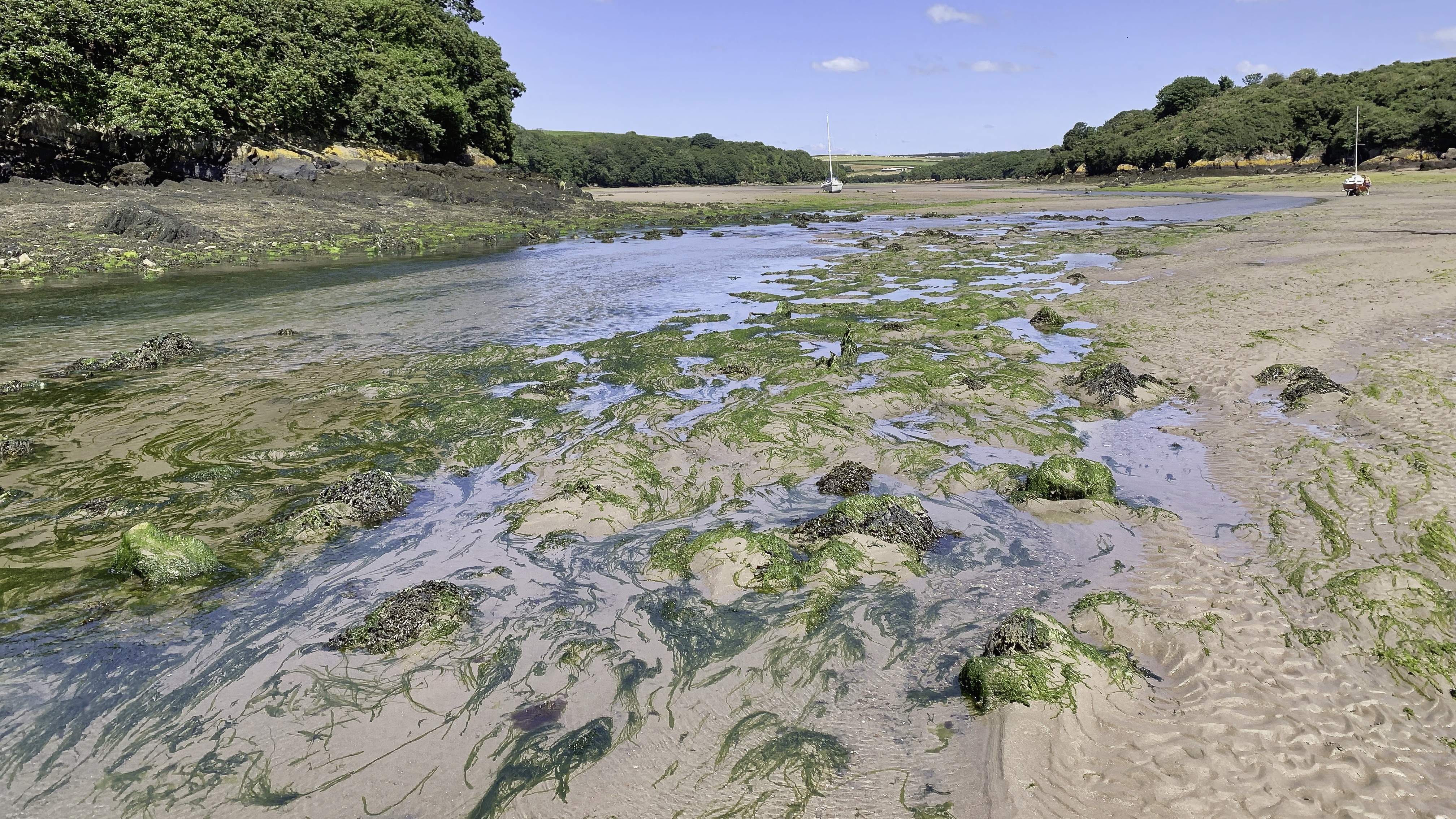
Right on the edge of the refinery we came across Sandy Haven. An apt name. Tucked into a sheltered inlet of the Milford Haven Waterway between Herbrandston and St Ishmaels, Sandy Haven is one of those places where the tides seem to dictate the rhythm of the landscape. At high water the estuary narrows into a tranquil creek, but when the tide retreats it reveals broad stretches of reddish sand, rock pools and winding channels beneath low wooded cliffs. Historically, Sandy Haven grew around an ancient crossing point over the estuary. Long before modern roads arrived, travellers heading west from Herbrandston crossed here at low tide using stepping stones, remnants of which survived for generations and became part of the character of the place. The small settlement that emerged nearby was never large, but it served local maritime life for centuries, supporting fishermen, boatmen and small-scale coastal trade linked to the busy Milford Haven waterway.
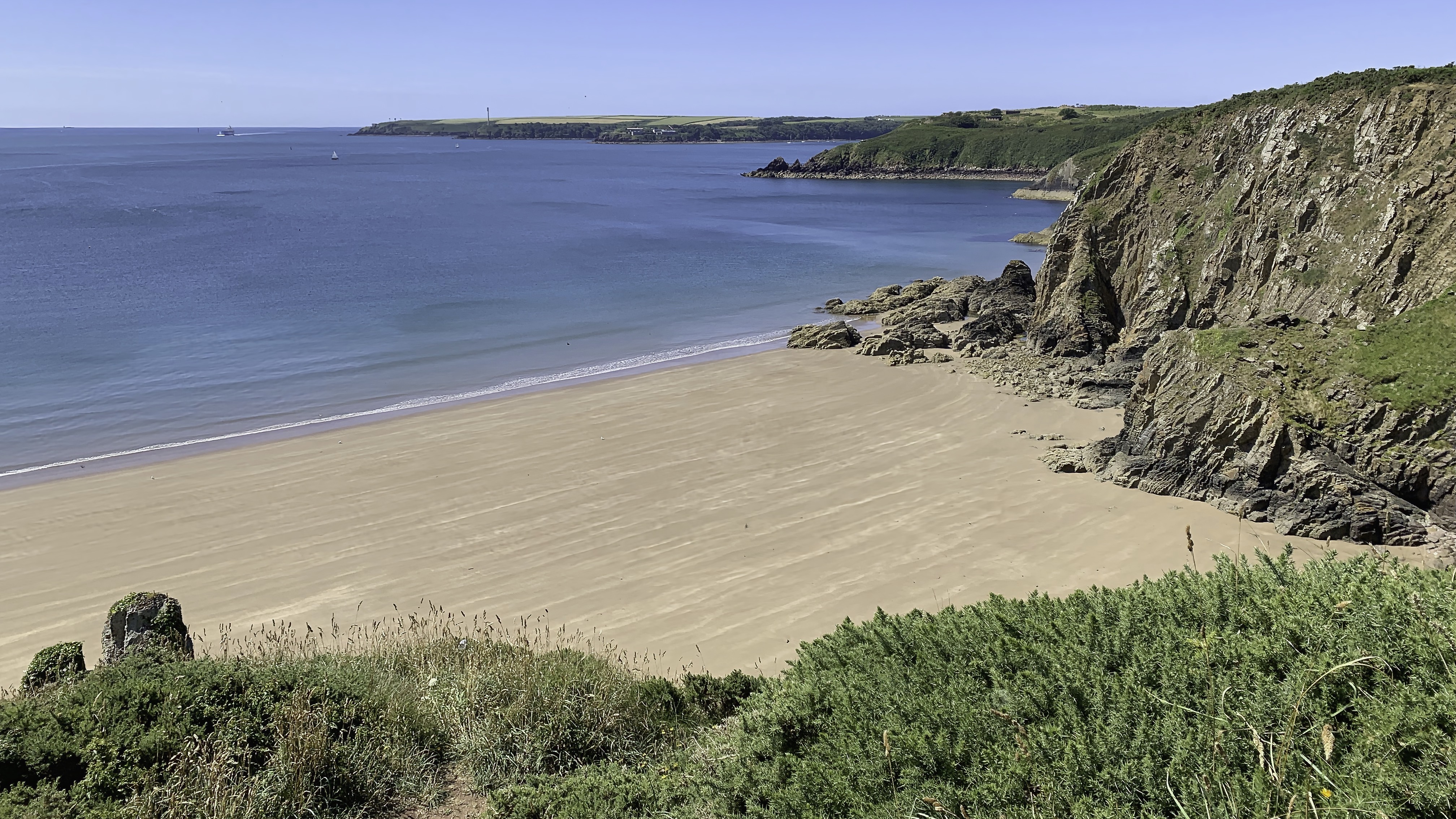
Lindsway Bay sits below the path, a beautiful golden sand bay that was calling to us to stop for a coffee break. Unfortunately we couldn’t find an easy way down so we continued on towards Monks Haven. The origins of Monks Haven are closely tied to the medieval religious houses that once held extensive lands around Pembrokeshire. Its very name is believed to derive from the monks of nearby St Dogmaels Abbey or possibly Pill Priory, who used the sheltered inlet as a small landing place and harbour during the Middle Ages. In an era when waterways were often safer and faster than rough inland tracks, the Haven may have provided an important route for moving goods, livestock and people around the Milford Haven Waterway.
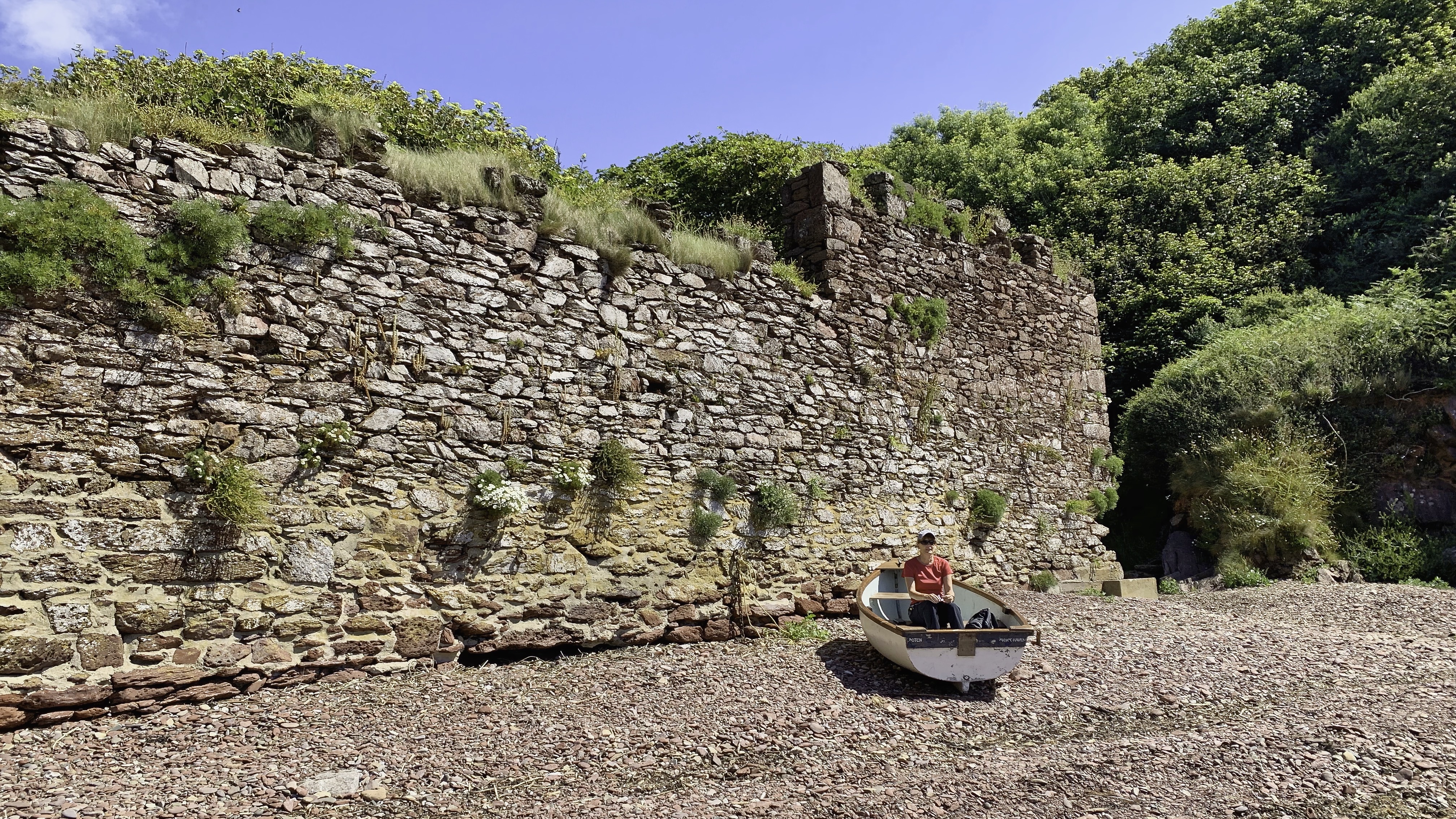
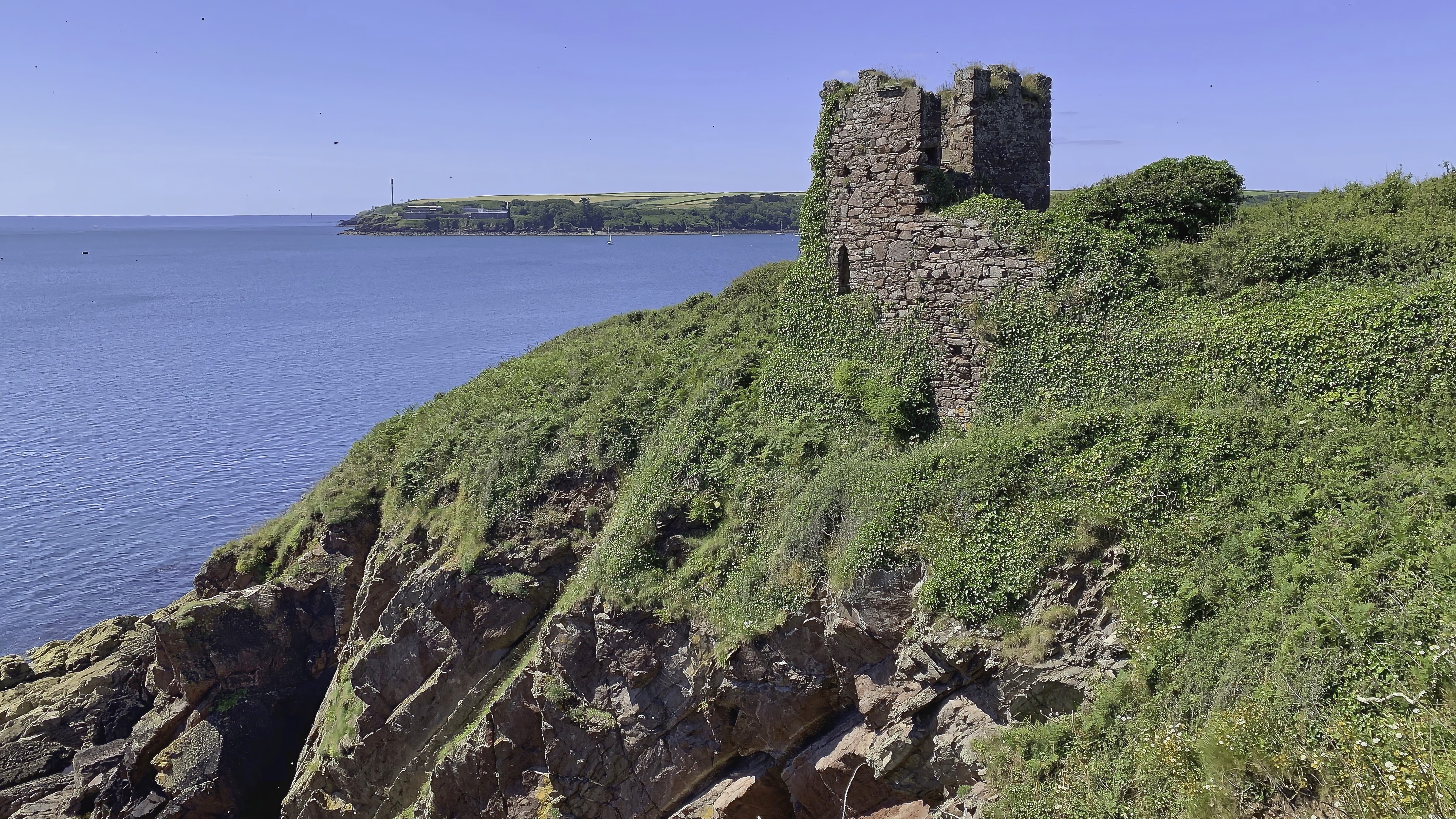
One of the most intriguing features at Monk Haven is the long stone wall that stretches across the tidal inlet below the cliffs. At first glance it appears almost defensive, cutting across the mudflats in a way that seems oddly out of place in such a peaceful creek. In reality, the structure is believed to have formed part of an eighteenth- or nineteenth-century ornamental landscape created for the Trewarren estate just inland from Monk Haven. Up above the creek on the cliffs stands a folly tower. The folly itself, standing prominently on the cliff edge, was likely built as a decorative feature for the Trewarren estate, designed to catch the eye from both land and water. During this period, wealthy landowners often shaped their landscapes to create picturesque views inspired by the Romantic movement, blending natural scenery with carefully placed architectural curiosities.
A little further one the cliffs give was to rolling green farm land and the path was bringing us closer to Dale, our destination for this walk. But before Dale it was necessary to skirt around a large tidal sand and shingle large bay. The path took us across the narrow stone line of the Pickleridge Causeway. At high tide it can appear almost submerged beneath the shifting waters, but when the sea retreats the ancient crossing emerges once more. The causeway is believed to have medieval origins, though parts of the structure may have been rebuilt and repaired over many centuries. In a landscape shaped by tides and inlets, such crossings were essential to local communities, allowing safer access across muddy estuaries and coastal marshes that would otherwise become impassable. Farmers, fishermen and traders likely used the Pickleridge route for generations, timing their journeys carefully with the retreating tide.
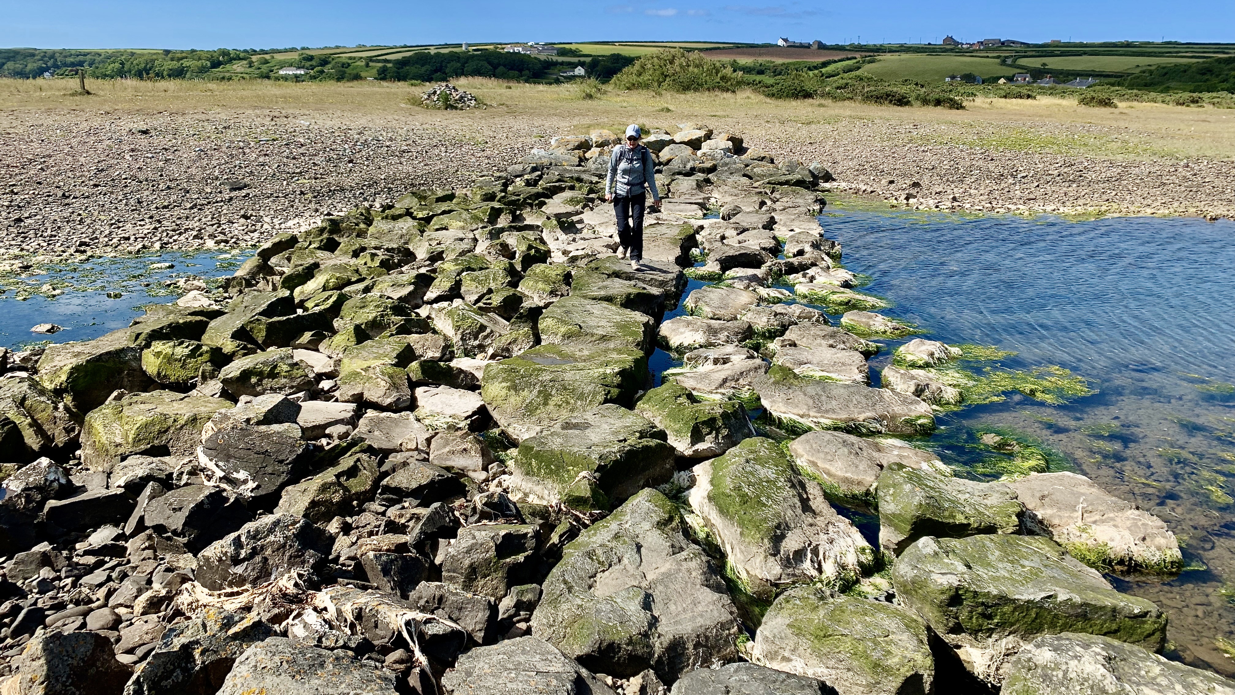
Its name probably derives from “pickle” or “pikel,” an old term associated with pointed stakes or rough rocky ground, an appropriate description for this exposed stretch of foreshore. The causeway itself was built from local stone laid directly across the tidal flats, sturdy enough to endure centuries of saltwater and storms, yet simple in construction. Even today it feels less like an engineered structure and more like a natural extension of the shoreline.
We were now almost in Dale and passed a group of limekilns. No longer in use these low, circular structures are fragments of a once-vital coastal industry that shaped both the landscape and rural economy of west Wales. The limekilns at Dale are generally dated to the 19th century, part of a broader expansion of lime production across Pembrokeshire during the late 18th and early 19th centuries. This was a period when agricultural “improvement” gathered pace: lime was burned from limestone to produce quicklime, a valuable material used to neutralise acidic soils and increase crop yields, as well as for mortar and whitewash in building. Across the county, kilns were typically constructed close to the shoreline to allow easy delivery of bulky raw materials—limestone and coal—by sea.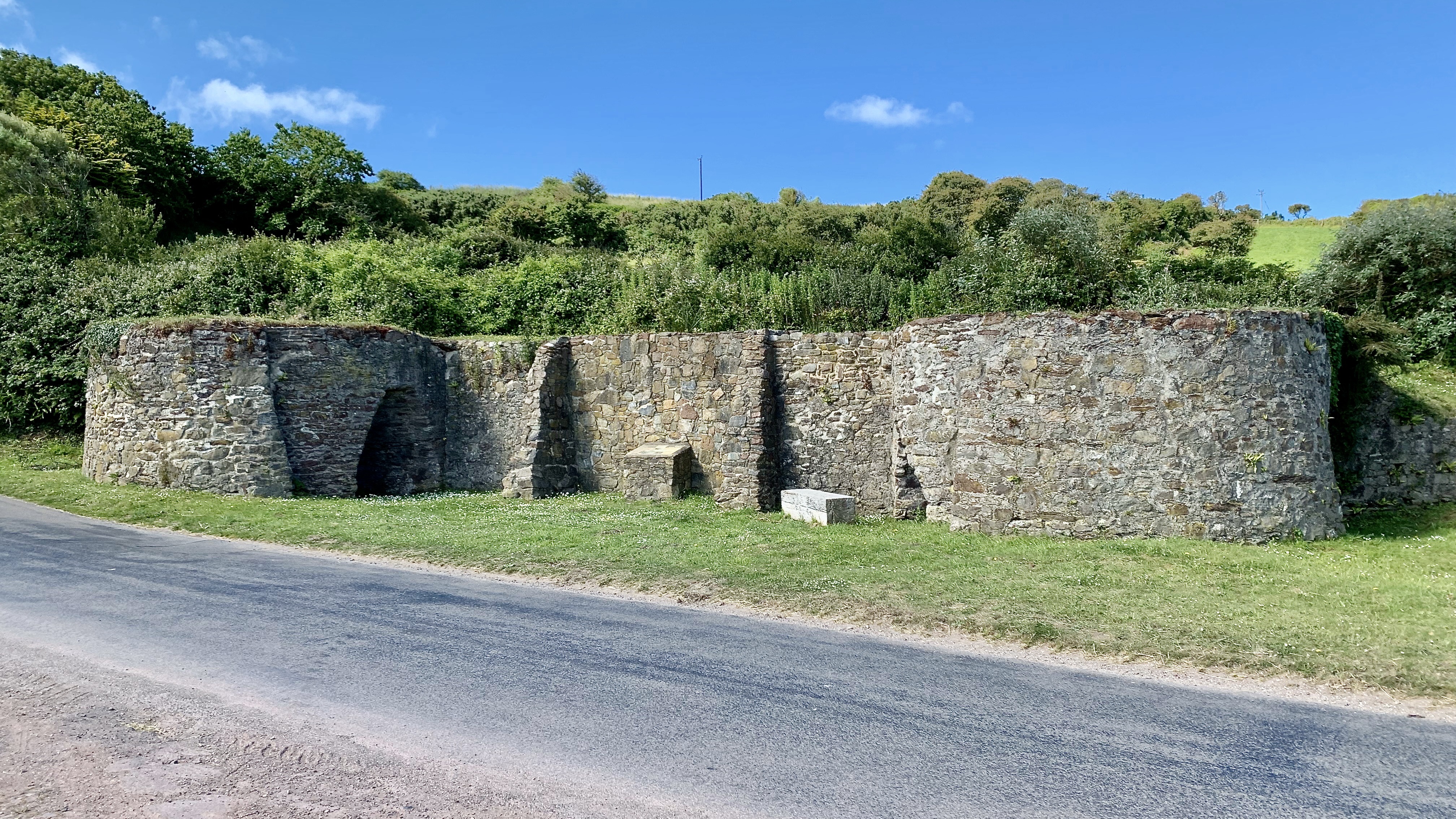
At Dale, the surviving kilns are built into a bank just back from the foreshore. Their design reflects standard coastal practice: circular stone-built chambers with “kiln-eyes” at the base, through which fuel was fed and the finished lime raked out. The proximity to the sea was essential, as small vessels could land cargo directly on the beach, supplying the kilns and carrying finished lime to nearby farms and settlements.
The walk was completed under cloudless skies and the sun was with us all the way. And at the end of the day a drink was called for before heading back to get ready for the next section.
Date Walked: 3 July 2019 Distance: 10.3 miles (16.6km)
Previous Section: https://paulchallinor.com/2026/05/10/milford-haven-to-pembroke-castle/
Next Section: https://paulchallinor.com/2019/07/15/dive-the-wrecks-off-dale-peninsula-sort-of-welsh-100-61/

Leave a comment